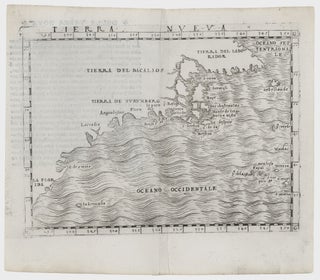
Northeast-Southeast/ New York City/ Bermuda. GASTALDI, G. [Venice, 1548] Tierra Nueva. 5 1/4 x 6 3/4 inches. A fine example with an uncommonly strong impression. .....
Northeast-Southeast/ New York City/ Bermuda. GASTALDI, G. [Venice, 1548] Tierra Nueva. 5 1/4 x 6 3/4 inches. A fine example with an uncommonly strong impression. .....
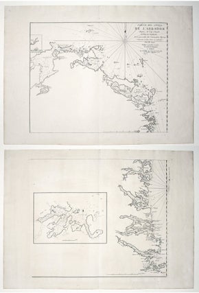
A mint example of this Revolutionary War-era chart, made for the use of the French Navy, and published the year before France became an ally of the American cause. It details the easternmost coastline of Labrador, and provides an inset chart of Mecklenburg Harbor. Georges-Louis Le Rouge (c. 1712-c. 1790).....
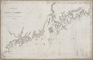
Maine/ Canada. NORMAN, John & William. [Boston, 1801/ 1803] A Chart of the Coast of America from Wood Island to Good Harbour From Hollands Surveys. 20 x 32 inches. Expected soiling & wear, some repairs to outer areas with small areas of restorations, still very good of this kind. The.....
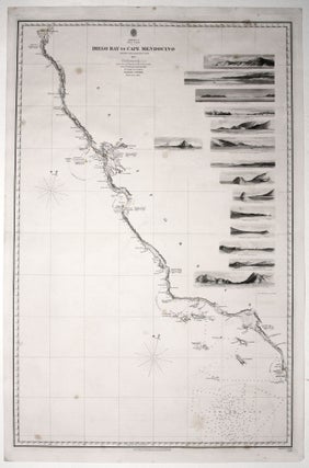
Scarce, finely engraved chart on two sheets of the entire west coast of the United States and including the southern portion of Vancouver Island. Each of the 27 coastal recognitions on the charts is delicately realized. These provided visual reference for the entry to the major bays and ports as.....
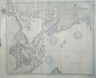
Maine/ Canada/ Passamaquoddy Bay/ Deer & Campobello Islands. HYDROGRAPHIC OFFICE, U. S. NAVY [Washington, D. C.: January, 1891] North America United States And Canada Passamaquoddy Bay And Approaches. 29 x 34 ½ inches. Lithograph with ighthouses daubed in yellow watercolor; some mended splits entering surface, partial reinforcing of outer margins.....