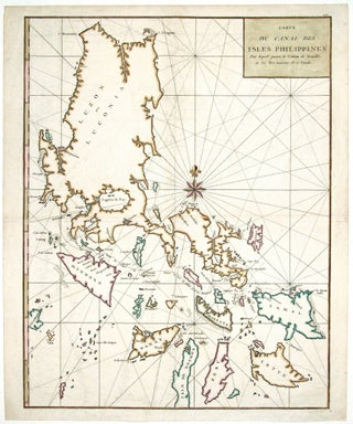
World/ Northwest Passage/ Australiana. KEERE, P. VAN DEN/ JANSSON, J. [Amsterdam, 1621/c. 1636] Totius Terrarum Orbis Geographica ac Hydrographica Tabula. 15 1/2 x 21 inches. Fine hand color; a few mended, inconspicuous into engraved surface & along a vertical crease, largely in margins, good overall. .....
New Arrivals
Results 1 - 3 (of 3)
The Cerographic Missionary Atlas… [Imprint inside front cover:] Entered according to Act of Congress, in the year 1848, By Se. E. Morse & Co.,….
An unusually well-preserved, scarce, and quite early American atlas of areas where missionary activity was being, or could be conducted. Includes an excellent map exclusively of the Hawaiian Islands. A map entitled “Indian Territory” encompasses Texas and east from Lake Superior and the Mississippi River to the Rocky Mountains in.....
Results 1 - 3 (of 3)