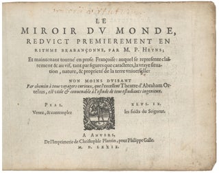
Atlas. ORTELIUS, A./ GALLE, F. [Antwerp, 1579] Le Miroir Du Monde, Reduict Premierement En Rithme… A Anvers, De l’Imprimerie de Christofle Plantin, pour Philippe Galle. M.D.LXXIX.Oblong octavo in contemp. Vellum, ties lacking; 72 maps, 6 of which folding; slight edge wear to text leaves, partial cropping to some folding maps for.....
New Arrivals
Results 1 - 3 (of 3)
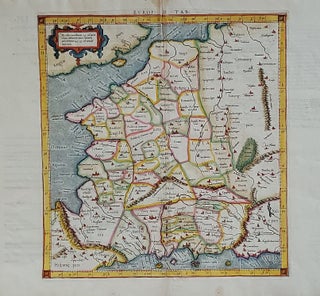
Europ: III Tab:.
A scarce, early issue, the second overall, from Mercator’s definitive edition of Ptolemy’s geography. The map shows France as it was known in the Roman Imperial period. It was based on geographic data and mapmaking instructions left by Alexandrian astronomer and geographer, Claudius Ptolemy (fl. A.D. 127-180), whose work laid.....
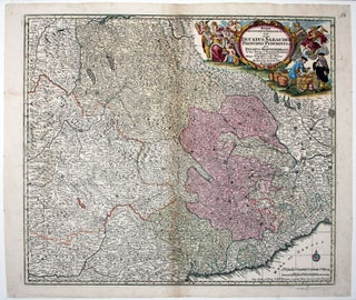
Regiae Celsitudinis Sabaudicae Status in quo Ducatus Sabaudiae Principat. Pedemontium ut et Ducatys Montisferrati….
A very attractive map of a geo-politically very important area at the time that encompasses northwestern Italy and southeastern France and includes the cities of Milan, Genoa, Turin, Nice, Grenoble as well as Monaco and the French Alps including Chamonix. In its beautiful allegorical cartouche, putti representing Armenia, Sardinia, Jerusalem.....
Results 1 - 3 (of 3)


