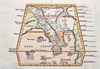
Myanmar (Burma)/ Thailand/ Bangladesh. FRIES, L., PTOLEMY, C. [Lyons: 1522/ 1535] [On verso:] Tabula XI Asiae. 11 x 16 inches. Fine hand color; excellent condition. One of the earliest acquirable maps to focus on a specific region of Southeast Asia. The areas depicted on the map is primarily today’s Myanmar.....
New Arrivals
Asia To Major James Rennell, Esqr. F. R. S. &c. &c. This Map Is Inscribed, by His much Obliged Humble Servant January 1st 1801. A. Arrowsmith.
Very scarce, sole edition of Arrowsmith's large, folding map of Asia, the most accurate of the continent available at the time. It bears all the hallmarks that made his maps models of clarity and accessibility. "It is a significant advance on other maps of the period, incorporating the work of.....
The Cerographic Missionary Atlas… [Imprint inside front cover:] Entered according to Act of Congress, in the year 1848, By Se. E. Morse & Co.,….
An unusually well-preserved, scarce, and quite early American atlas of areas where missionary activity was being, or could be conducted. Includes an excellent map exclusively of the Hawaiian Islands. A map entitled “Indian Territory” encompasses Texas and east from Lake Superior and the Mississippi River to the Rocky Mountains in.....
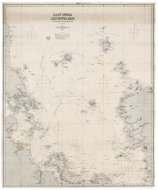
Singapore/ Parts of Malaysia, Borneo & Java. JAMES IMRAY & SON [London: 1880] East India Archipelago [Western Route to China. Chart No.2]… 1880. 49 x 40 inches, 124.5 x 101.7 cm. Two joined, lithographed sheets mounted on new, heavy blue paper with original trade label affixed. Courses with positions and.....
Philippines/ Hong Kong/ Taiwan. JAMES IMRAY & SON [London: 1881] East India Archipelago [Western Route to China. Chart No.6]…London…1881. 49 ¾ x 40 inches; 126.5 x 101.5 cm. Two joined lithographed sheets, mounted later blue backing bearing original company label. Early annotated courses marked in pencil. Mended 3 ½-inch split.....