click here to zoom
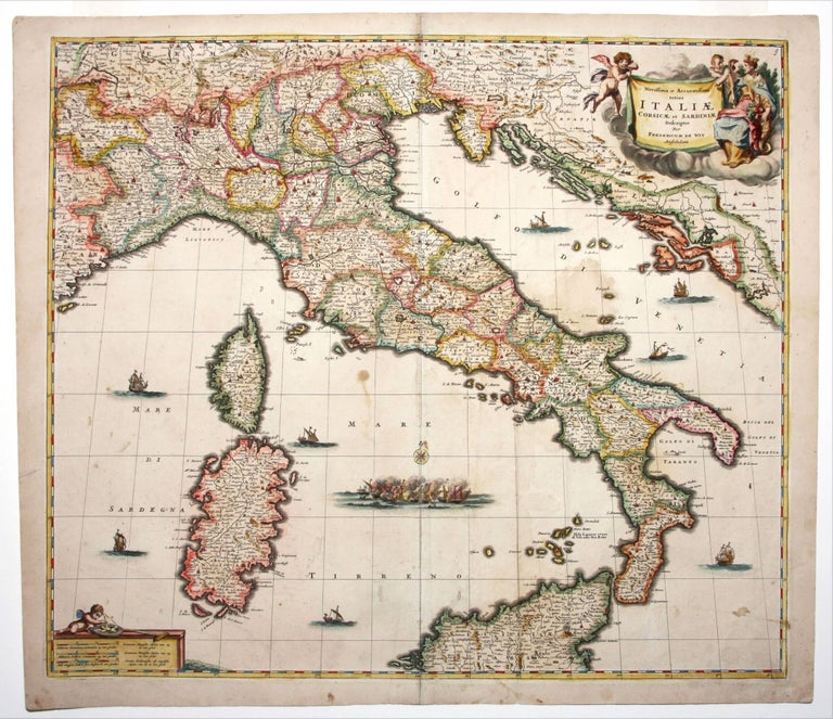
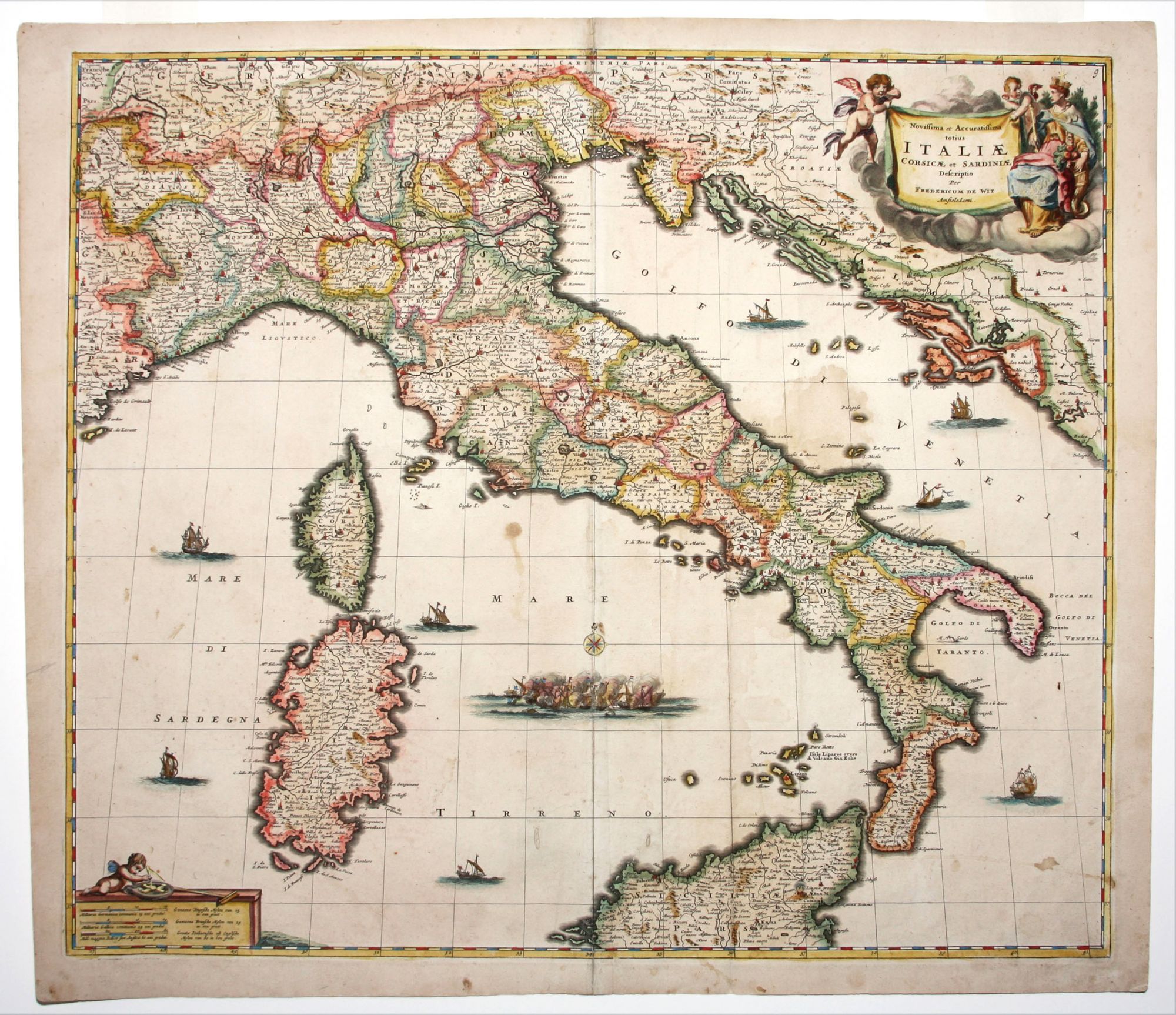
Novissima et Accuratissima totius Italiae Corsicae et Sardiniae . .
19 x 22 ¾ inches, Original color refreshed; top and bottom centerfold reinforced, few mended wormholes with no loss, slight stain, very good condition.
A beautifully colored Dutch map of Italy, Sicily, Sardinia and Corsica. The cartouche is decorated with putti and a regal figure representing the city of Rome, and by extension, Civilization. On the scales in the lower left a putto plays with surveying implements. The map features many ships, and a sea battle, pitting the Venetian and Turkish navies, rages in the middle of the Tyrrhennian Sea.
Frederick De Wit (1630-1706) was the most prolific publisher of all manner of cartographic products of the late Dutch period. Although the Dutch by the late 17th century had lost their ascendant position in map publishing, De Wit maintained a high standard for both geographic precision and beauty of engraving. This is borne out by the fact that his maps remained in publication long after his death.
Sold