click here to zoom
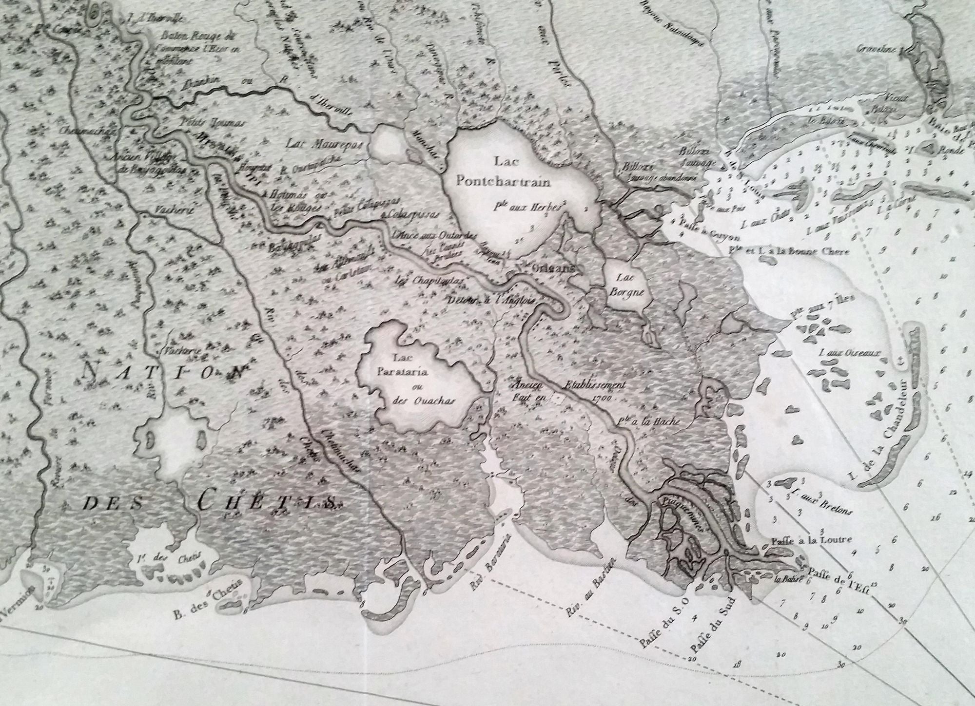
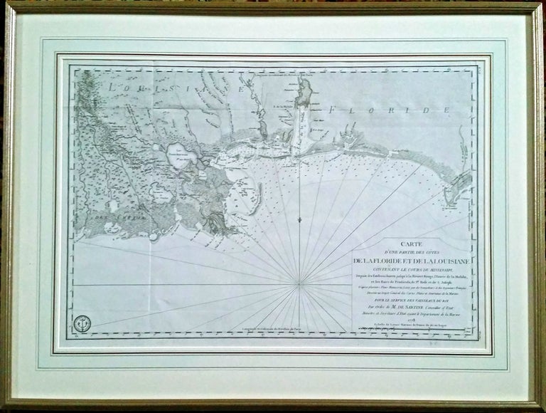
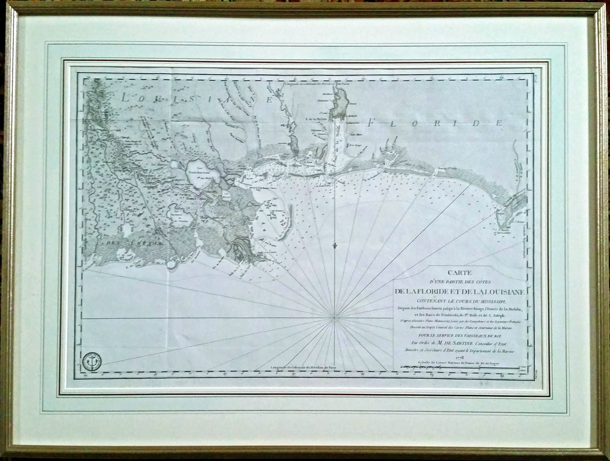
American Revolution/ New Orleans/ Baton Rouge/ Mobile Bay/ Pensacola. De SARTINE, Gabriel Carte [Paris: 1778 [1780]] D’une Partie Des Cotes De La Floride Et De La Louisiane. 15 3inches. Fine condition. In fine archival frame and French mat. Scarce, handsomely engraved chart that is valuable for its detailed depiction of the Mississippi Delta region, especially so in light of the rapid changes the area’s landmasses have undergone in recent years. The chart extends from west of the Mississippi Delta to Panama City at its eastern extreme and includes Pensacola, Mobile Bay and Baton Rouge. It was prepared for the use of the French Navy after France joined the American cause in the Revolutionary War. When France entered the American Revolution in 1778, practically the only printed charts of American waters available to them in their language were those in Le Rouge's Pilote Americain. Over the next two years a much more carefully prepared set of charts was produced for the French Navy by the Depot des cartes et plans de la marine under the supervision of Gabriel Sartine, the Naval Minister at the time. In all, 25 charts were produced and were bound into an atlas called the Neptune Americo-Septentrional. As Schwartz points out, "the official reference for major United States and Canadian harbors used by the French navy was the 1780 Neptune Americo-Septentrional with twenty-five engraved hydrographic charts in fine detail showing soundings, shoals, and pertinent topographic features." Because the atlas appears to have been intended for official use, it is now rare on the market. The maps had the benefit of knowledge gained from French experience in American waters after the outbreak of war and therefore represent some of the best charts available at the time. They also had the benefit of DesBarres’s monumental Atlantic Neptune, first published in 1776, which provided the first generally accurate charting of the North American coast. In fact, the Sartine charts rival those of DesBarres in both precision and their fine realization of topography. Cf. Philips, Atlases 1211; Schwartz/Ehrenberg, Mapping of America, p. 202.
Sold