click here to zoom
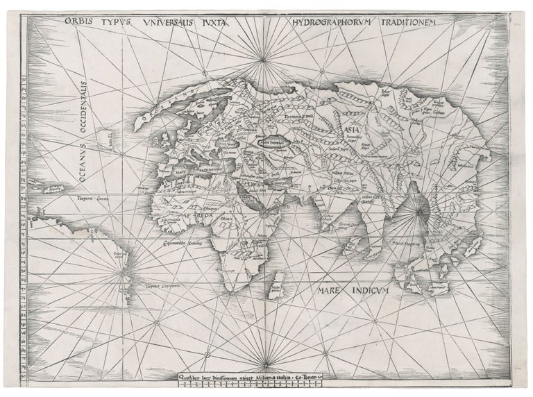
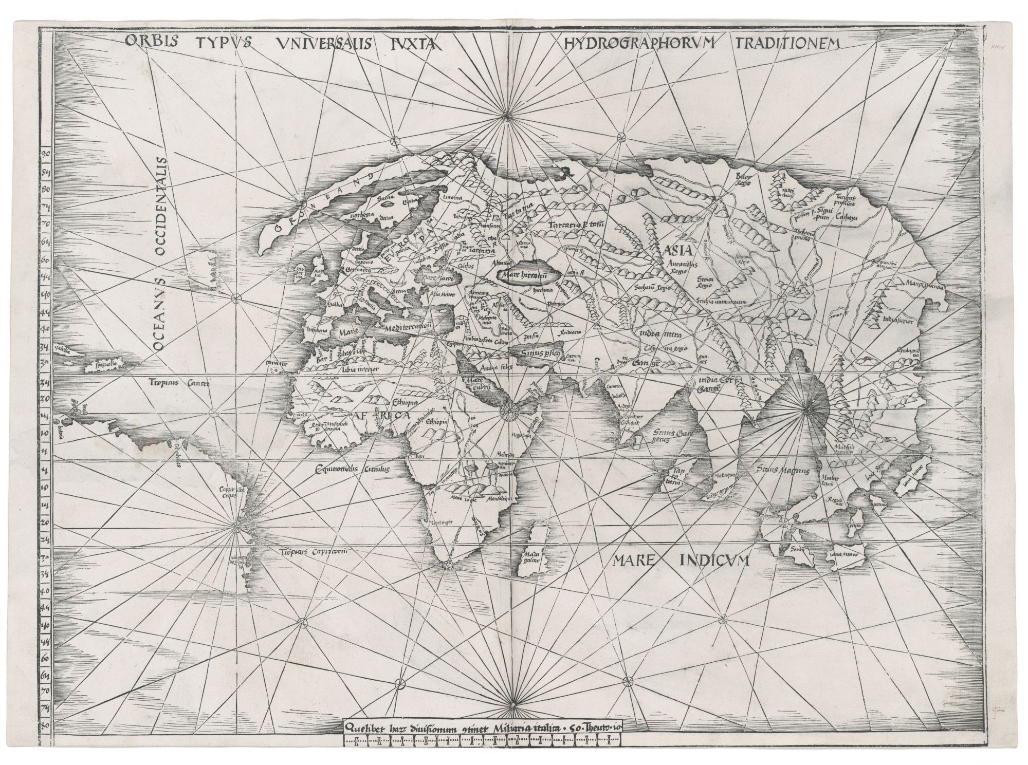
World. WALDSEEMULLER, M. [Strasbourg, 1513] Orbis Typus Universalis Iuxta Hydrographorum Traditionem. 17 3/8 x 22 1/2 inches. Woodcut with a strong printing impression; very slightly cropped along bottom, still overall excellent condition. An uncommonly attractive example of one of the most important world maps of the Discovery Period. It is one of the earliest, obtainable world maps to present the greatly expanded picture of the known world that resulted from the explorations of Columbus, Vespucci, Cabral, da Gama, Dias, and others. In fact, Martin Waldseemuller was the first to suggest the name “America” and is considered to have been the greatest geographer of his age. This is the only acquirable world map by him that includes the new discoveries. Interestingly, between the time of Waldseemuller’s naming of America in 1507 and the publication of this map, he withdrew his support for the use of “America,” which explains its absence from this map. To fully appreciate this map, one must realize how early its creation actually was. This and the other maps in Waldseemuller's atlas are believed to have been cut in 1505 and 1506 and then set aside, perhaps for financial reasons, and not published until 1513. The fragmentary delineation of America on this map certainly supports this dating. The excellent general shape of Africa on the map indicates that Waldseemuller had fully absorbed the Portuguese explorations of Dias, da Gama, and others. Portuguese sources are also evident in the mapping of the western portion of India, but most areas farther east are still based on Ptolemy. Although Waldseemuller here emphatically opted to show Asia and America as separate landmasses--East Asia possesses a clear, unbroken coastline—this, of course, was pure speculation. The separation of the continents would not be truly confirmed until the end of the 18th century. Students of this map have not commented, to our knowledge, on the close proximity of the New World to the Old as depicted on it. It is not known whether this was a deliberate distortion enforced by the simple miscalculation of having a map on too large a scale for the size of the paper or whether it was based on what was believed as fact. The map has been called “The Admiral's Map” because it was believed at one time to have been the work of Columbus, who was often referred to as the Admiral. This, however, was most likely the result of an erroneous reading of the introduction to Waldseemuller’s atlas, in which the Admiral is merely mentioned as one of the sources of the map. The image surface of this map was substantially larger than the other maps in the atlas in which it was published, thus it was usually cropped, often severely, in the process of binding. Here cropping along just the lower border is negligible. Shirley 35; Suarez, T. Shedding the Veil, no. 11; cf. The World Encompassed, no. 56.
Sold