
click here to zoom
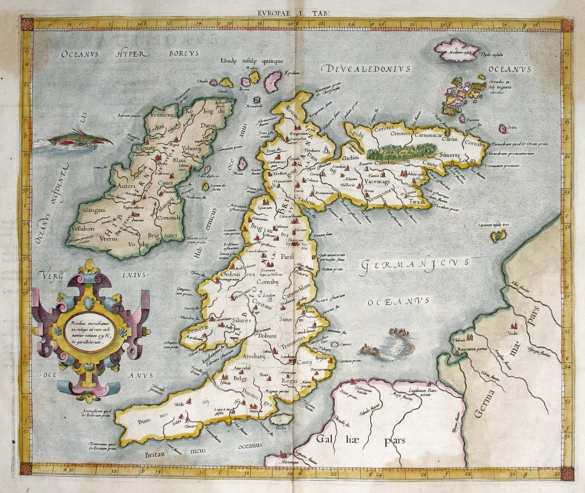
British Isles/ History of Cartography. MERCATOR, G./ PTOLEMY, C. [Cologne: 1584] Europae. I. Tab: 13 3/8 x 16 inches. Fine hand color; two light stains upper left & right (less pronounced on the actual map than in the image), else excellent condition. Mercator in 1540 published Literarum latinarum, the first instructional handbook in the use of the italic hand in engraving to appear outside of Italy. It was also the first work to offer instruction in the use of italic script in the engraving of maps. It was the maps in Mercator’s edition of Ptolemy that were arguably the finest demonstrations Mercator provided in the use of italics. Moreover, “the beauty and legibility of the best sixteenth and severteenth-century Dutch maps can be traced in large measure to Mercator’s influence” (Karrow, p. 382). Shirley, R. Early Printed Maps of the British Isles, no. 141, cf. no. 123; Karrow, R. Mapmakers in the Sixteenth Century, pp. 376-406.
A very attractive example from an early edition of Mercator’s definitive edition of Ptolemy’s geography. “The ancient British Isles map has been finely drawn and engraved by Mercator himself” (Shirley). Mercator’s edition of Ptolemy became the standard text for this classical geographic work; it was based on the best available sources, and all the maps were re-edited and redrawn to conform to Ptolemy’s original design. As Shirley noted, “Mercator’s plates in his Geographia represent some of his best work and such was their excellence that seven further editions were printed from them.” This map was from the scarce second edition; only this edition and the first of 1578 were published during Mercator’s lifetime.
Sold