click here to zoom
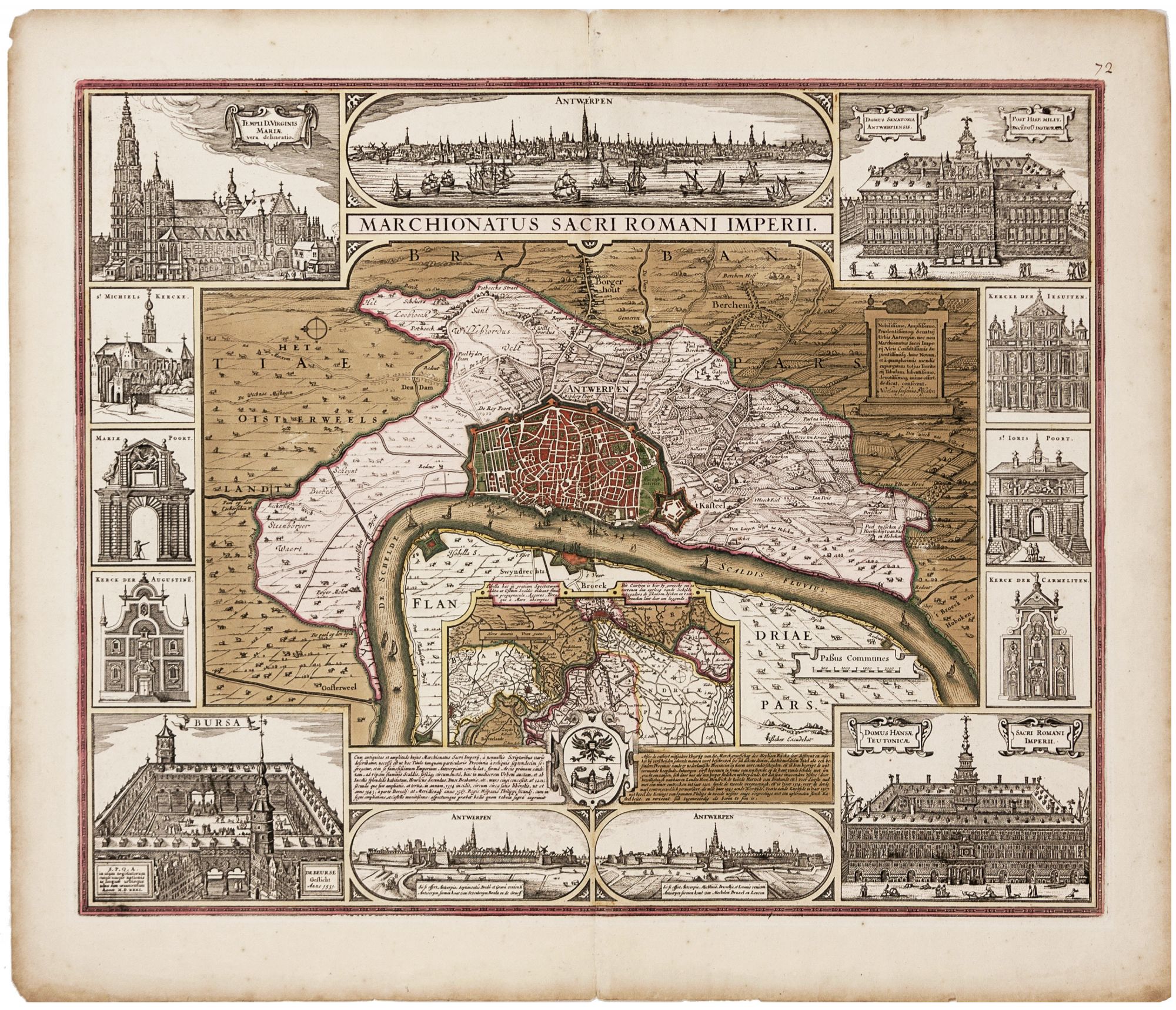
Antwerp/ Financial History. VISSCHER, C.J. /VISSCHER, N. J. [Amsterdam, c. 1630] Marchionatus Sacri Romani Imperii… C.J. Visscher Excudebat. 18 x 21 ¾ inches. Fine original color; bit of edge chipping & toning in margins, else excellent. Separately published, richly engraved plan of Antwerp--home of the famed mapmaker, Abraham Ortelius, and Europe’s first great center of trade. The engraving includes three profile views of the city. The borders contain depictions of the city's most important buildings, including the Bourse, built in 1531 as the first structure intended expressly for trade in commodities; it exists in replica today. This beautifully composed engraving has at its center a detailed plan of Antwerp and its surroundings, with an inset map of the Flemish-Dutch boundary along the Schelde River. Several structures that survive today are depicted, such as the magnificent Our Blessed Lady Cathedral (the city's tallest building even now) and the Statdhuys (City Hall), shown rebuilt after the Spanish sack of the city in 1576. Lost to us now but beautifully depicted on the map are the House of the Hanseatic League (burned in 1891). Also illustrated are several other churches and the gates of the city. Ortelius’ Antwerp stood at the confluence of European trade and profited greatly from the wave of discovery at the turn of the 16th century. The Portuguese brought pepper and cinnamon; the Spanish brought American silver; and Europe’s textiles all came to be traded through Antwerp. In order to support the foreign trade pouring through the city, Antwerp’s Bourse was constructed. It is in this context of active trade and exploration that Ortelius’ atlas was born. Campbell, T. Map Collectors’ Circle 46, no.8, pl.IV.
Price: $950.00