
click here to zoom
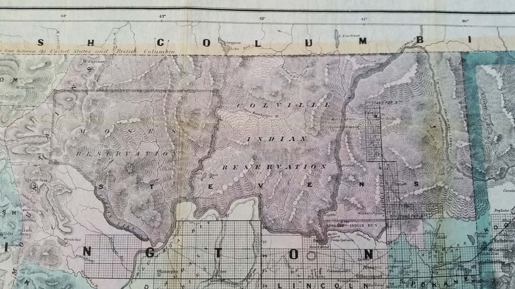
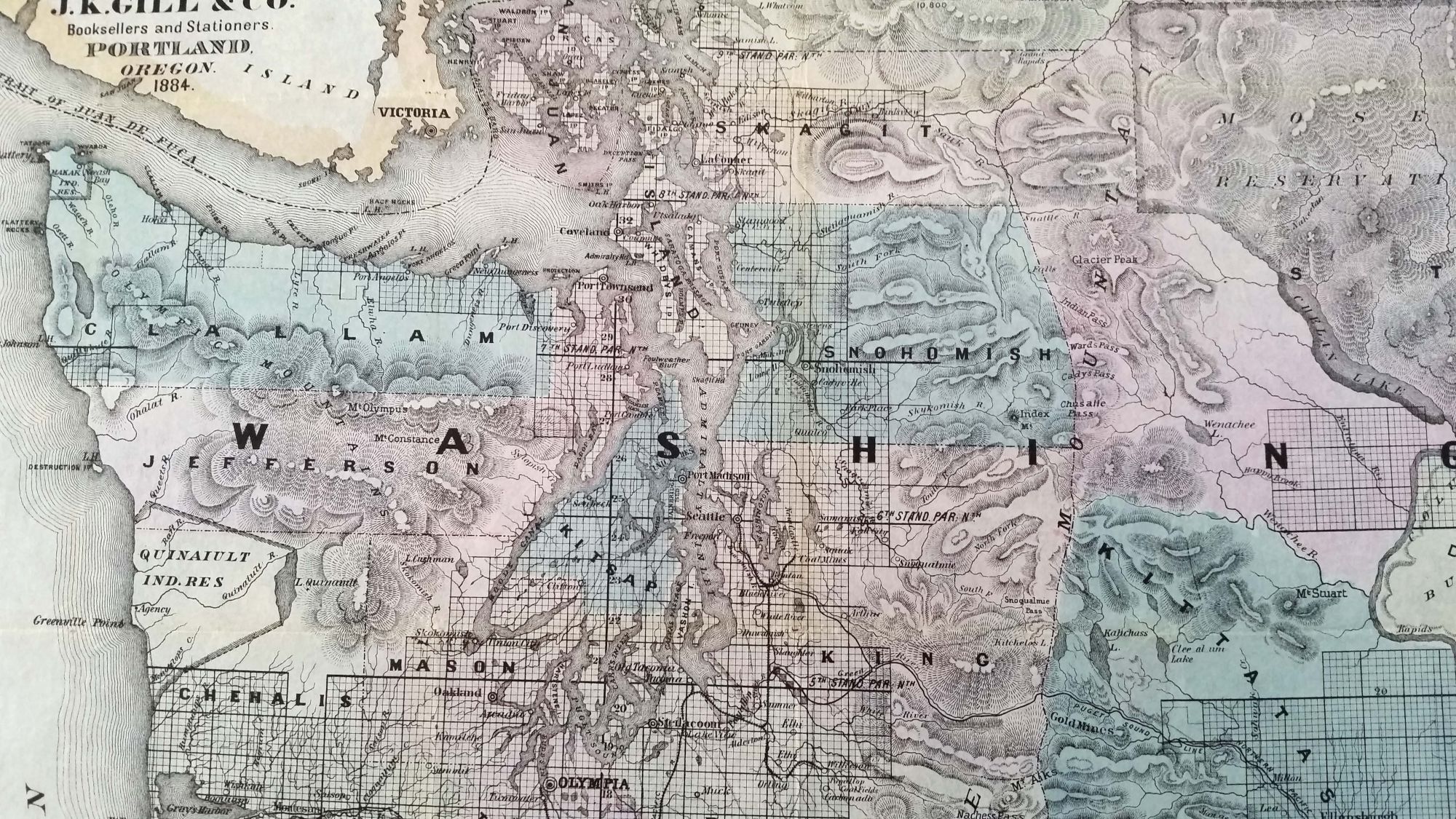
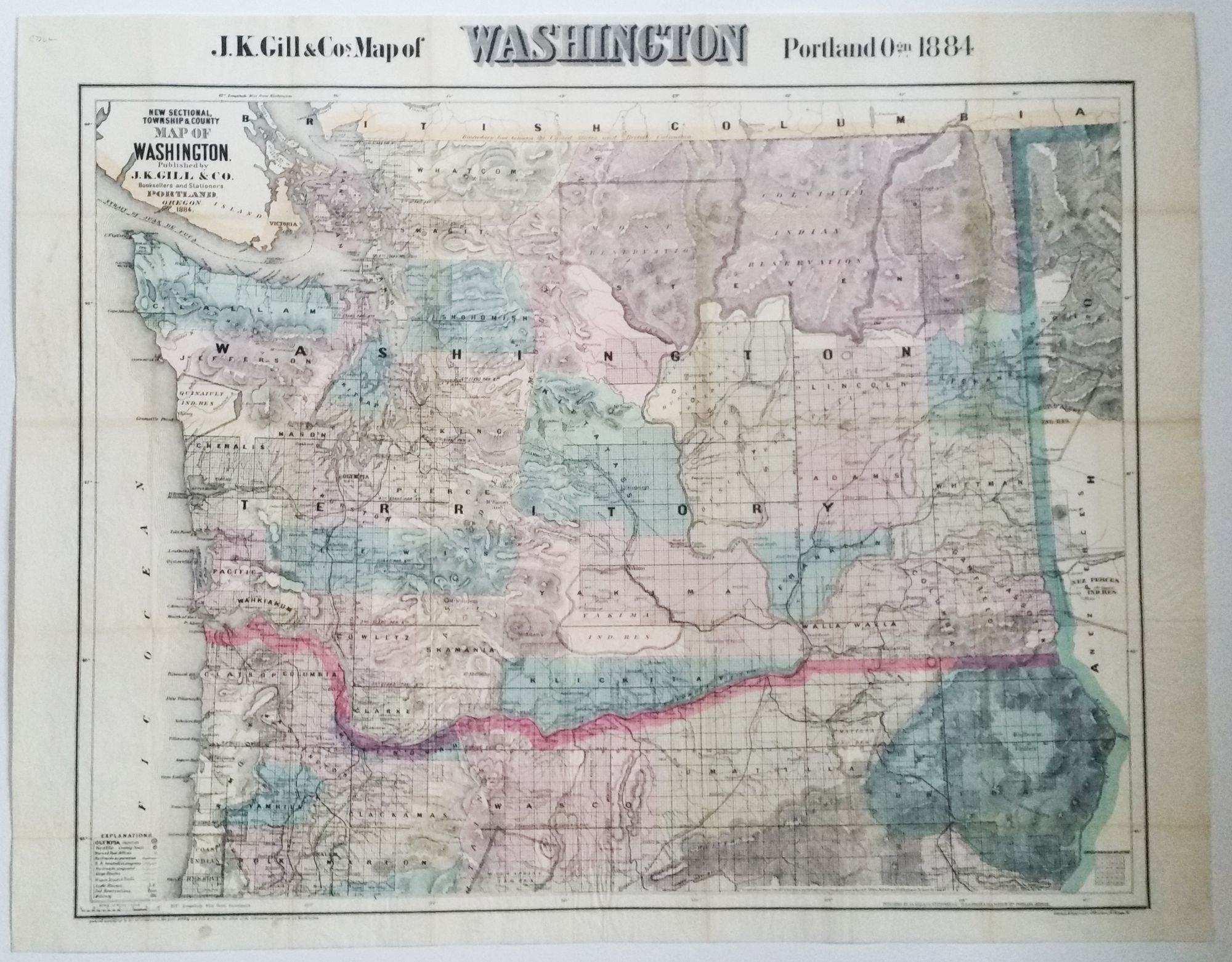
Washington Territory. J. K. GILL & CO./ GALVANI, W. H. [Portland, OR: 1884] J. K. Gill & Cos. Map of Washington. Portland Ogn. 1884./ New Sectional, Township & County Map of Washington…1884. 22 ½ x 27 inches. Lithograph with full, original wash color. Ex-folding map, here flattened, original embossed covers retained. Excellent, bright example. A subtle difference between this map of Washington and those that would come even just a few year later is the extent to which this one graphically acknowledges the presence of native peoples. Two large reservations at the top right are highlighted in color with their borders clearly demarcated, suggesting an inviable separateness to these lands. In later maps, Indian reservations and tribal names become less distinct in the overall picture. It is interesting to compare this map to an 1883 map by Gill in the Rumsey Collection—map no. 6816.002 and the link below. At first glance, they appear identical, but the differences that emerge when comparing them speak to what a fast-moving target Washington was, cartographically speaking, at the time. The present 1884 map shows several counties and their boundaries not on the 1883 map. There is also a minor difference in the map’s secondary titles. No doubt further study will reveal other differences. An inscription at the bottom right of this map states it was compiled by William H. Galvani from U. S. and railroad surveys. He was a prominent Portland civil engineer whose primary work was for railroads, for which he played a significant role. The map was lithographed by L. M. Synder in Chicago. J. K. Gill & Co. was Portland's leading stationer and school supplier for numerous decades. In one form or another, the company existed for about 130 years with its last locations not closing until 1999. https://www.davidrumsey.com/luna/servlet/detail/RUMSEY~8~1~239996~5512091:New-county-and-township-map-of-Wash?sort=Pub_List_No_InitialSort%2CPub_Date%2CPub_List_No%2CSeries_No&qvq=q:gill%20washington;sort:Pub_List_No_InitialSort%2CPub_Date%2CPub_List_No%2CSeries_No;lc:RUMSEY~8~1&mi=11&trs=12
The rare first issue (copyrighted 1884) of this attractive and highly detailed map of the then fast-developing Territory of Washington that would achieve statehood five years after the map’s publication. Notably, the map was published in the Pacific Northwest, in Portland. The map’s wealth of detail includes counties, well-rendered topography, rail and stage coach lines, wagon roads and trails, Indian reservations, military installations, lighthouses, the grid of the U. S. Ordnance Survey, towns and post offices, and much else. Numerous mountains are identified with the heights of several provided.
Sold