click here to zoom
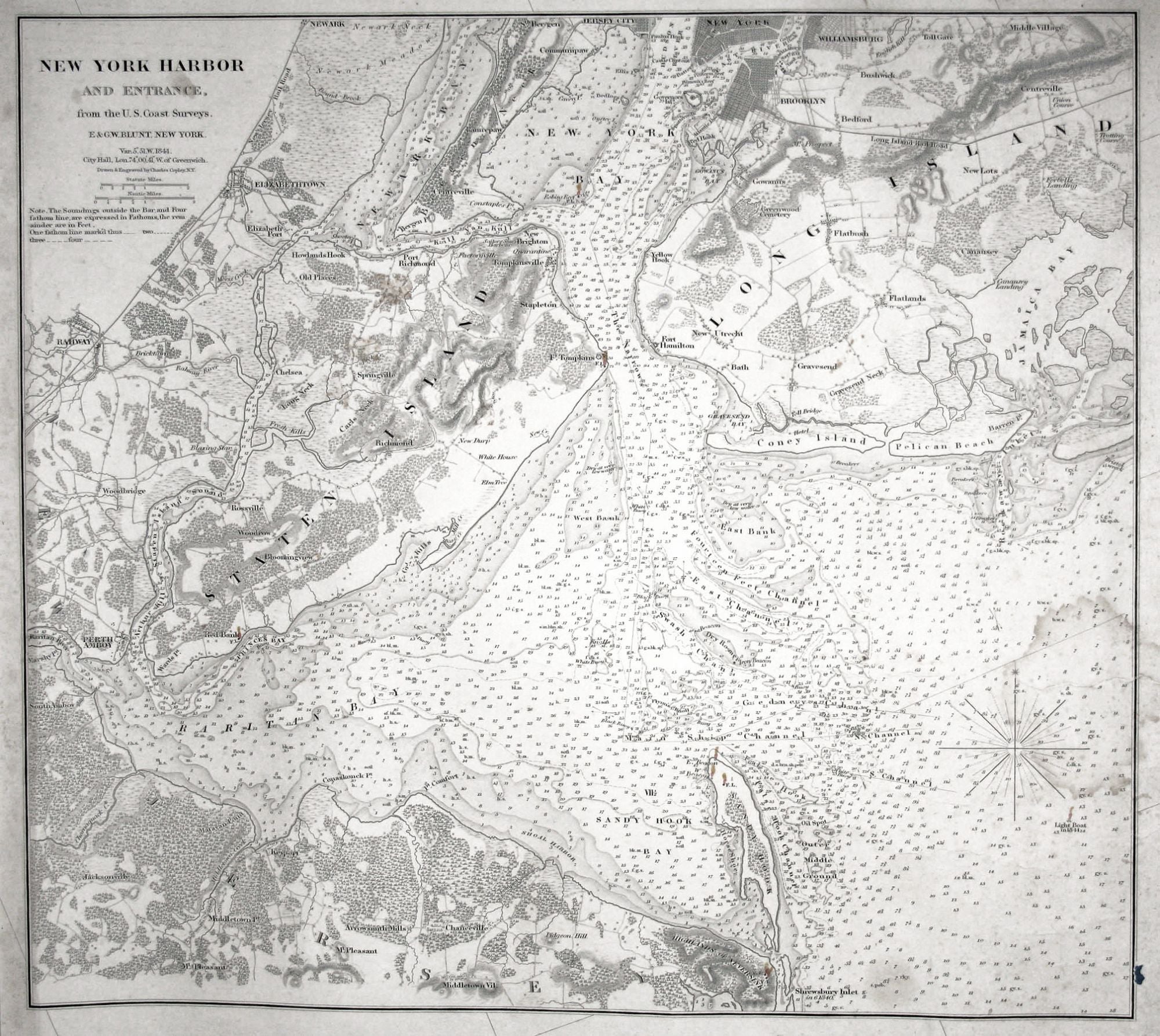
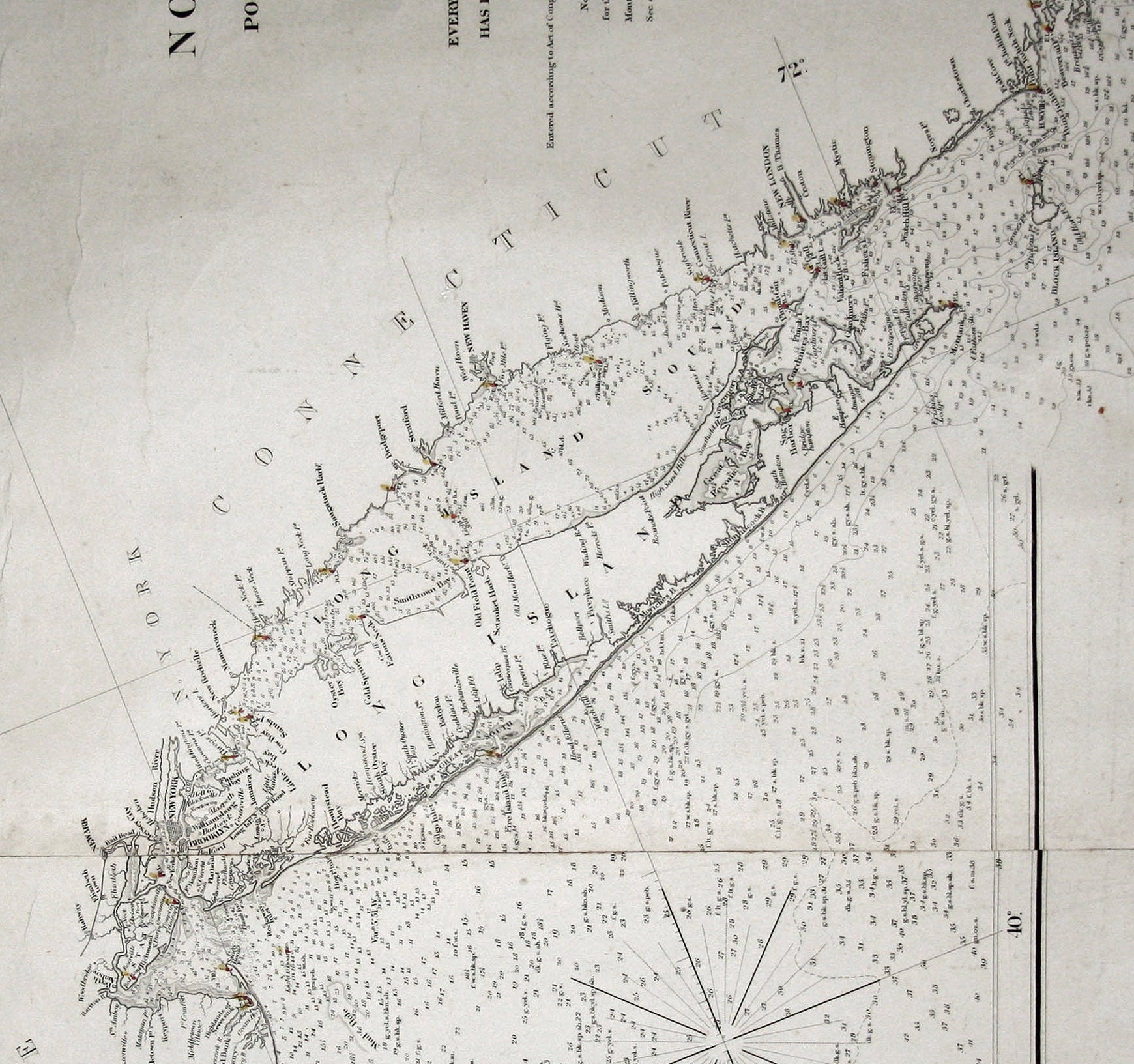
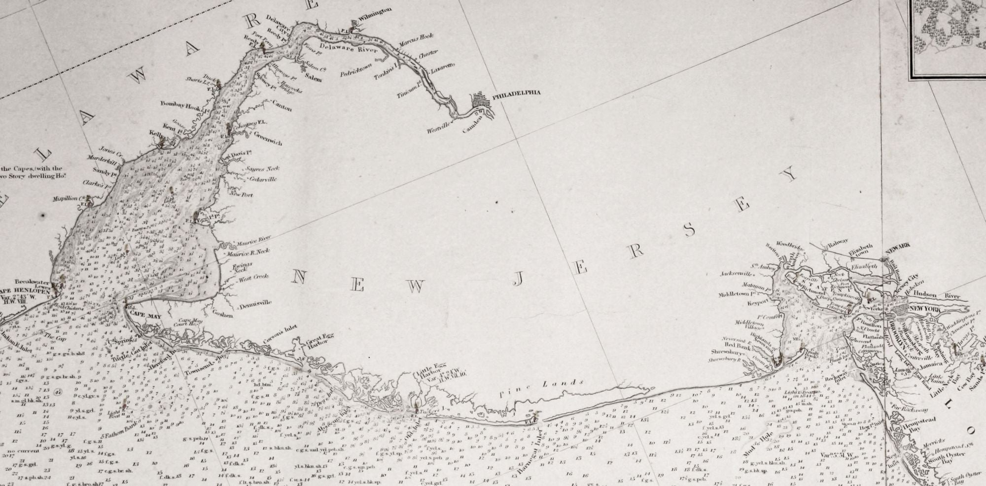
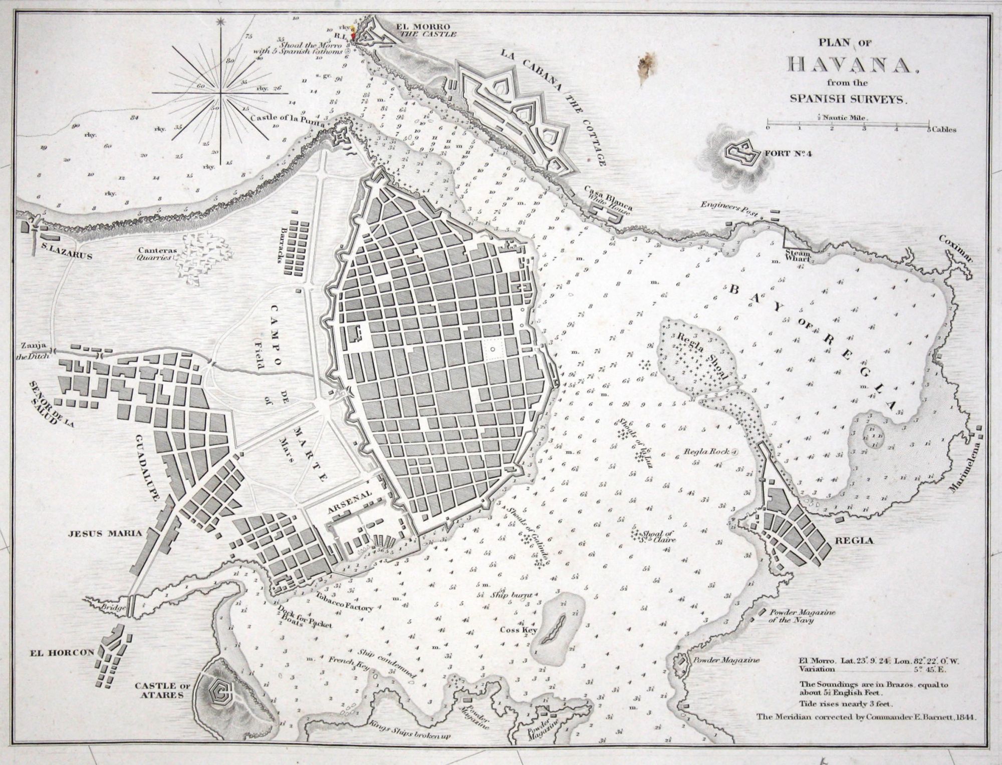
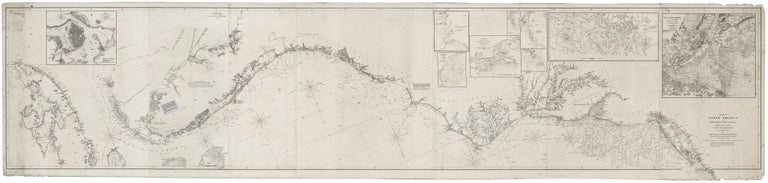
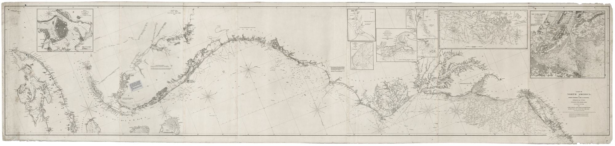
Nautical Chart: Block Island to Cuba. BLUNT, E. & G. W./ COPLEY, Charles [New York, 1853] Coast Of North America from Point Judith to Cape St. Antonio. (Island Of Cuba) Including The Bhama Banks… Every Authentic Survey, American, English & Spanish, Has Been Used In The Construction Of This Chart… 29 x 120 ½ inches. Seven sheets joined and mounted on heavy blue paper; lighthouses noted with daubs of color & lightboats indicated in red ink; few stains, light wear along right margin, but overall fine condition for this type. A superb specimen of American chart making: a working mariner’s blueback chart that provided the most accurate mapping of most of the east coast of the United States in the mid 19th century. As Guthorn has pointed out, “mariners were said to favor large charts composed of several sheets, rather than smaller charts” in bound or loose form. Such large charts came to be known as bluebacks after the heavy blue paper on which many were mounted. These immense rolled works allowed the mariner to gradually unroll the chart as the ship made its way. This chart covers from Point Judith, Rhode Island to Cuba and includes the entire peninsula of Florida. It has 9 inset charts of various harbors and areas including a very large, minutely detailed one of New York Harbor, another of the coast between Long Beach Island and Cape May in New Jersey, several of areas on the Outer Banks and South Carolina coast, and a large harbor chart and street plan of Havana. Founded in 1796, the Blunt firm was the foremost producer of charts, pilot guides, and instruments in the United States throughout the first half of the 19th century. Two of its publications, The American Coast Pilot and The American Practical Navigator, were carried aboard most vessels of the day. The company published large-scale charts of the east coast of the United States in one form or another from 1813 to about 1860. This particular chart first appeared in 1846, as indicated by a note stating it was entered at the Court of the Southern District of New York that year. The company continually improved its charts by adding new towns and harbors, more exact and extensive depth soundings, and various aids to navigation, such as the lighthouses on this chart indicated with hand color. And while as noted in the title of this chart, it was compiled from American, English and Spanish charts, from the 1820’s onward the company incorporated information from its own surveys and explorations. In fact, the company operated its own observatory in Brooklyn to insure the accuracy of the marine chronometers is both used and sold. The company also maintained close relations with the United States Coast Survey, assuring the company access to the Survey’s work and allowing for consistency between the output of the commercial firm and the government agency. In fact, sons of the founder of the firm, Edmund M. Blunt (1770-1863), worked at one time or another for the Coast Survey. Guthorn, P. United States Coastal Charts, pp. 9-11; cf. 89-92.
Sold