click here to zoom
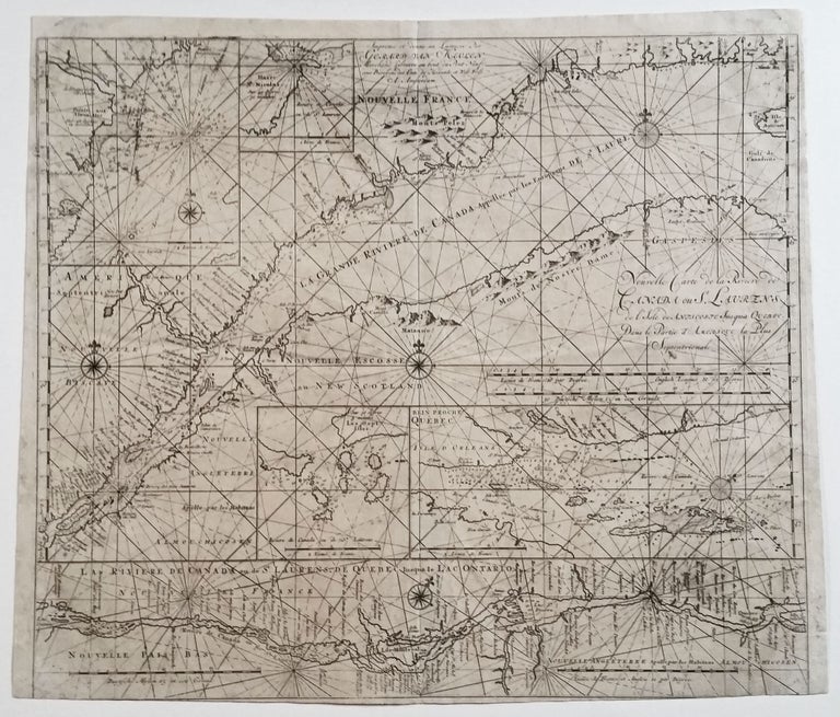
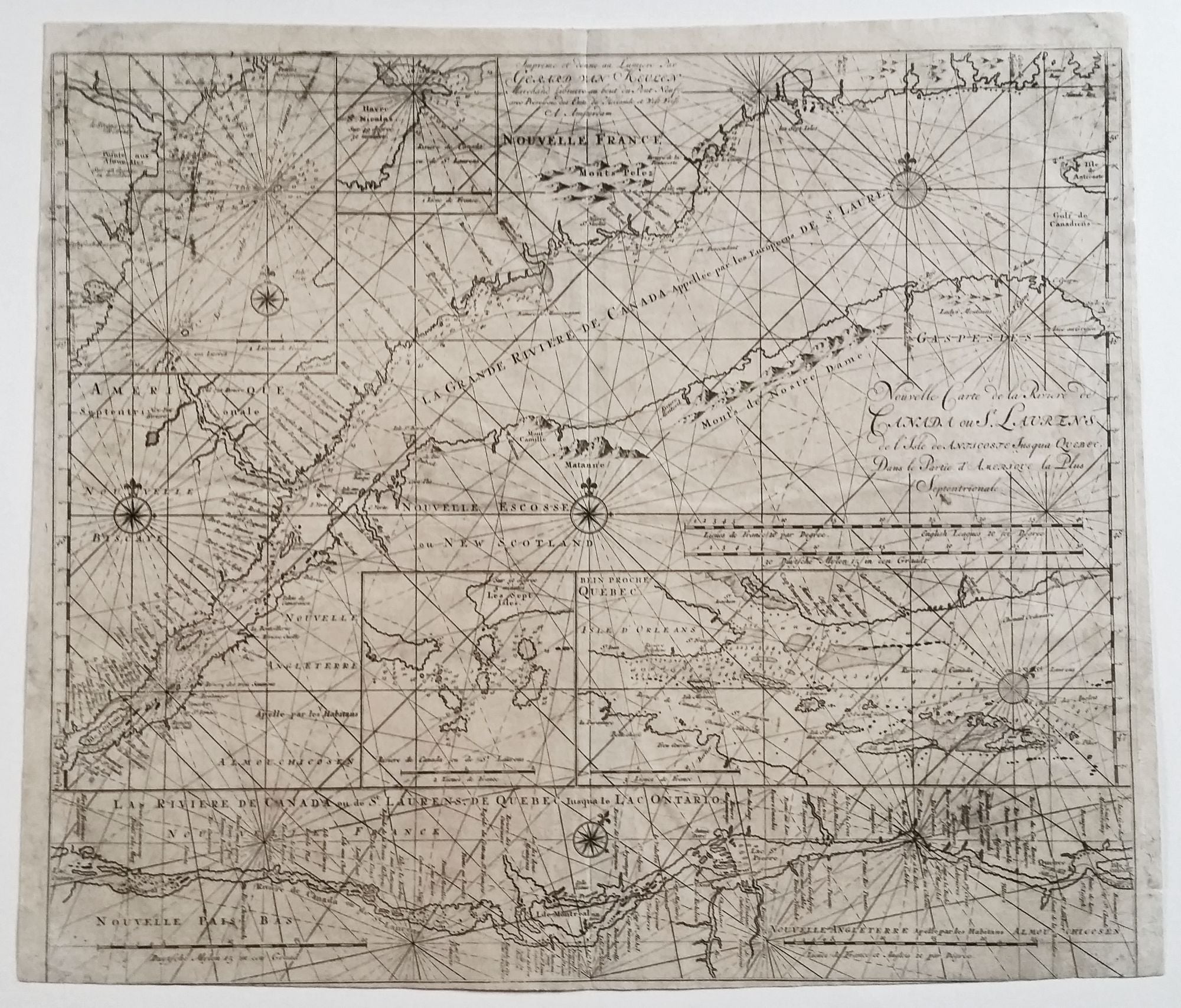
St. Lawrence River. VAN KEULEN, Gerard [Amsterdam: 1717] Nouvelle Carte de la Riviere de Canada ou St. Laurens… [Imprint:] Imprime et donne au Lumiere pare Gerard Van Keulen…A. Amsterdam. 20 ½ x 23 ¾ inches. Trimmed close at lower right with very slight loss, two corners extended & side margins partially reinforces but no surface loss in these areas, overall very good. It was published by Gerard Van Keulen in his De Nieuwe Groote Lichtende Zee-Fakkel, Part IV. In the 18th century, the Van Keulen firm began offering charts covering more parts of the world and with greater specificity than it did in the 17th century. These later charts tend to be more than the earlier ones because they were typically meant for use at sea. The primary reason this chart is so detailed and up-to-date for its period is that it is derived from a landmark, though here uncredited French chart by Jean Deshayes: Carte marine de l’embouchure de la rivière de Saint-Laurent, originally published in 1686 and re-issued in 1702 by Nicolas de Fer. Deshayes, the first official Hydrographer of New France, made the earliest hydrographic survey of the St Lawrence River, when he was sent by Jean Dominique Cassini of the Paris Observatory and the Académie Royale des Sciences to observe an eclipse in 1685 and to plot longitude. Deshayes was thus able to use data based upon celestial observations in the preparation of his groundbreaking chart. He also plotted the river’s navigational hazards--perilous currents and shoals—that made it of actual use to French pilots. The van Keulen firm was the most successful chart making company to emerge in the 17th century, remaining in business for over 200 years. Gerard van Keulen, a son of the company’s founder, was arguably the most skilled cartographer of this illustrious family and became the official hydrographer of the Dutch East India Company. Because the firm’s sea atlases appeared in several languages, they enjoyed an unusually wide market. Dictionary of Canadian Biography, Vol. II; Withers, Charles J., Placing the Enlightenment: Thinking Geographically about the Age of Reason.
A scarce sea chart delineating the St. Lawrence River and Waterway in remarkable detail. It consists of two primary charts that together show the entire river from the west part of Anticosti Island through to Lake Ontario. Four inset charts provide further detail of key areas along the river.
Sold