click here to zoom
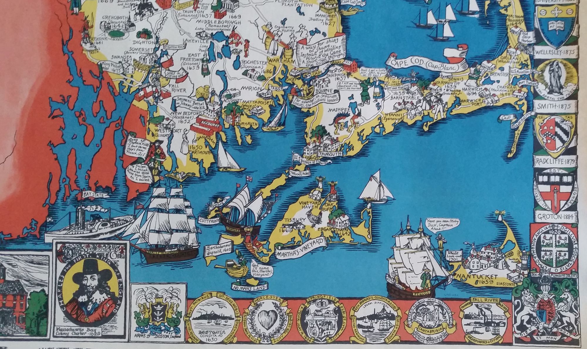
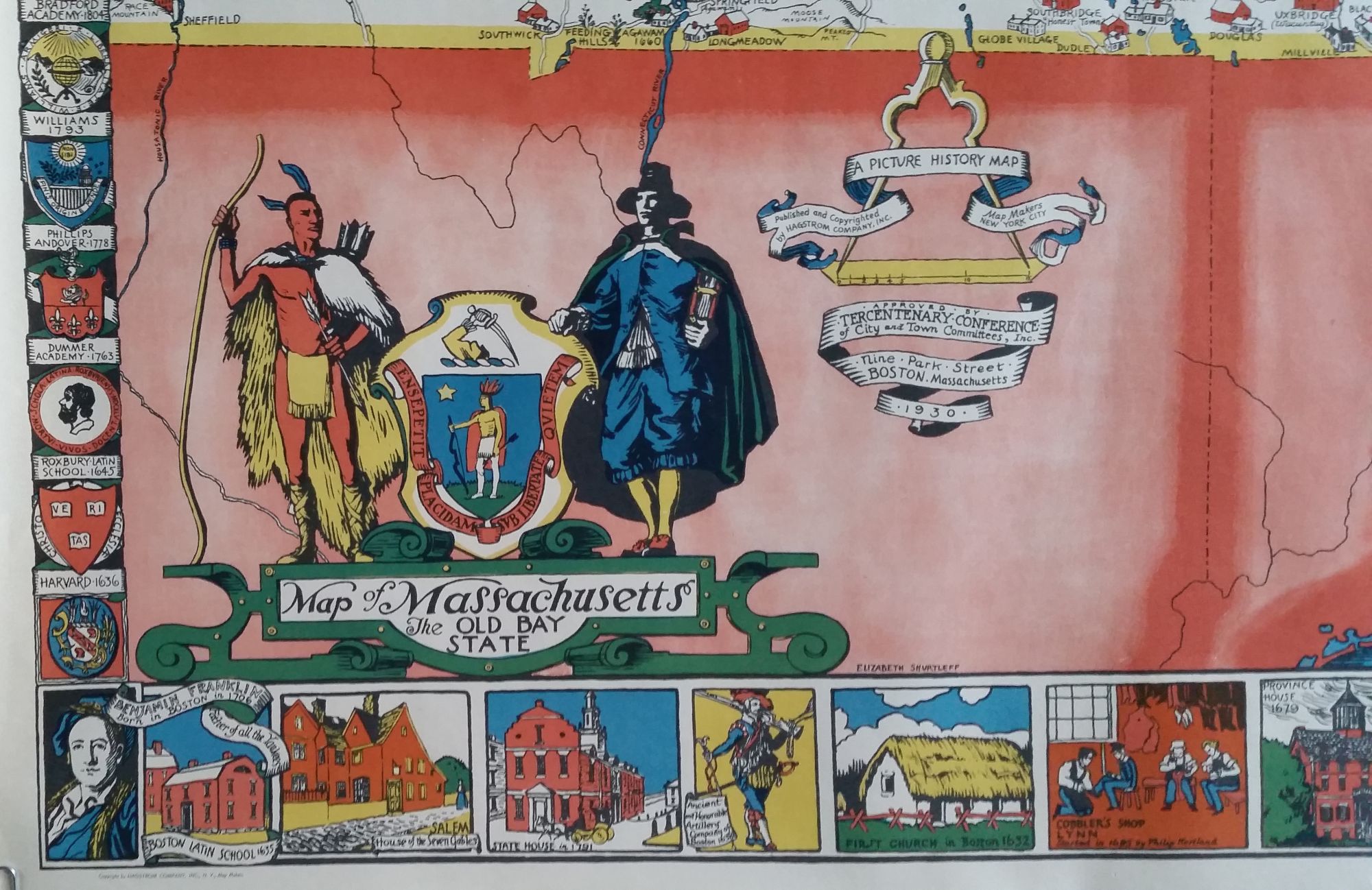
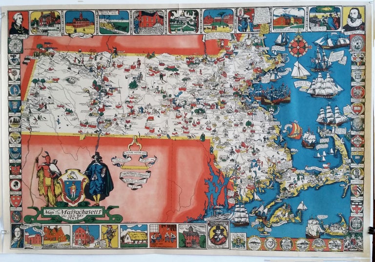
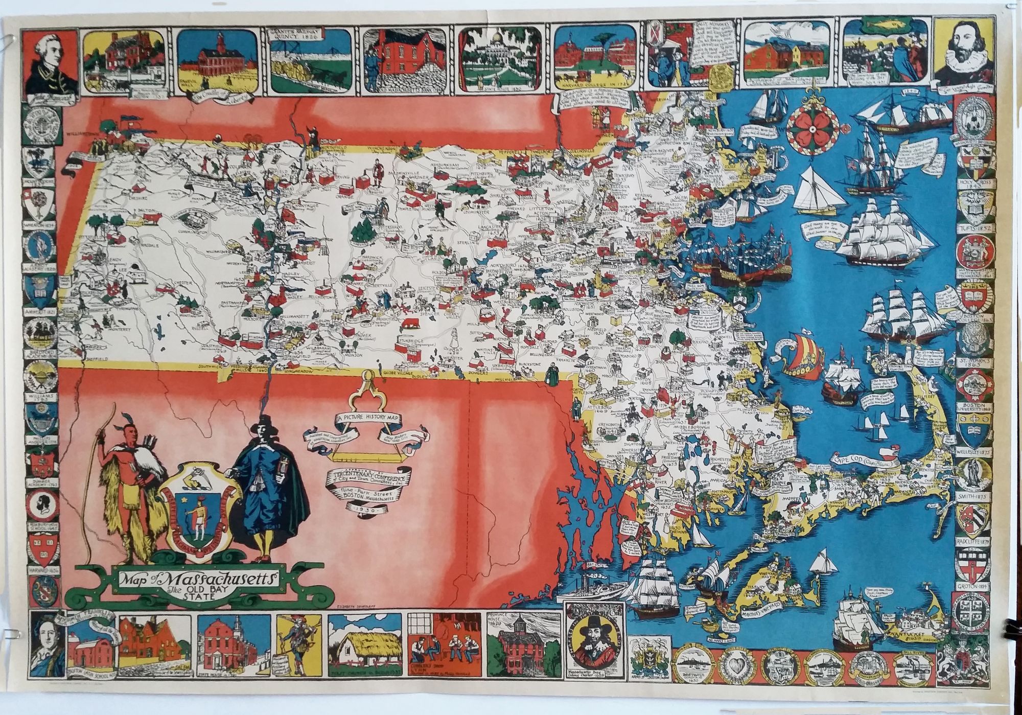
Massachusetts/ Education. SHURTLEFF, Elizabeth [New York: dated 1930] Map of Massachusetts The Old Bay State. [Secondary title:] A Picture History Map Published by the Graphic History Association… 26 ¼ x 38 inches. Four-color print. Two mended splits in margins, pin holes in corners, else excellent condition with very vibrant color. One of the most richly detailed and vibrantly colorful pictorial maps we’ve seen. The mapmaker/ artist here adopted the style of 17th century Dutch cartography marked by border vignettes and plentiful imagery within and around the map itself. This scarce map is known in two variants—three and four-color iterations; this is the far more richly colored, four-color state of the map. The map’s border vignettes consist of the crests of Massachusetts’ educational institutions, both secondary and university, with their founding dates; the state’s iconic structures and places; and portraits of historical figures. Within the map are images emblematic of the state’s towns and cities, many accompanied with notations. Not surprisingly, the map was marketed at the time not only as a striking wall decoration and travel guide but also as engaging educational device with which to capture the attention of students who may not otherwise be interested in history. The map in fact was accompanied by a historic quiz game as a teacher’s aid. A photo illustration on page 48 in Picturing America (see reference below) shows similar maps in a classroom setting. Elizabeth Shurtleff (1890-1968), a painter and artist, was among the first women to engage in the production of pictorial maps. From the 1930s to 1970s, many women would work in the genre. Born in Concord, New Hampshire and educated at the Boston Museum School of Fine Arts, Shurtleff produced a small body of highly striking maps, sometimes individually as in the case but usually in partnership with other women mapmakers. With Helen F. McMillan, she formed the The Graphic History Association based in New York. Hornsby, S. J. Picturing America the golden age of pictorial maps, pp. 22, 48, 90-91 (illustrated).
Sold