click here to zoom
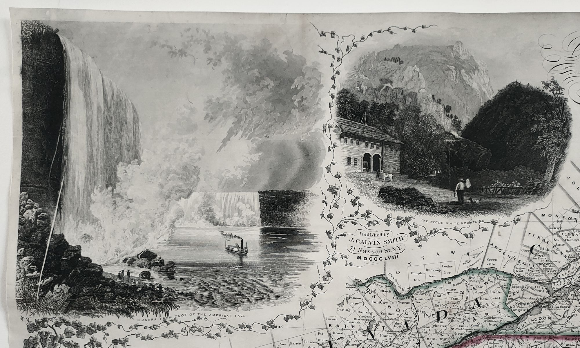
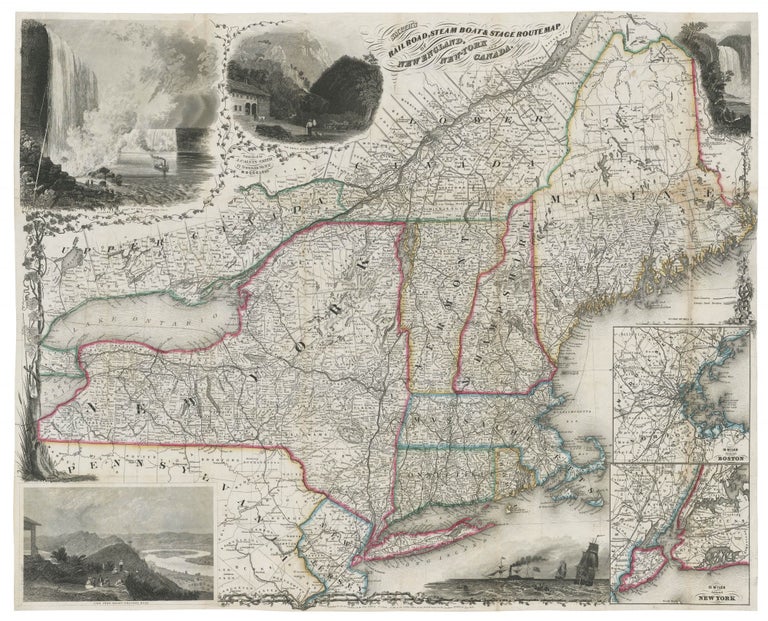
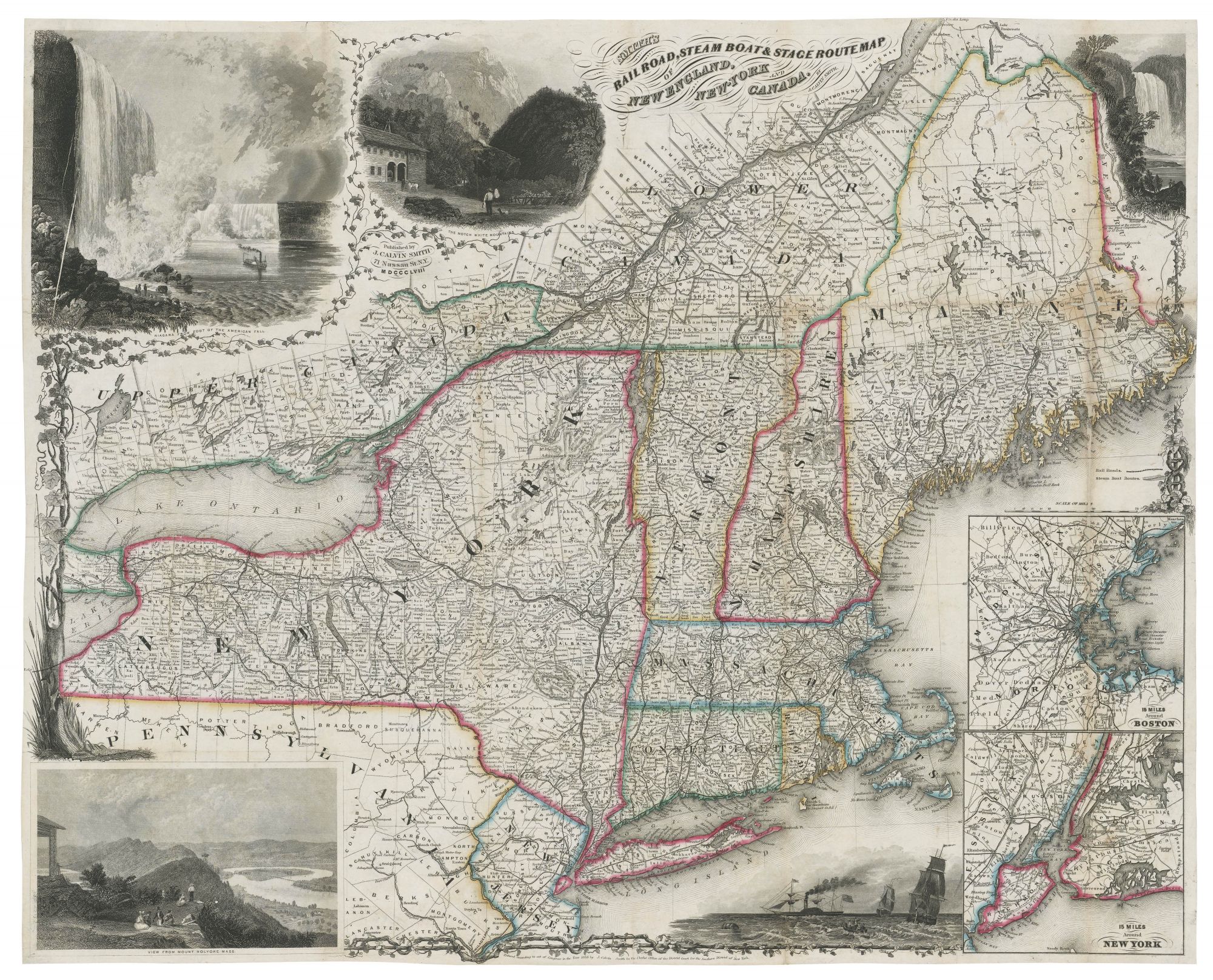
Northeast/ Canada/ Transportation History. SMITH, J. Calvin [New York: 1855/ 1858] Smith’s Rail Road, Steam Boat & Stage Route Map Of New England, New-York And Canada. By J. Calvin Smith. Published by J. Calvin Smith71 Nassau St. N.Y. MDCCCLVIII. 22 X 26 ¾ inches. Folding map, here flattened & mounted on rice paper; minor losses along a few folds, else a bright, very good example. A very scarce, exceptionally detailed map providing a virtually complete picture of the transportation infrastructure of mid-19th century New England, New York State, and parts of Canada, Pennsylvania and New Jersey. Not only does the map lay out rail, steam ship and stage routes, but it also indicates their interconnections. With travel by rail in the United States beginning only about 25 years before this map was published, its proliferation as seen here is quite breathtaking. This is an updated edition of a map first published in 1850 by both Sherman & Smith; this edition was by Smith alone. The imprint below the present map indicates that Smith controlled the rights to the map as of 1855. This Smith edition added several rail lines not found on the Sherman and Smith: one connecting Hartford and Providence, a completed line in Maine previously shown as proposed, and new branch lines in Vermont. Very likely other updates will be noted with further study. Smith has in this work taken full advantage of the remarkable precision and fineness of line that steelplate engraving is capable of, both in the map itself and especially in its five, exquisite illustrations. The density of the lines in these vignettes approaches the limits of what’s possible in steel engraving. Also, some of illustrations are notable for their unusual and highly scenic subject matter. While the Niagara Falls is a relatively common subject in map illustrations, its treatment here at upper left is unusually dramatic. More unusual is the view at lower left from the summit of Mt. Holyoke in Massachusetts with the Connecticut River seen below. Also depicted are The Notch (Crawford’s Notch) in the White Mountains in New Hampshire; the Falls of Montemorenci (Montmorency Falls) in Quebec that drop into the St. Lawrence River; and an untitled nautical scene depicting both sailing and steam vessels. At bottom right are details of Boston and New York City and surrounding regions with their transportation networks. Modelski 106; Rumsey 2416.002.
Sold