click here to zoom
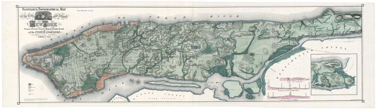
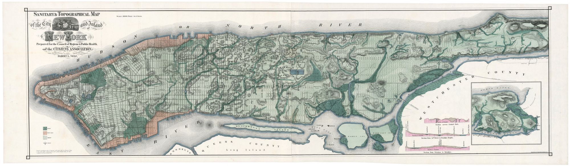
Manhattan. VIELE, Egbert L. [New York, 1865] Sanitary & Topographical Map of the City and Island of New York,… 18 x 62 ½ inches. Lithograph with original hand color. Fine condition. As suggested by the map’s title, its original purpose was not related to construction but to an effort to control contagious disease in the city. Viele argued that the filling in of the city’s watercourses resulted in hindering their natural drainage, thus creating areas of excessive moisture that promoted disease. His call for the city to allow the free flow of natural watercourses obviously went unheeded. The map, which was many years in preparation, grew from Viele’s surveys of the lands of Central Park; he was the park’s first engineer-in-chief. The lower half of the map first appeared in 1859 in a State Senate report. The map in the form offered here appeared in both 1865 and 1866 with two different titles--as given here and with a slightly different title-- Topographical Map of the City Of New York. Each appeared in different publications. A slightly enlarged version of the map was published in 1874 under the title, Topographical Atlas of the City of New York… Augustyn/ Cohen, Manhattan in Maps, pp. 136-39; Haskell, Manhattan Maps, no. 1133, cf. 1135, 1136.
This is the finest example we have seen of this now scarce, and to this day, still utilized map of New York City. This large-scale (1000 feet=1 inch) work provides a virtual cartographic x-ray of Manhattan Island, recreating on paper its pre-development topography and contours. “It delineates the original watercourses, streams (underground and surface), meadows, marshes, ponds, ditches, canals, and the shoreline before landfill expanded the city’s boundaries” (Augustyn/ Cohen). So accurate was the map in achieving its purpose that it is used to this day by construction companies and public utilities to ascertain where water might still be flowing underground. Martin Febesh (cited in Augustyn/ Cohen), whose company laid the foundation of the Citicorp Center, said of the map that he had found it “…accurate within feet.”
Sold