click here to zoom
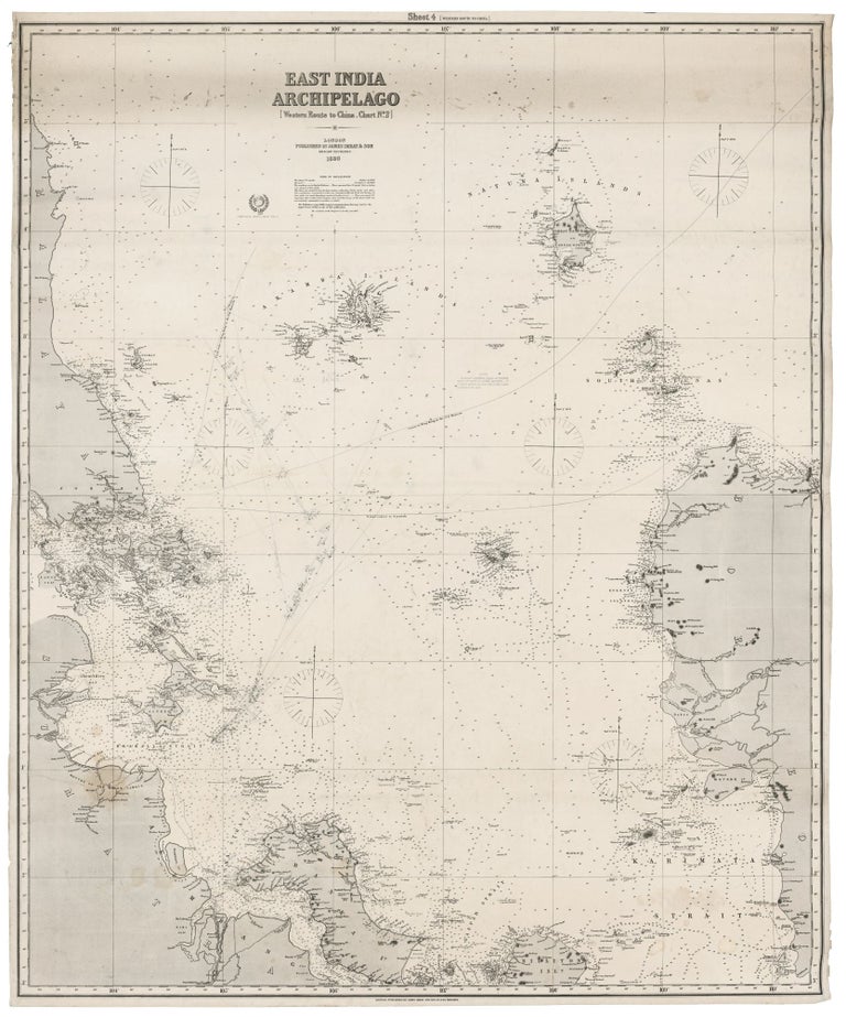
Singapore/ Parts of Malaysia, Borneo & Java. JAMES IMRAY & SON [London: 1880] East India Archipelago [Western Route to China. Chart No.2]… 1880. 49 x 40 inches, 124.5 x 101.7 cm. Two joined, lithographed sheets mounted on new, heavy blue paper with original trade label affixed. Courses with positions and log references marked in pencil. A few areas of light staining, else excellent. A fine, state-of-the-art chart of this focal point of English commerce, with exceptional detail of the Singapore area. Having come under direct British control in 1867, Singapore at the time of this chart was in a process of exponential growth as a hub of British commerce. While the chart is remarkably accurate for its period, Imray is candid in indicating various areas of cartographic uncertainty and solicits information from users of the chart to improve it: “The Publishers respectfully request communications that may tend to the improvement of this or any of their publications.” James Imray (1803-1870) was the leading publisher of sea charts in Britain during the latter part of the 19th century. Imray's charts were prized throughout the world by both naval officers and merchant mariners for their unparalleled accuracy and precise, elegant engraving. Imray was consistently able to source the most up-to-date hydrographic intelligence from the British Admiralty, as well as from commercial pilots and captains. Imray was also London’s leading seller of navigational equipment and sailing directions. Imray himself directly managed the chart end of the business. Initially a bookseller and binder in Cheapside, Imray in 1836 joined with Michael Blachford, a sea chart publisher based in London. The partnership flourished and soon began to compete with the larger firm of Norie and Wilson. In 1846 Imray bought out Blachford, taking over as sole proprietor. Through various partnerships over the years, the company has survived to this day, now specializing in charts for yachting and fishing.
Price: $1,300.00