click here to zoom
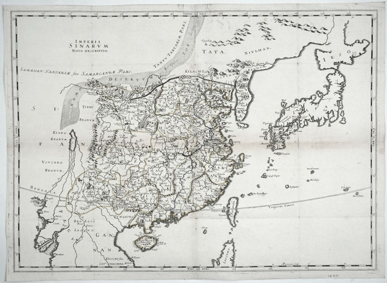
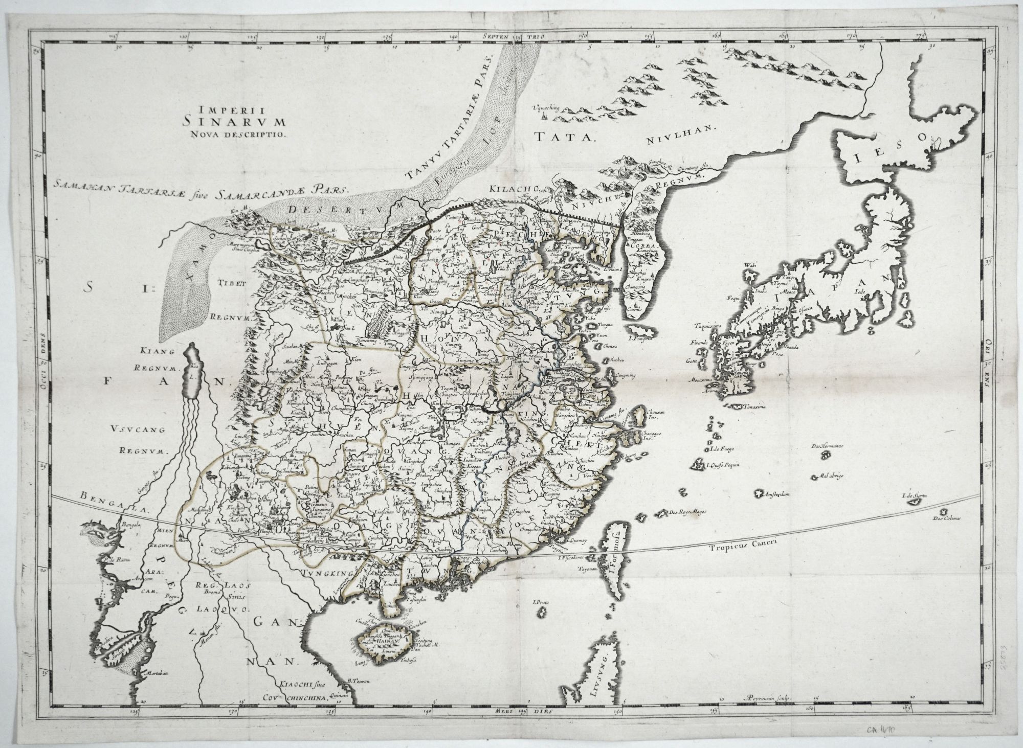
China/ Japan. THÉVENOT, Melchisédech. [Paris, 1663] Imperii Sinarum Nova Descriptio. 18 x 25 inches. Original outline color; some fold wear with minor separations & losses, flattened & mounted on rice paper, overall very good. An important map embodying significant advances that were made in the Western mapping China since the early part of the 17th century. While this is evident in the generally accurate shape of China as a whole, it is equally apparent in the mapping of its interior, particularly its river systems. The Blaeu/ Martini was the model for this map, but Thevenot added considerably more detail, notably place names along the Chinese coast and in Japan. The map also shows greater detail along the Great Wall than earlier maps. The Korean peninsula is here depicted more accurately and now includes 10 place names. Hokaido (here “Ieso”), Japan’s northernmost island, is shown in transition from a peninsular to its correct, island form. Imperii Sinarum Nova Descriptio was included in one of the most important 17th century travel collections pertaining to the Far East, Thevenot’s five-part Relations de divers Voyages Curieux, a work that Suarez has described as one “which was to France what Hakluyt’s writing had been to England and Ramusio’s had been to Italy.” Suarez, T. Early Mapping of Southeast Asia, pp. 208, 212; not in Walter.
Price: $2,250.00