click here to zoom
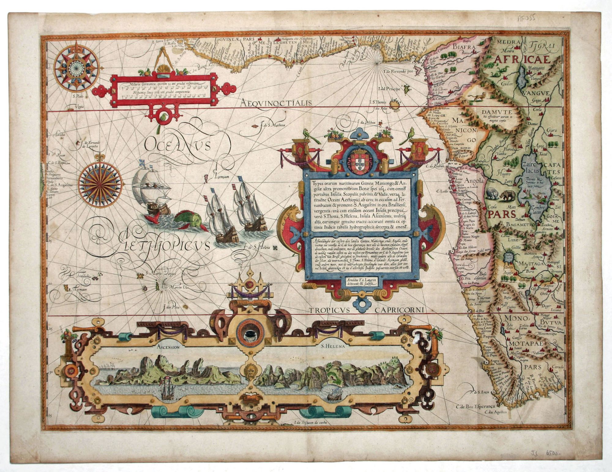
South & Western Africa. LINSCHOTEN, J. VAN/ LANGREN, A. & H. VAN [Amsterdam, 1596] Typus orarum maritimarum Guineae, Manicongo, & Angolae ultrap promontorium Bonae spei . . . 15 1/8 x 20 3/8 inches. Fine hand color; margins expertly extended with no loss of engraved surface, excellent. $5500 A beautiful, richly colored example of Jan van Linschoten’s map of southwestern Africa. A rare, early, Dutch issue on heavy paper. With its large and intricate cartouches and compass roses, graceful swash lettering, and other ornamental flourishes, this is one of the most richly engraved maps of early cartography. Its distinctive visual character was due to having been modeled after a Portuguese portolan chart. In fact, the title cartouche design still retains the Portuguese coat-of-arms. The map extends to just beyond the Cape of Good Hope. In the lower cartouche are views of Ascension and St. Helena Islands, located far off the West Coast of Africa and important stopping points in the route around Africa. Jan van Linschoten (1563-1611), though of Dutch origin, was secretary to the Portuguese Archbishop at Goa. In this capacity, he had access to numerous documents including maps and sailing directions concerning the lucrative spice trade in the East Indies. Upon his return to Holland, Linschoten published this material in his Itinerario, arguably one of the most influential books ever published in that it gave access to the spice trade to, first, Holland and then other to other European nations, as editions of his work proliferated. Norwich 239a; Tooley, MCC No. 29, 167.
Sold