click here to zoom
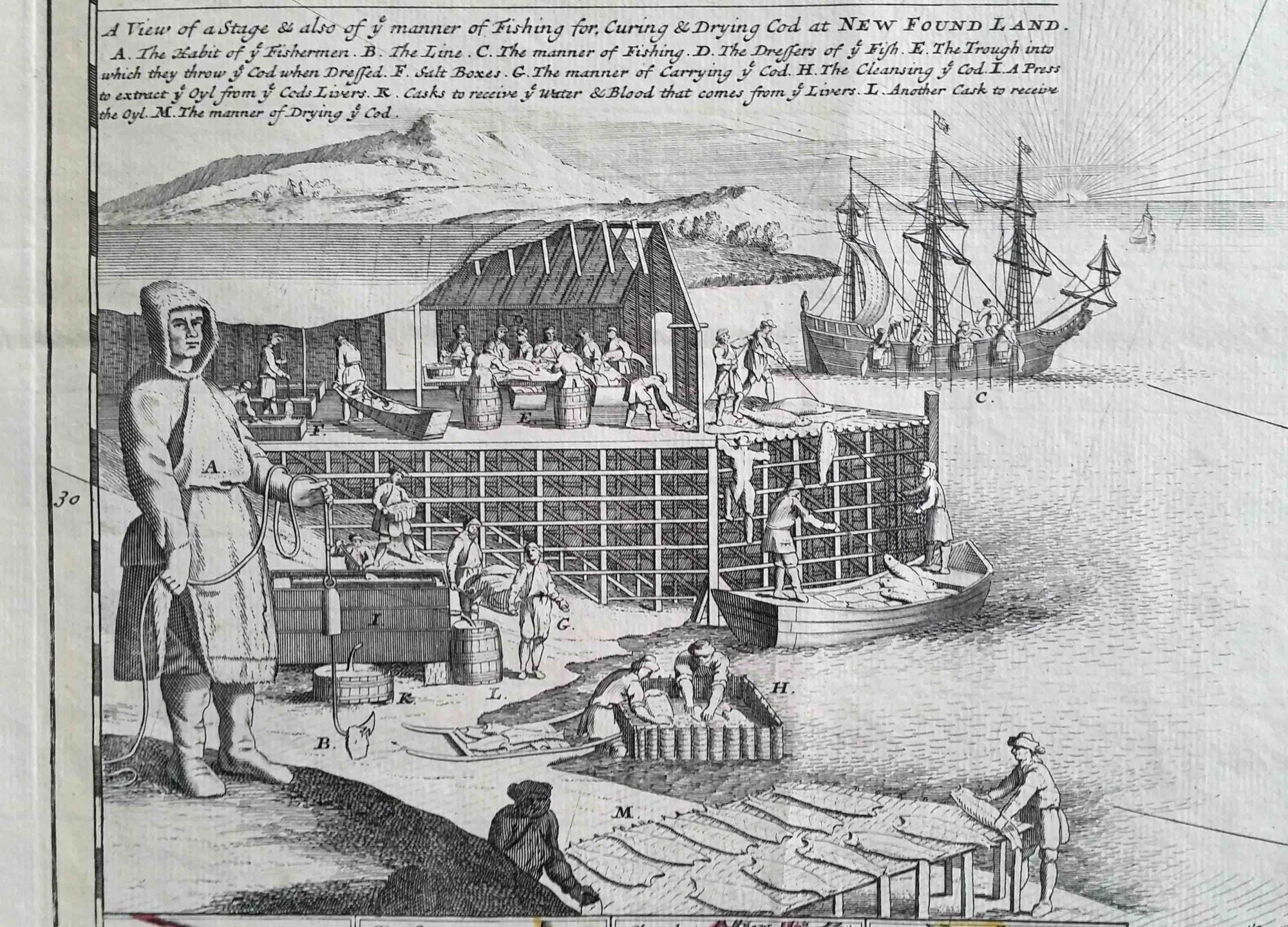
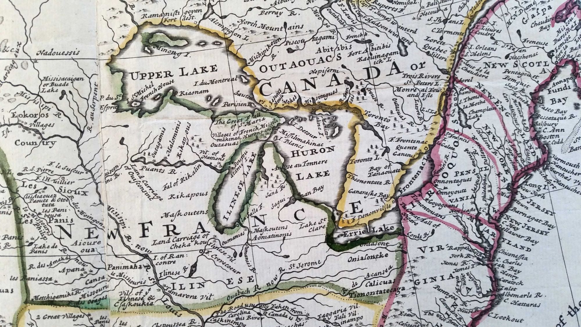
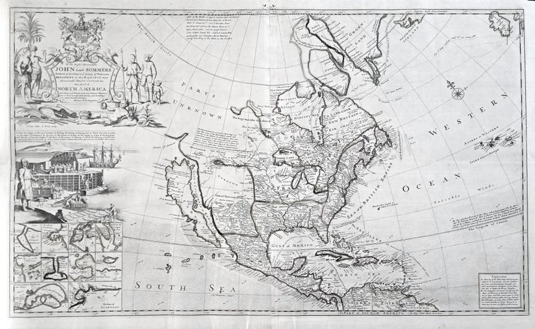
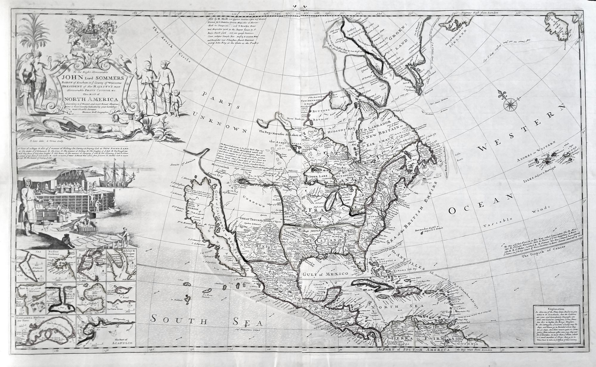
North America/ California as Island. MOLL, H. [London, 1720] To the Right Honourable John Lord Sommers . . . This Map of North America . . . 22 5/8 x 38 inches. Original outline color; few, small wormholes in upper margin, reinforcement in lower margin, else excellent condition. Highly pictorial and important, English map of colonial North America, noted for its well-detailed illustration of the curing and processing of codfish. More than a mere decoration, this vignette highlighted an industry that was a mainstay of the North American economy for centuries, dating from the 15th century. Somewhat surprisingly, Moll in this map adopted a considerably less aggressive depiction of English territorial claims than he would on other maps of North America. The western boundary of English possessions is placed along the Appalachian Mountain range, though all the northern territories, Nova Scotia, and Newfoundland are claimed for the English. Yet, the Great Lakes region, the entire Mississippi valley, the Gulf Coast, and Florida are all shown as French territory. Since Moll would elsewhere be such a strident denouncer of French territorial encroachments, the passive approach of this map is somewhat puzzling. The map contains a bold Sanson-like delineation of California-as an-island, and ten inset charts at lower left depict important harbors. The preferred route of the Spanish treasure fleets and detailed notes pertaining to it are shown in the Caribbean. In the American West, Moll was unable to resist adding Lahontan’s speculative lake and river system that suggests the possibility of a waterway to the Pacific. McLaughlin 192; Tooley, America, no. 82, p. 130; Leighly 145; Goss, Mapping of North America, no. 53; Karpinsky, pp 123-124.
Sold