click here to zoom
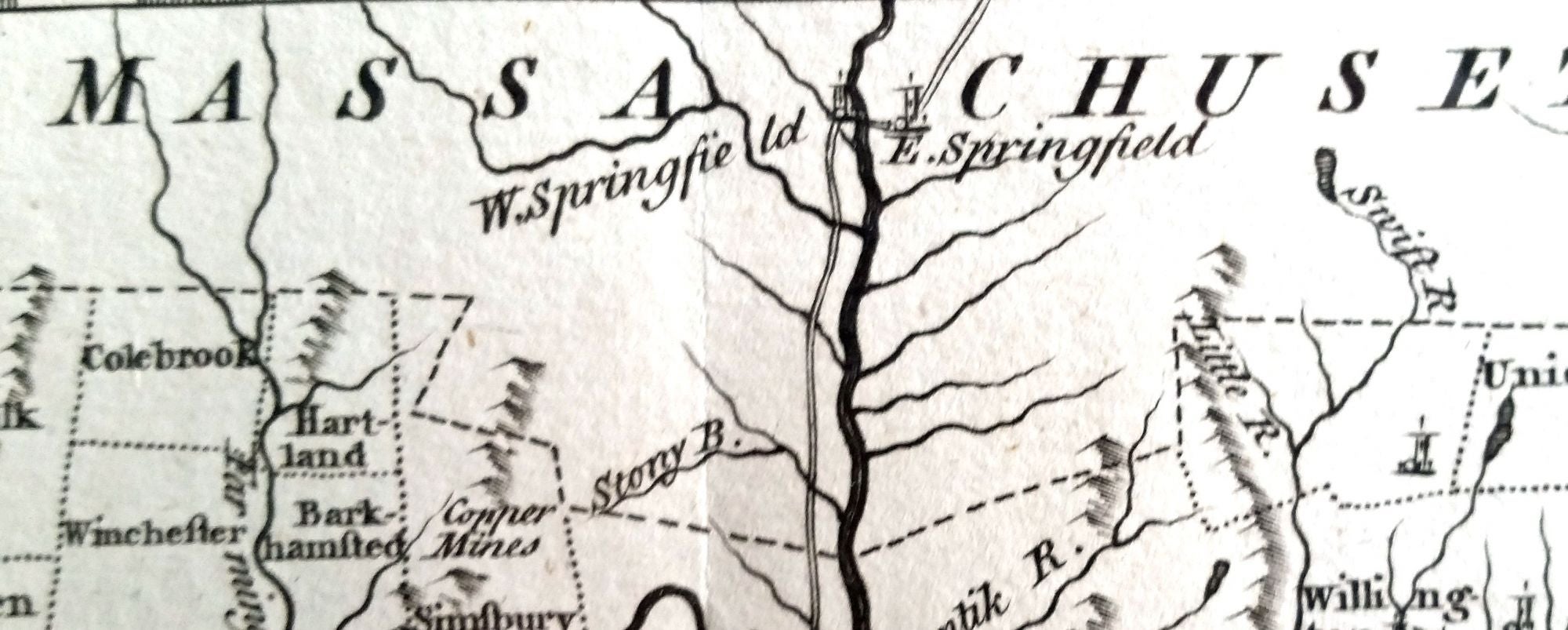
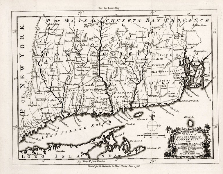
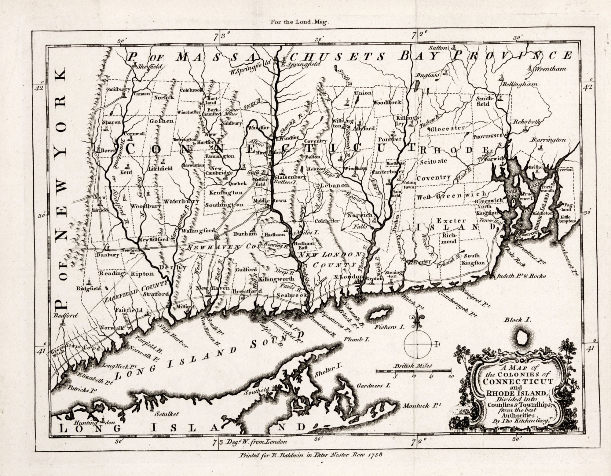
KITCHIN, Thomas [London: 1758] A Map of the Colonies of Connecticut and Rhode Island Divided into Counties & Townships… Engraved area: 7 1/8 x 9 inches; framed size: 15 ½ x 17 inches. Copperplate engraving; mint condition. Archivally framed. “…the first printed map that is primarily of Connecticut now extant, and the data it shows of township lines is not to be found an any existing earlier sources” (Thompson—see below). The attractively engraved map appeared in the London Magazine, a sophisticated monthly publication that provided in-depth reports on world affairs and developments in science and technology. As can be seen, Connecticut at the time of this map consisted of substantially fewer towns than at present, and its few main roads are also shown on the map. While this map relied on Jefferys’s 1755 map of New England, Thompson suggests that both utilized yet unknown, perhaps lost sources. A fascinating feature on the map is the indented area or notch that can be seen in the center of the state’s northern borderline adjoining Massachusetts; it is sometimes called the “Southwick Jog.” A war of surveyors between the two states began in 1642 when a Massachusetts survey team ran a line that Connecticut authorities claimed was 8 miles too far to south. This began a dispute that despite various attempts, including a joint survey, was not fully resolved until 1804. See online at https://libguides.ctstatelibrary.org/hg/maps/jog Thompson, Maps of Connecticut, no. 14, pp. 30-33.
Sold