click here to zoom
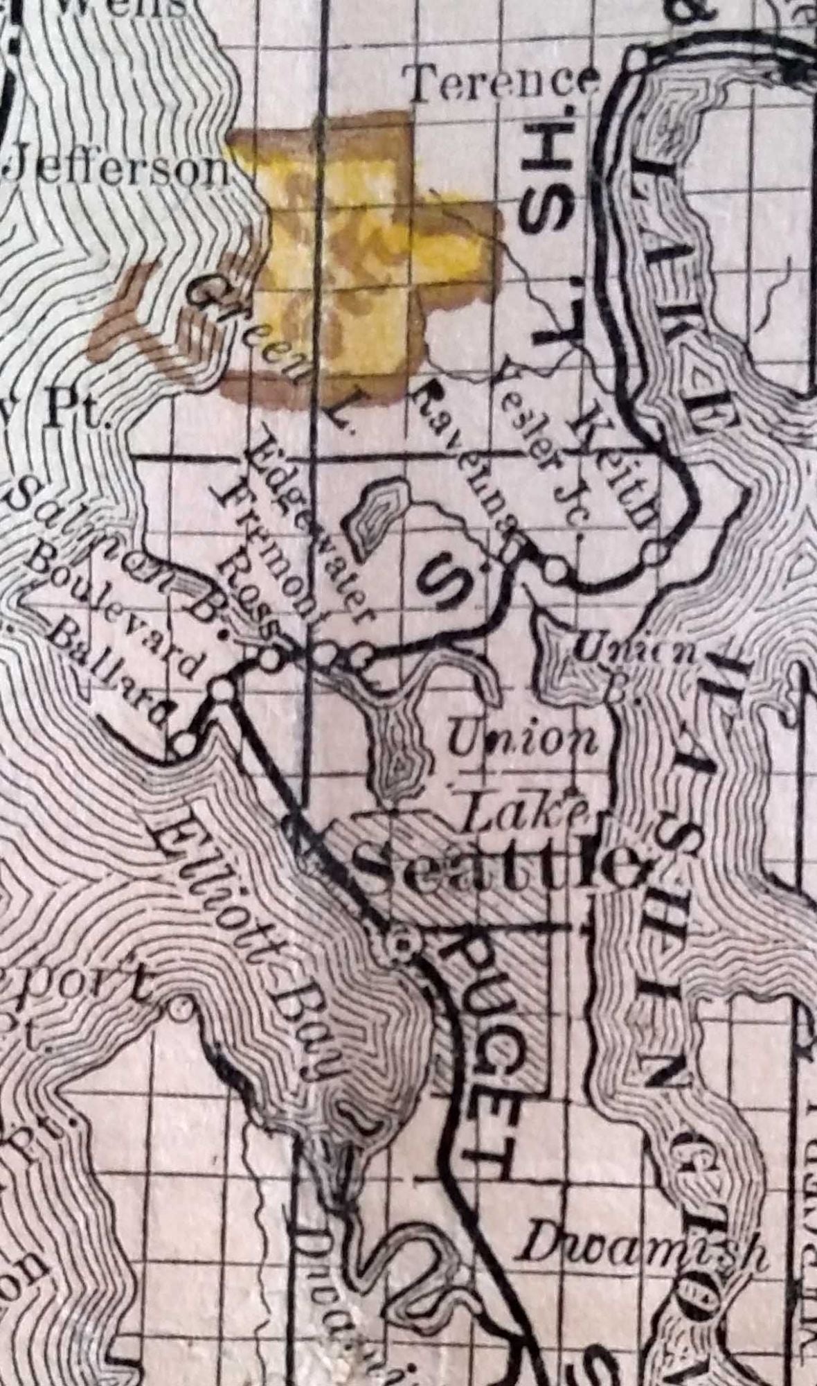
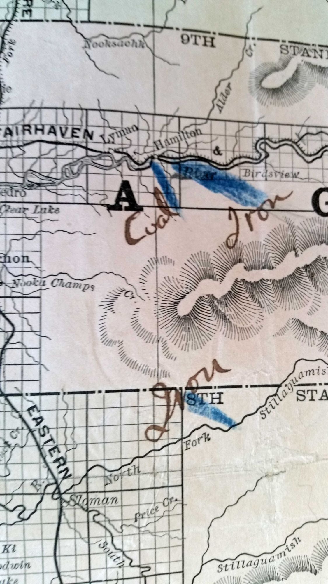
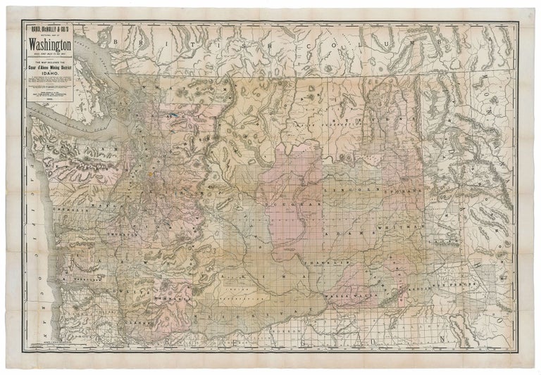
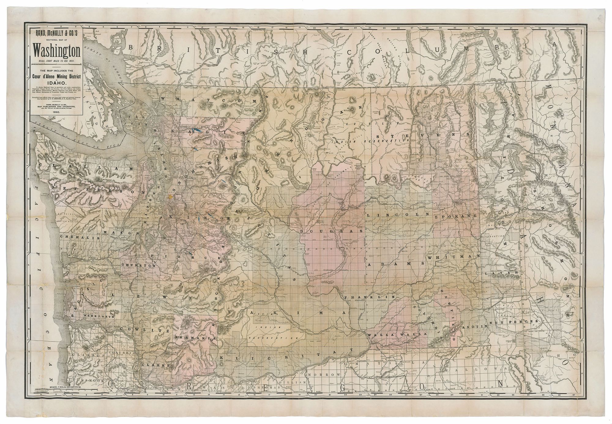
Washington State/ Mining History. RAND, MCNALLY & CO. [Chicago: 1890] Rand, McNally & Co.’s Sectional Map Of Washington. Scale, Eight Miles to One Inch. The Map Includes The Coeur d’Alene Mining District In Idaho… 37 1/4 x 55 3/4 inches. Lithograph with original hand color. Ex-folding map that has been expertly flattened & mounted on acid-free paper; some fold wear & minor losses, overall a very good, bright, attractive example. First edition of this rare, large-scale map of Washington, published the year after statehood, with manuscript notations reflecting serious use. We are aware of no earlier map of Washington as a state. It would be difficult to name a more richly informative map at this pivotal juncture in the state’s history. It notes mineral deposits—gold, silver, iron and coal primarily--throughout the state and in western Idaho, and it illustrates rail lines, both in use and under construction. Indian and military reservations are delineated; the elevations of the state’s peaks are given; and wagon roads and ferries are shown. Additional mineral deposits are noted in ink in an early hand. Although the map was copyrighted in 1889, this 1890 issue appears to have been the first. Only four institutional examples of it are recorded in OCLC (no. 32379712); each is an 1890 issue. There were later issues of 1891 and 1894. Another manuscript notation on the map reflects the re-building Seattle at the time after it had suffered a devastating fire in June of 1889 that leveled much of the city. In the area of what is now north Seattle, an early user of this map had drawn in yellow a crude town plan and labelled it “Town Site.” As noted on the map, some of it was prepared with the field notes and assistance of C. H. Amerine of Spokane Falls, which accounts for the excellent mapping of eastern Washington and northern Idaho and its detailed depiction of the various mining districts in these areas. Amerine was a noted cartographer who published two maps of Washington in Spokane Falls in 1888 and 1889 that were both smaller than this one.) He also produced a large regional map in Tacoma in 1891 that included Washington, Oregon, Idaho and western Montana.
Sold