click here to zoom
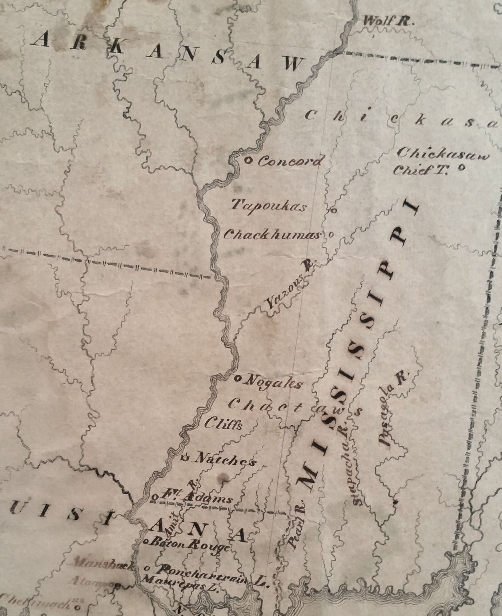
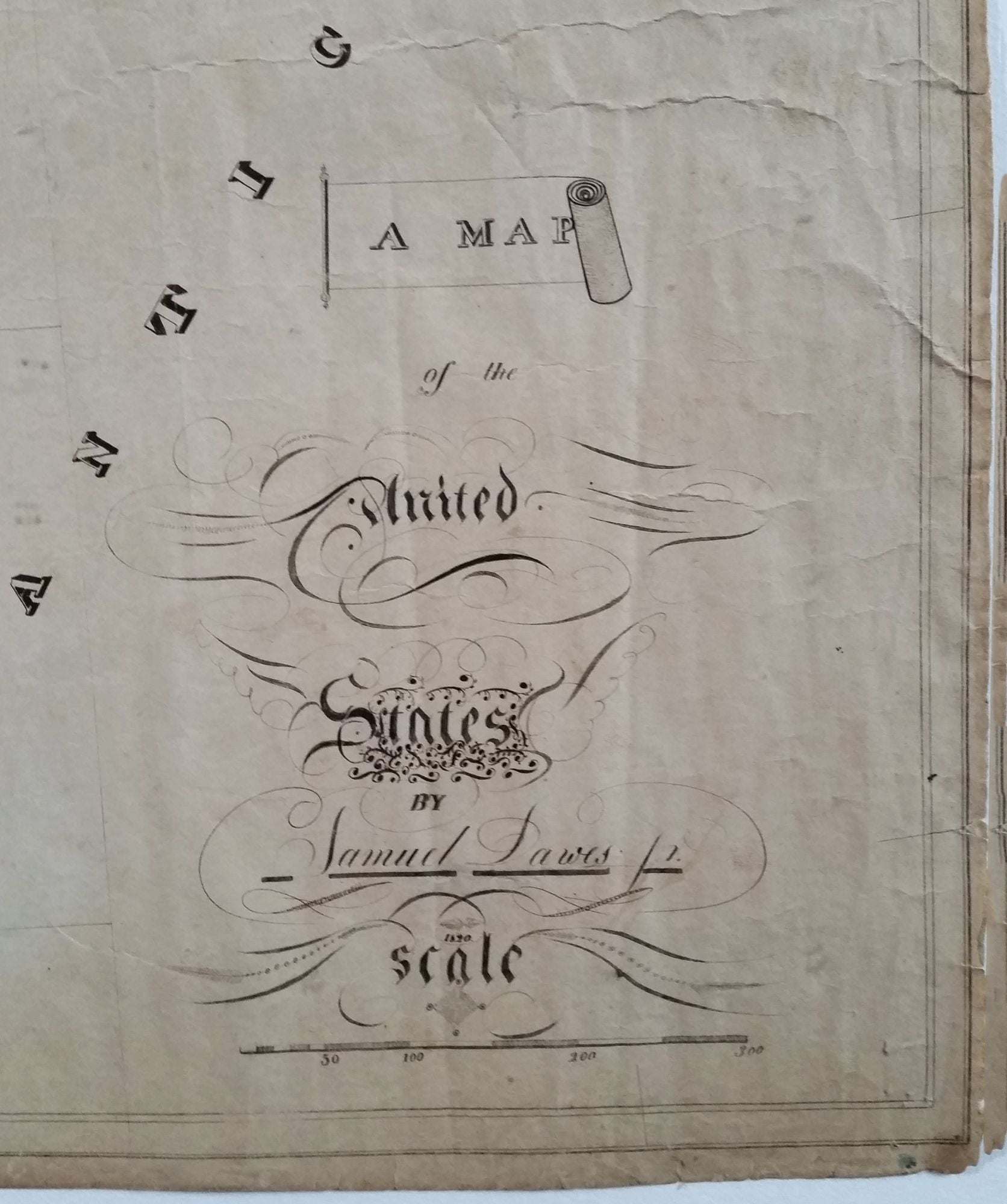
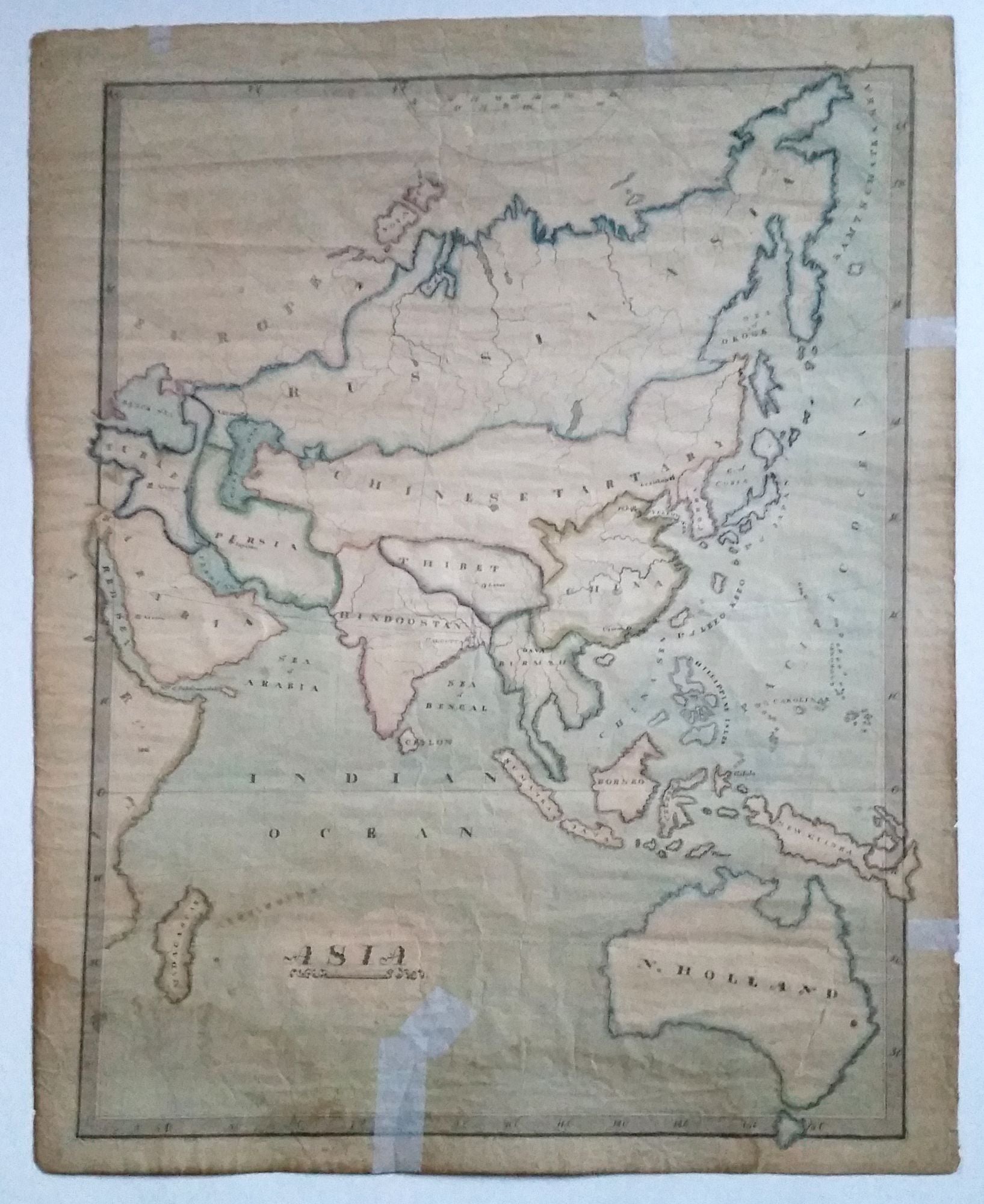
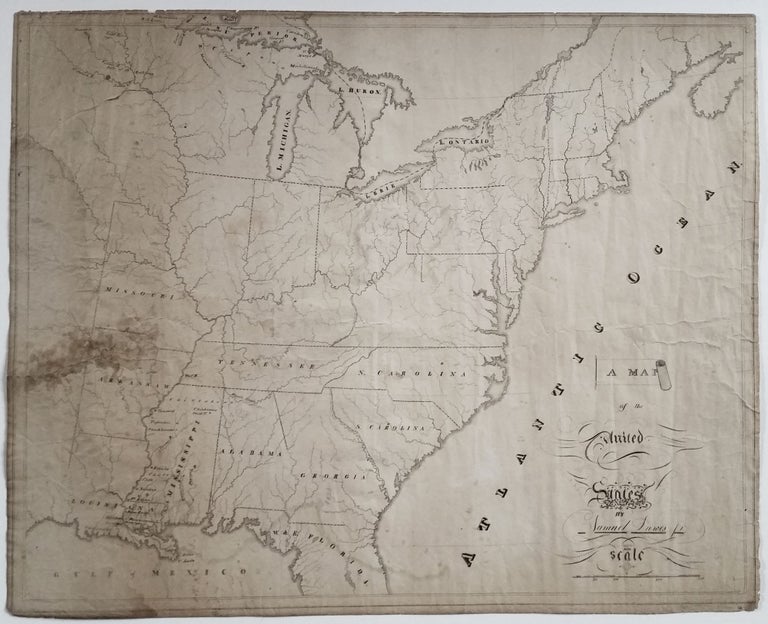
United States/Early Geographic Education/ Native American History. DAWES Jr., Samuel [Mississippi?: Dated: 1820] A Map of the United. States By Samuel Dawes Jr. 1820. [Verso:] Asia. 18 ¾ x 23 3/8 inches. Pen & ink & watercolor on woven paper. Some staining and age toning, three neatly closed splits into surface, chipping along edges, still very good for this kind. One of the most finely drafted school-exercise maps we’ve seen, and an uncommon and early example by a male student. Its precision and superb lettering and calligraphy are remarkable. This very gifted student even devised his own graphic style for indicating border lines with alternating dashes and crosshatching. Most American school-exercise maps, in addition to having been primarily produced by girls, almost entirely originated in the northeast. Judging from where the most geographic detail is concentrated in this map, it was almost certainly produced in the south in what is today Mississippi and Louisiana. Still more interesting is that much of the detail here refers to Native Americans. In northern Mississippi is the notation—“Chickasaw Chief T.”—which likely refers to where the last great Chickasaw chief, Tishomingo, was forced to re-settle. Also named in northern Mississippi are three, apparently very small settlements—Concord, Tapoukas and Chackhumas—the latter two being local tribal names. Likewise, there are three quite obscure names in Louisiana’s bayou country: “Manshack,” (the town of Manshac); “Atacapas” (Attakapas is county today); and “Chetimachus,” (likely referring to the Chitimacha tribe). On the reverse side of the sheet is a similarly finely drawn map of Asia and Australia that is also nicely colored. A notable detail is that the sea between Japan and Korea is called the “G. of Corea.” Surprisingly, we have yet to find biographical information on the mapmaker. Given the skill displayed in this work, one expect he would have become a cartographer.
Sold