click here to zoom
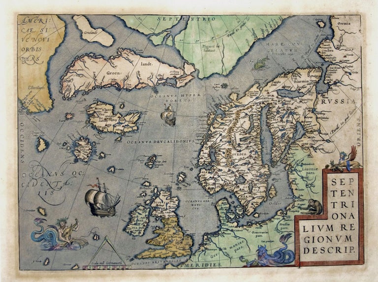
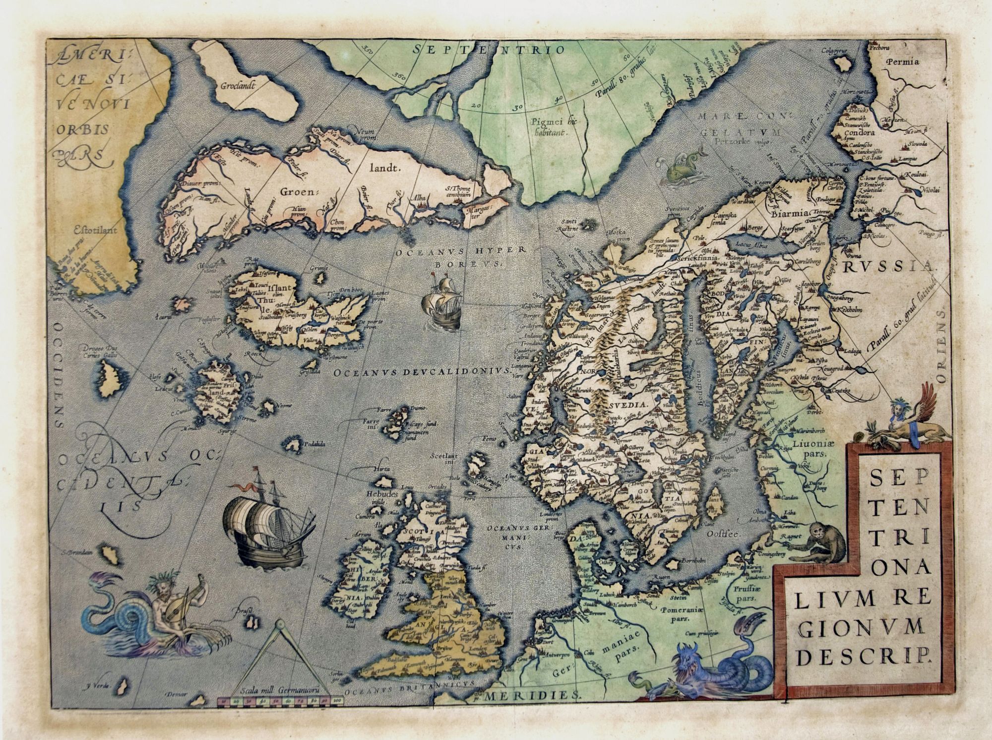
Septentrionalium Regionum descrip.
14 x 19 inches, Fine hand color; excellent condition.
One of Ortelius’s most important European maps, in an attractive example. It clearly summarizes what 16th century geographers believed of northern Europe and the waters above it. In his atlas, Ortelius cited an array of cartographers whose ideas contributed to this map, including several whose maps are now unobtainable. Greenland and Estotiland (mainland North America) were drawn largely from Ziegler and Nicolo Zeno. The presence of the fictional island of Frisland reflects the extent to which of Zeno’s highly speculative chart of the north Atlantic was accepted. The outline of Scandinavia itself shows the strong influence of Olaus Magnus, whose own monumental 9-sheet Carta Marina is known to exist only in two copies. Ortelius’ attractive engraving is embellished with a mer-man and sea monster in the ocean, and the cartouche is decorated with a dragon, a harpy, and somewhat incongruously, a monkey.
* van den Broecke, 160.4; Ginsberg, Printed Maps of Scandinavia and the Arctic 1482-1601, 24 state 5.
Sold