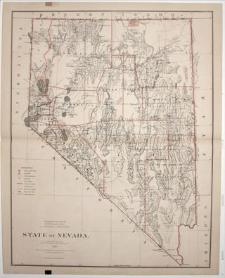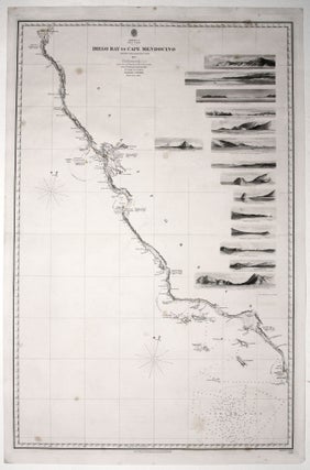
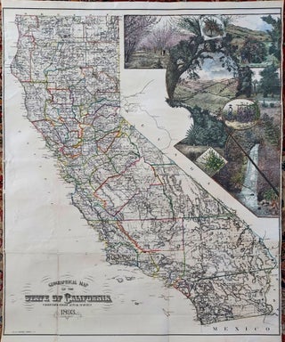
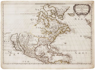
Two sheets: America West Cape Mendocino to Vancouver Id. from Cape Flattery southward... [and] America West Diego Bay to Cape Mendocino.
Scarce, finely engraved chart on two sheets of the entire west coast of the United States and including the southern portion of Vancouver Island. Each of the 27 coastal recognitions on the charts is delicately realized. These provided visual reference for the entry to the major bays and ports as.....
![Item #10137 The Cerographic Missionary Atlas… [Imprint inside front cover:] Entered according...](https://rtamaps.cdn.bibliopolis.com/pictures/10137.jpg?width=320&height=427&fit=bounds&auto=webp&v=1658773966)