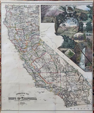
California/ Winemaking. H. S. CROCKER CO. [San Franscisco: 1893] Geographical Map of the State of California Compiled From Actual Surveys 1893. 27 x 33 inches. Lithographed, hand-colored folding map, flattened & mounted on linen. A few closed fold separations, overall excellent. .....
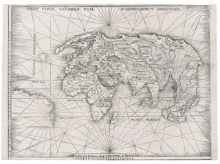
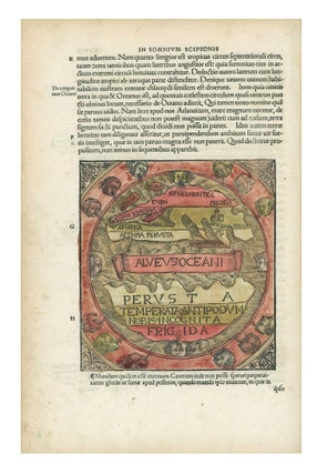
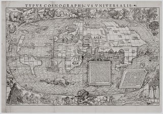
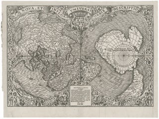
![Item #267 Caelestem Hic Terram Inspicias Terrestre Q[uam] Caelum. C./ BERLINGHIERI PTOLEMY, F](https://rtamaps.cdn.bibliopolis.com/pictures/267.jpg?width=320&height=427&fit=bounds&auto=webp&v=1585677042)