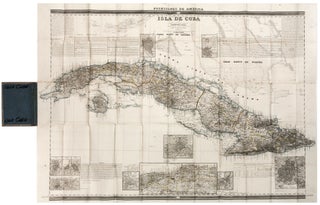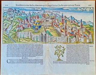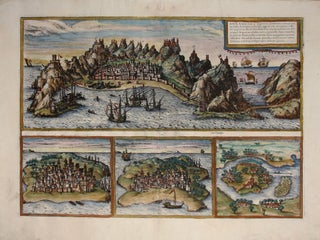
Aden, Arabiae Foelicis Emporium….
One of relatively few engravings by Braun & Hogenberg of non-European locales. The earliest acquirable European view of Aden in Yemen, the Arabian port commanding the passage between the Red Sea and the Indian Ocean. Also pictured are Mombasa in Kenya, Kilwa in Tanzania, and Sofala in Mozambique, all on.....
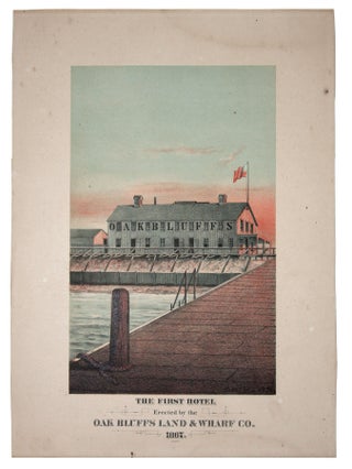
![Item #11075 FIRST VIEW of the BATTLE of PATAPSCO NECK [:] DEDICATED TO THOSE WHO LOST THEIR...](https://rtamaps.cdn.bibliopolis.com/pictures/11075.jpg?width=320&height=427&fit=bounds&auto=webp&v=1585677032)