click here to zoom
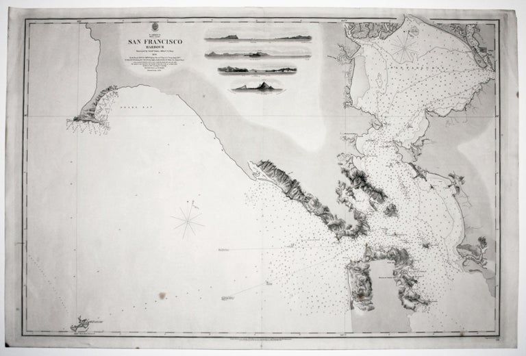
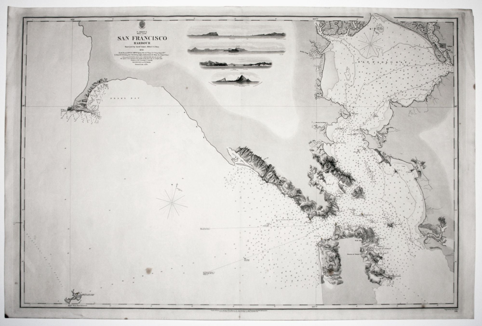
N. America West Coast San Francisco HarbourSurveyed by Lieut. James Alden U. S Navy 1856.
25 1/4 x 37 1/2 inches. Bottom of centerfold reinforced, one stain, else a fine, bright example on heavy paper.
A superb, scarce, very well-preserved, mid-19th century chart of San Francisco Bay and Harbor. Although a semi-official British chart, it was based on the survey of an American Naval officer, Lt. James Alden. Under the superintendence of Capt. Washington, the Admiralty office greatly increased its output and obtained surveys sources beyond their own surveys. British Admiralty charts were still copperplate-engraved at the time rather than lithographed, accounting for the refined visual character of this work. Coastal topography is nicely realized as are the four profile views at upper center.
The chart extends as far north as Drake Bay and includes South Farallon Island at lower left. At the time of this chart San Francisco remained a magnet for fortune seekers, especially with the discovery of the Comstock Silver Load in 1859. The city's growth is reflected in the expanded street grid for San Francisco and the development of Valejo shown on the chart.
* Ritchie, Rear Adm. G. S. The Admiralty Chart, p. 283; Rumsey 6860.
Sold