click here to zoom
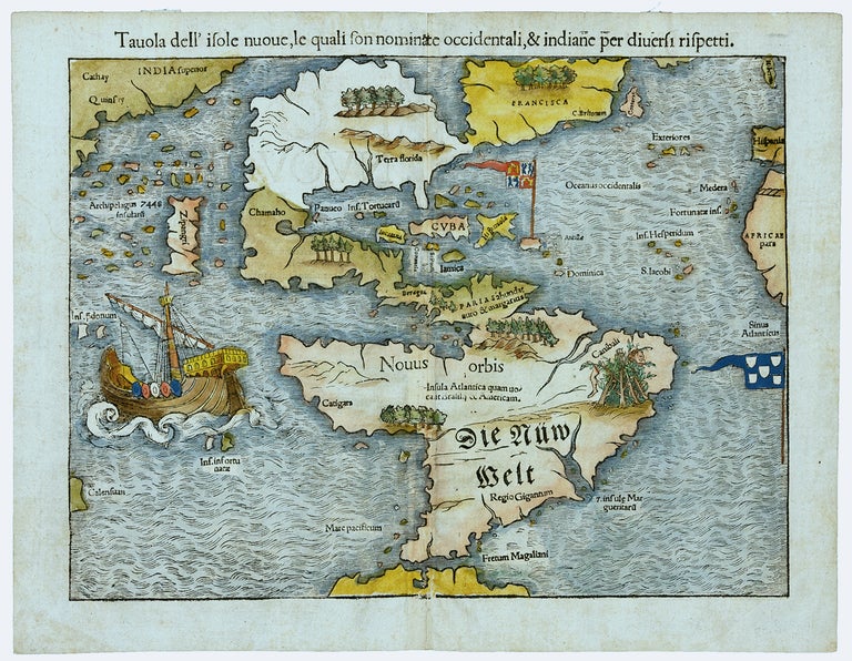
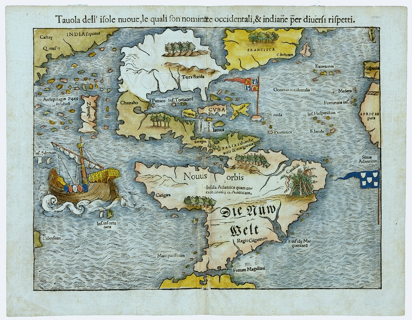
Tavola dell’ isole nuove.
11 ½ x 14 5/8 inches. Fine hand color; excellent condition. Excellent example of the earliest separate map of the entire Western Hemisphere. This was also the earliest map to refer to the Pacific Ocean (along with Munster's world map) by a variant of its present name, Mare pacificum. It was one of earliest acquirable maps to show Japan prominently, which is depicted as a large single island called Zipangri (after Polo) just off the coasts of California and Mexico. The depiction of North America is dominated by one of the most dramatic geographic misconceptions to be found on early maps--the so-called Verrazanean Sea. On the map, the Pacific Ocean cuts deeply into North America so that there is only a narrow isthmus between the Atlantic and Pacific oceans. This resulted from the voyage of Verrazano, who mistook the waters to the west of the Outer Banks, the long barrier islands outlining the North Carolina coast, as the Pacific Ocean. The division of the New World between Spain and Portugal is recognized on the map by the flag of Castile planted in Puerto Rico, here called Sciana.
* Schwartz/Ehrenberg, Mapping of America, pp. 43, 45, 50; Cortazzi, H. Isles of Gold, pl. 12; Tooley, R.V. Maps and Mapmakers, p. 112, pl. 80; Burden 12, state 8.
Sold