click here to zoom
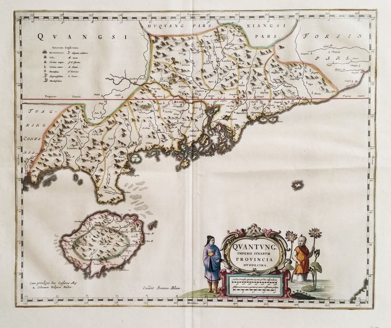
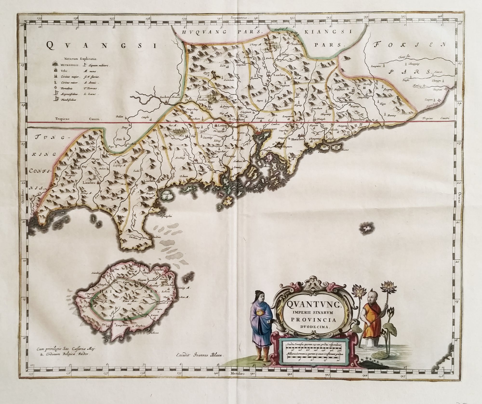
Quantung, Imperii Sinarum Provincia Duodecima.
16 x 19 inches, Fine original color; fine condition. An exceptionally fresh example, in brilliant original color, of the earliest separate map of the area that now includes Hong Kong. Macau, Guangzhou (Canton), and several other place names appear in the Zhu (Pearl) River delta, and Hainan Island to the southwest is quite well detailed. Finely engraved Oriental figures flank the cartouche, and the map’s original color is exceptionally vibrant. The map appeared in Blaeu’s atlas of China, which was “based on Chinese sources, [and] was far in advance of any previous European work. For the period it was remarkably accurate. . . “ (Tooley) .
* Van der Krogt/ Koeman [8432:2] 2:501.
Sold
See all items in
Antique Maps
See all items by J. BLAEU