click here to zoom
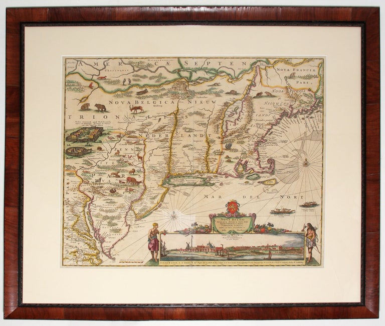
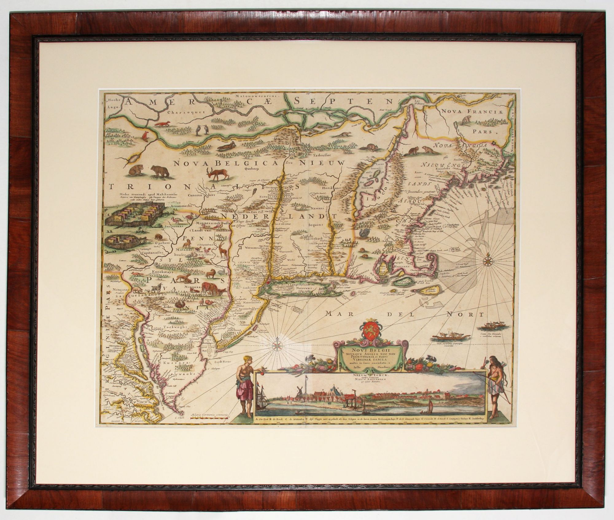
Novi Belgii Novaeque Angliae.
18 1/4 x 21 1/2 inches, Fine original color, refreshed; lightly toned, else excellent.
This is the most lavishly decorative of all the early editions of the best 17th century, Dutch map of the Northeast and New York. It added illustrations of animals and other detail not found on previous issues. The map was the culmination of all the surveys of the area conducted by the Dutch colonists of New Netherlands during their first three decades in America. It is also the first printed map to delineate the shape of Manhattan with relative accuracy. Also, English towns that were just being settled at the time, such as Milford, Guilford, Stratford, and Stamford, are shown along the Connecticut shoreline. Every Indian tribe encountered by the colonists, as well as every town and settlement in existence at the time, are believed to be on this map.
The map in its original form was part of a protest by New Netherlands colonists against the policies of the Dutch West India Company, the organization which sponsored the colonization of New York. As recently argued by Joep de Koning (see below) The author of this original was possibly Adrien van der Donck, a young lawyer who spearheaded the protest..
The view of New Amsterdam in the lower right hand is based on the second earliest image of the city. It is believed to be generally accurate but sanitized, and shows New Amsterdam approximately 25 years after initial settlement. The view reveals a modest but charming village set on the rolling landscape that characterized Manhattan topography in its virgin state.
* cf. Stokes, I, pl. 7-b, pp. 147-48; Tooley, America, pp. 285-6 state 9; cf. Burden 315; cf. Augustyn/ Cohen, Manhattan in Maps, pp. 32-33; J. De Koning in Mercator’s World, Jul./Aug. 2000, pp.28-33.
Sold