
click here to zoom
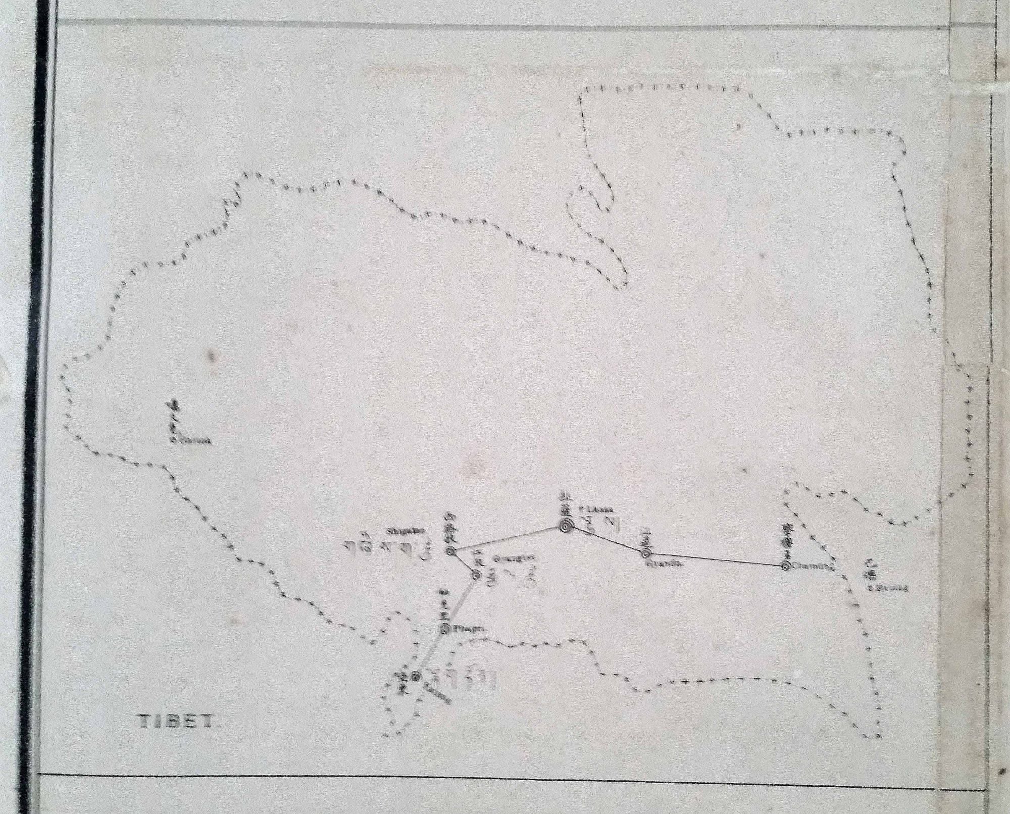
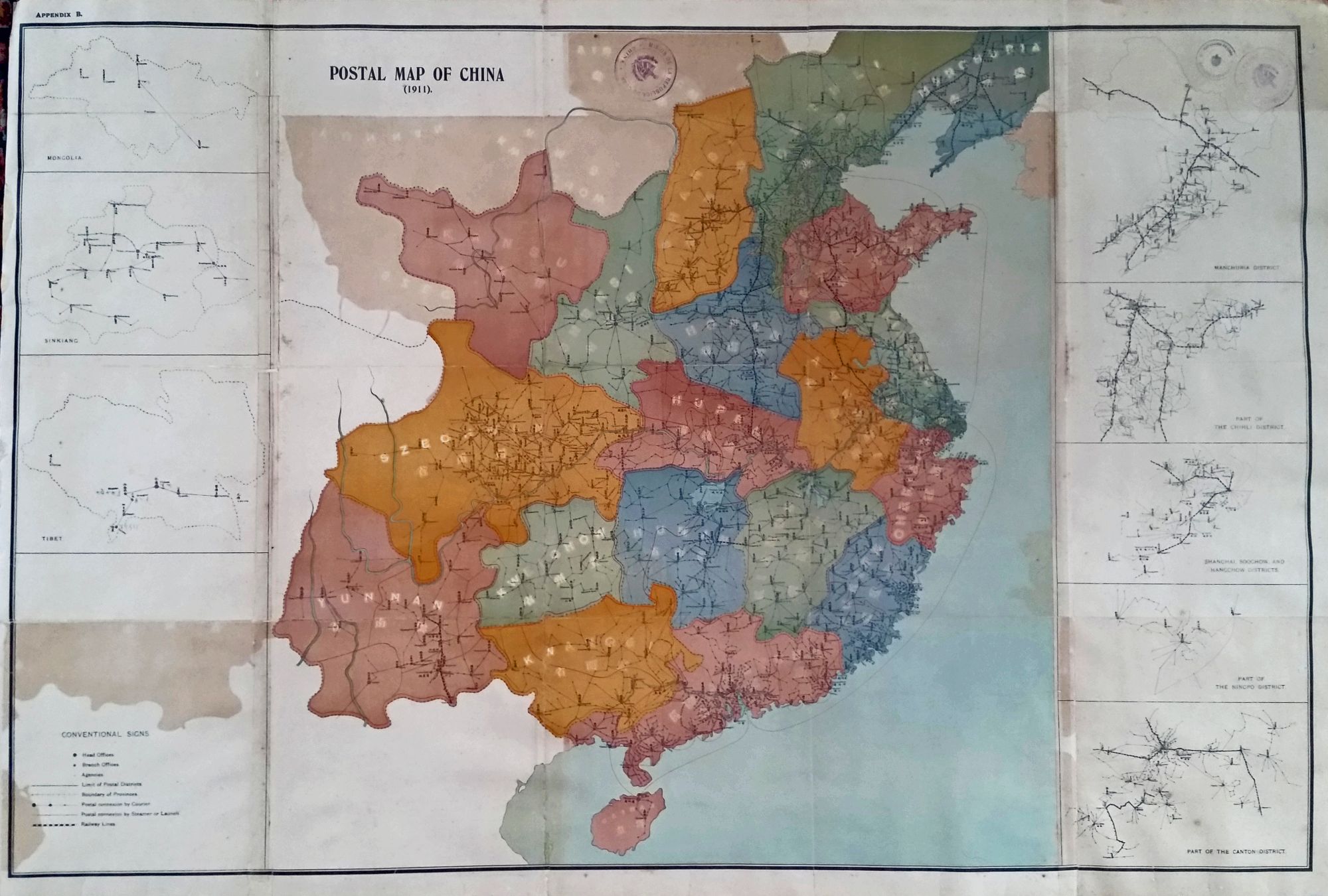
China/ Tibet/ Postal History. Postal Map of China. [Canton: 1911] 23 x 35 ½ inches. Color lithographed map. Ex-folding map, here flattened & expertly conserved, mounted on rice paper; mended fold splits, lightly age-toned, still very good. This early 20th century map of China’s postal system reveals it to have been highly developed. A map such as this one diagraming a postal network also provides an excellent visual representation of China’s population density at the time. Place names on the map are both in English and in Chinese characters. The table at lower left, in English, indicates various aspects of the postal system expressed by the map; e.g. the symbols for head and branch offices, those indicating various types of postal connections (courier, steamship and launches), and lines indicating the outer limits of the system. There are seven insets flanking the map; those to right mostly providing greater detail of dense urban areas (e.g. Shanghai and Canton), while those to left diagram the postal systems of remote areas such as Mongolia and Tibet. The Customs Post Office of the Qing Empire was established by a Northern Irish official, Robert Hart, in 1878, and it developed into one of the most efficient postal services in Southeast Asia. In 1911 the Postal Service became independent of the Customs Service. In 1912 the Postal Service morphed again and started using airline services for long range distribution rather than railways.
Provenance: Old library stamps of the China Mission of Cuba.
Price: $2,000.00