click here to zoom
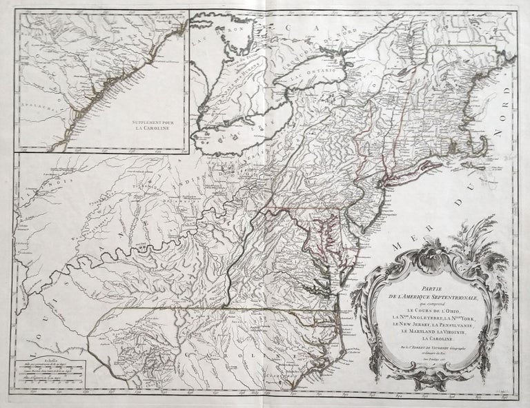
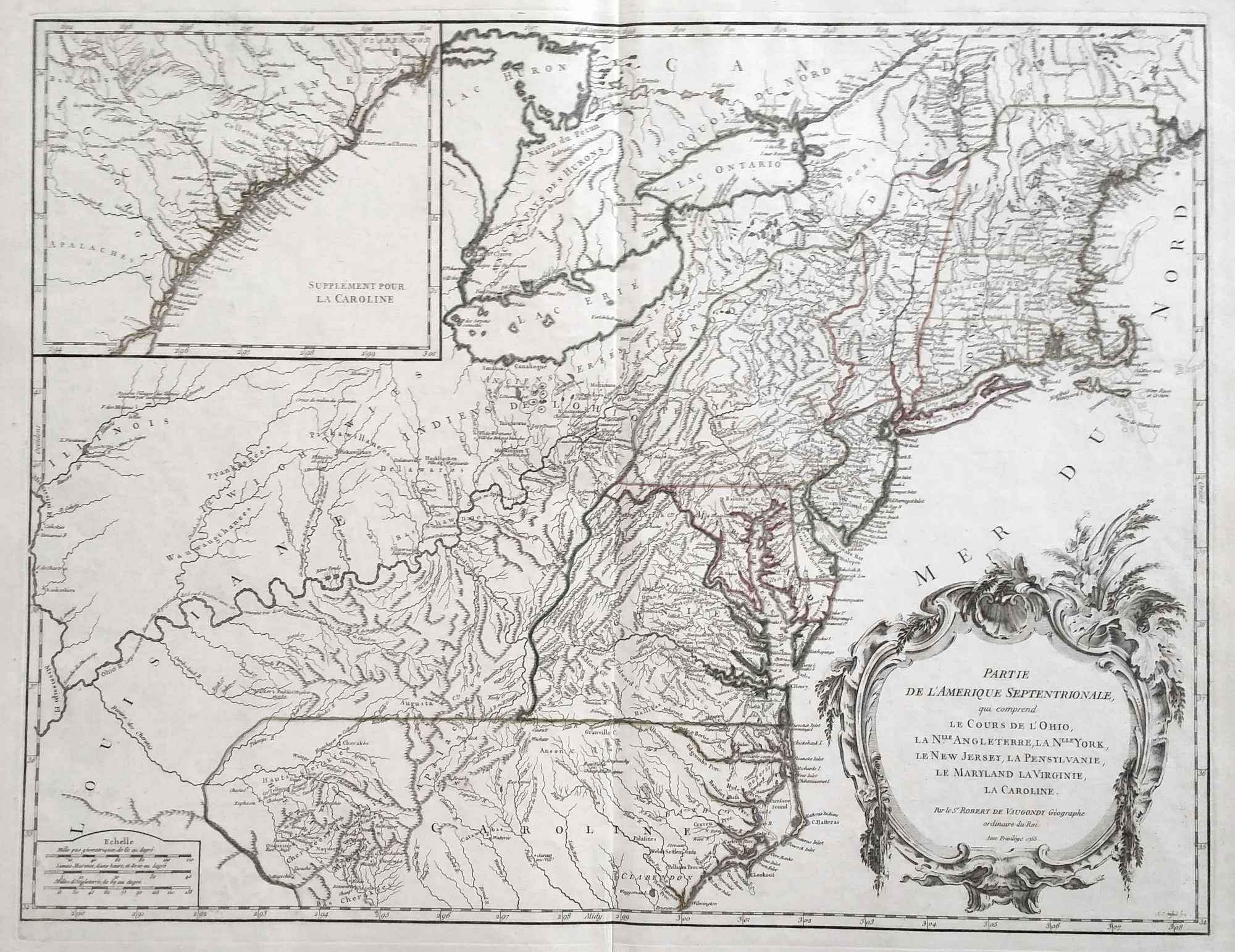
Northeast/ Mid Atlantic/ Old Northwest. ROBERT DE VAUGONDY, Didier. [Paris, 1755] Amerique Septentrionale, dressee, sur les Relations les plus modernes des Voyageurs et Navigateurs 18 ¾ x 22 ¾ inches. Original outline color; excellent condition. First state of a well-detailed map of a soon-to-be contested part of North America, produced by France’s pre-eminent mapmaker just prior to the French and Indian War. It contains then recently updated cartography for Canada, the Great Lakes and the Mississippi – all areas within the French sphere of influence. Vaugondy’s delineation of political borders between French and English-held territories was highly skewed in the French favor; he parceled out a relatively tiny portion of land for New England and was aggressive in defining French borders in Canada. To the south, he depicted the Carolinas as a Spanish possession. The French and English had already come to blows during King George’s War in 1744; looking at this map, it is unsurprising that they would do so again in 1756. Pedley, Bel et Utile, no. 448, state 1.
Sold