click here to zoom
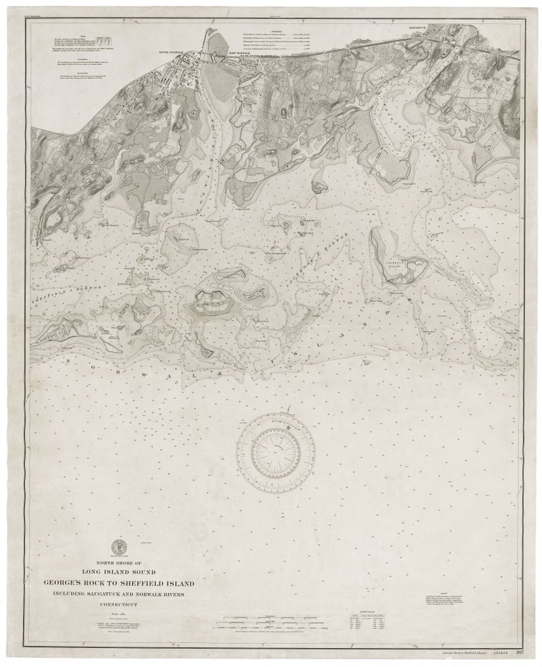
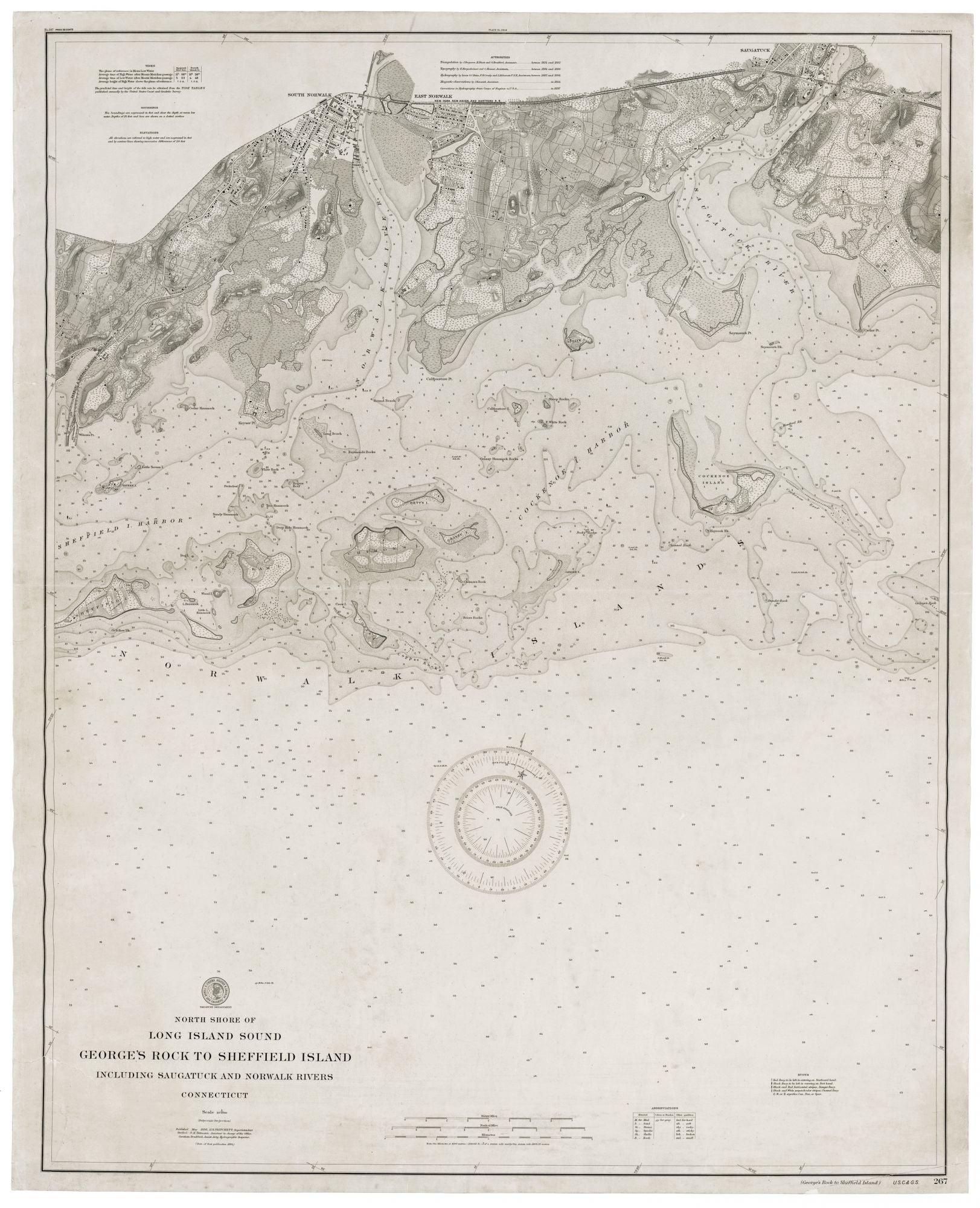
U.S. COAST & GEODETIC SURVEY. [Washington, DC: 1894/ 1898] North Shore Of Long Island Sound George’s Rock To Sheffield Island Including Saugatuck And Norwalk Rivers Connecticut… 42 x 33 ¼ inches. Lithograph expertly mounted on new linen. A few closed splits in margin & outer printed areas; overall very good condition. A rare navigational chart focusing on the waterways that provided access to the towns of Westport (the Saugatuck River) and Norwalk (the Norwalk River), published at a time when both towns conducted a vibrant maritime trade. All of the expected navigational detail—depths, currents, hazards, etc.—are provided in abundance. However, the charts also contain interesting shoreline and topographic details, showing original wetlands and generally providing a good sense of the landscape at the time. The locations of homes and other structures, and roads and rail lines are also indicated. The four largest islands in the area covered by the chart—Sheffield, Shea (then Ram’s Head), Chimon and Cockenoe are all delineated in great detail. The area’s small islands are both shown and named. In the years since the inception in 1816 of the U. S. Coast Survey, its charts gradually added more interior detail, including topography, in addition to its finely rendered nautical data. In the period in which this chart was published, the Coast Survey concentrated mainly on surveys of individual harbors and bays.
Price: $750.00