click here to zoom
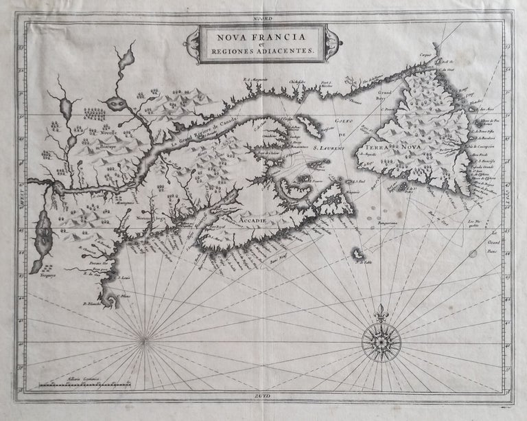
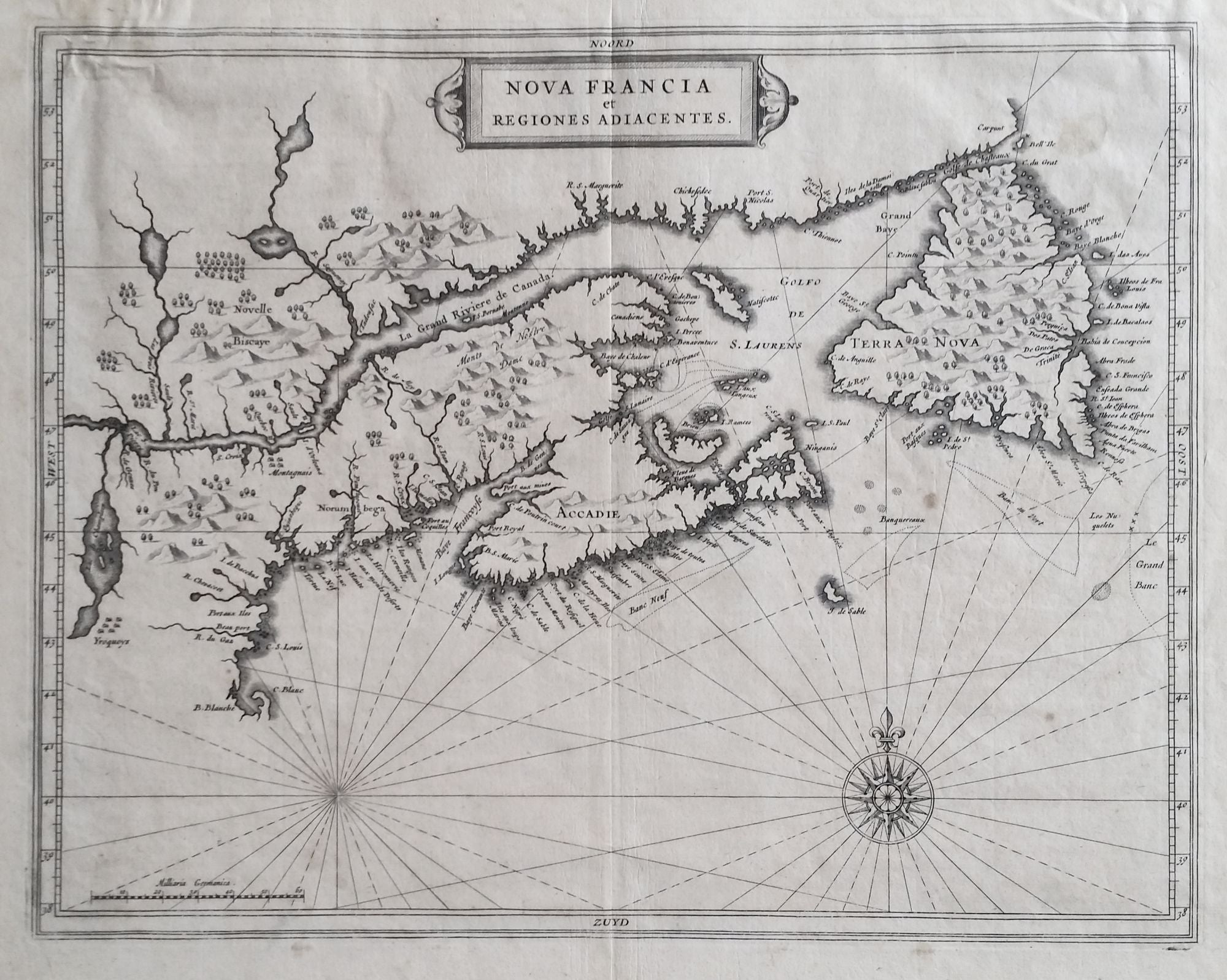
Canada/ Lake Champlain/ Maine/ Northern New England. DE LAET, Johannes/ GERRITSZ, Hessel [Leiden: 1630] Nova Francia et Regiones Adiacentes. 13 ½ x 16 inches. Copperplate engraving. Full margins, a few light stains, creasing at upper left, overall very good condition. A finely engraved, landmark map, the earliest to show Lakes Champlain and George in their proper north-south orientation. “One of the foundation maps of Canada,” (Burden) it was also the first printed map to accurately delineate Prince Edward Island. De Laet’s map appeared in his seminal work on America, which is widely regarded as the most important and influential treatise on the subject published in the 17th Century-- Beschrijvinghe van West-Indien. The actual maker of the map, Hessel Gerritsz, was the chief cartographer of both the East and West India Companies. De Laet was a director of the Dutch West India Company and thus had access to its internal documents, including maps. Finally, Kershaw points out, "the map is of considerable importance to the early cartography of Canada and is the source map of several derivatives,” maps by Blaeu and Coronelli among them. Burden 230; Kershaw 88.
Sold