click here to zoom
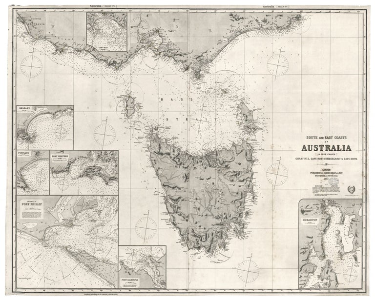
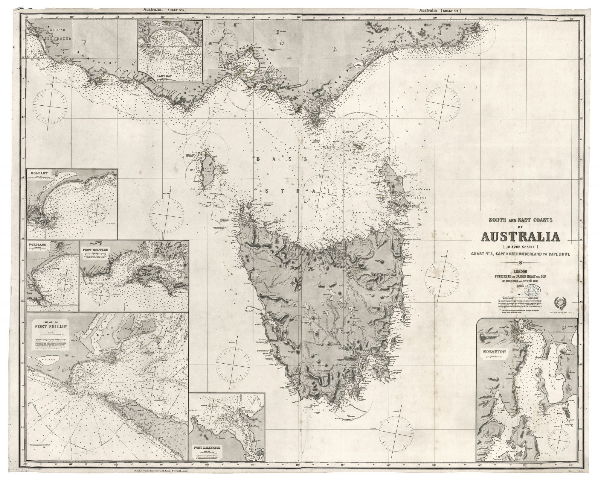
Southern Australia/ Melbourne/ Tasmania. JAMES IMRAY AND SON [London: 1883 [1885 (stamped)] South And East Coasts Of Australia [In Four Charts] Chart No. 2, Cape Northumberland To Cape Howe…40 ¼ x 50 inches (102.3 x 127cm). Two joined, lithographed sheets mounted on heavy, later blue paper with original yellow, trade label. Lighthouses in red & yellow hand color. Small amount of scattered foxing, else excellent. James Imray (1803-1870) was the leading publisher of sea charts in Britain during the latter part of the 19th century. Imray's charts were prized throughout the world by both naval officers and merchant mariners for their unparalleled accuracy and precise, elegant engraving. Imray was consistently able to source the most up-to-date hydrographic intelligence from the British Admiralty, as well as from commercial pilots and captains. Imray was also London’s leading seller of navigational equipment and sailing directions. Imray himself directly managed the chart end of the business. Initially a bookseller and binder in Cheapside, Imray in 1836 joined with Michael Blachford, a sea chart publisher based in London. The partnership flourished and soon began to compete with the larger firm of Norie and Wilson. In 1846 Imray bought out Blachford, taking over as sole proprietor. Through various partnerships over the years, the company has survived to this day, now specializing in charts for yachting and fishing.
The most detailed and up-to-date chart of the southern coast Australia including all of Tasmania available at the time. There are seven highly detailed insets of key harbors and bays, the largest of which is of Melbourne’s Port Phillip; the others being of Lady Bay, Belfast, Port Western, Port Dalrymple, and Hobarton. In addition to indicating depths and navigational hazards, the chart provides recommended courses for entering harbors and ports. Interesting land-based information includes street grids, railroads, and mountains and their elevations. Tasmania’s interior is shown in considerable detail.
Sold