click here to zoom
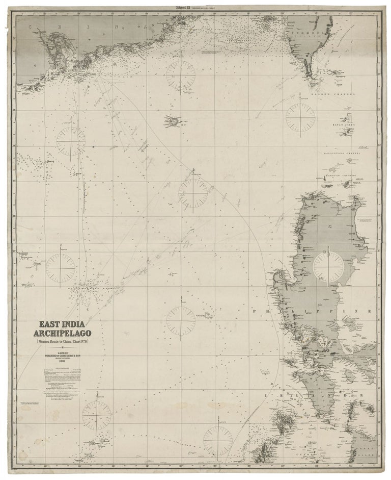
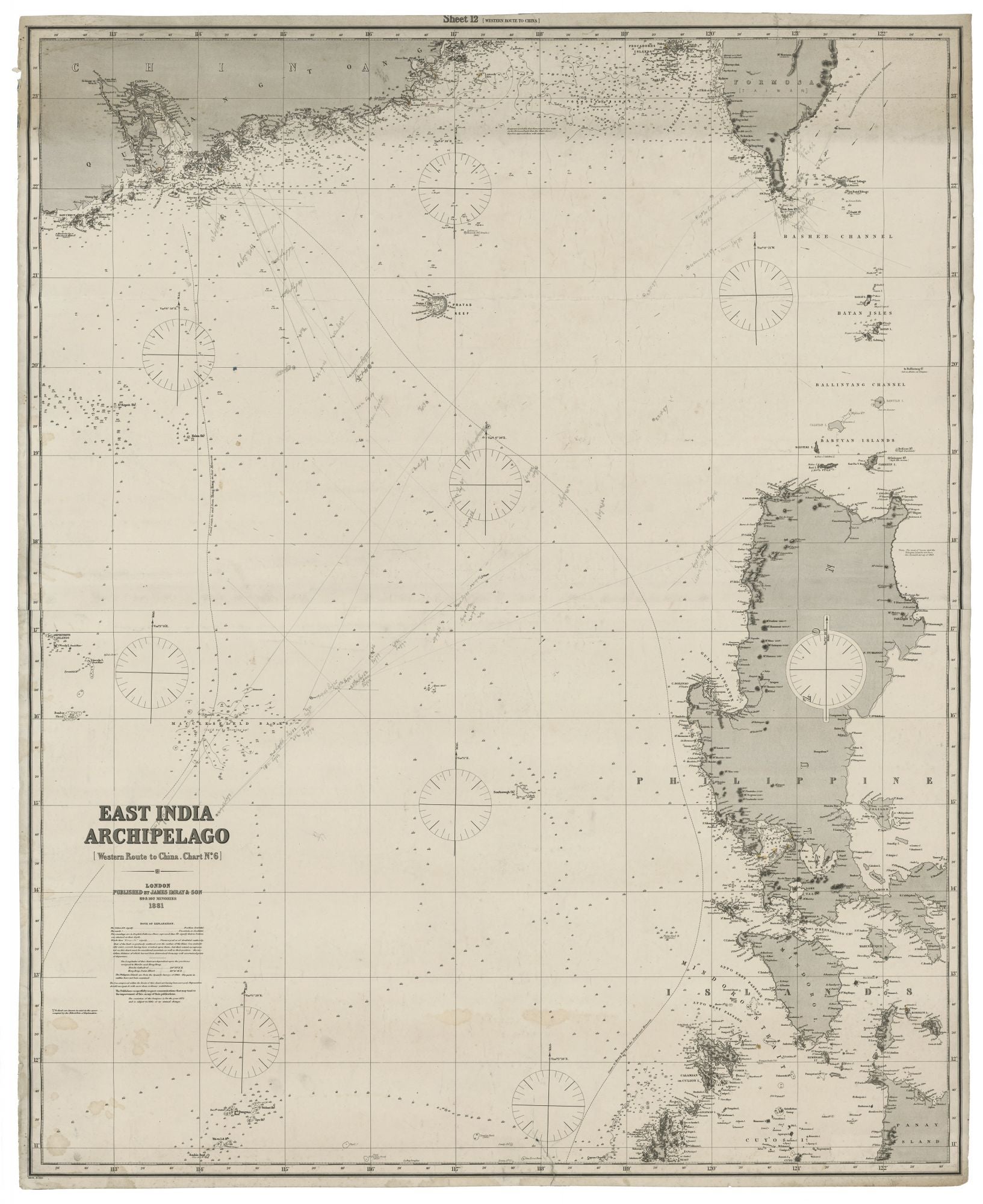
Philippines/ Hong Kong/ Taiwan. JAMES IMRAY & SON [London: 1881] East India Archipelago [Western Route to China. Chart No.6]…London…1881. 49 ¾ x 40 inches; 126.5 x 101.5 cm. Two joined lithographed sheets, mounted later blue backing bearing original company label. Early annotated courses marked in pencil. Mended 3 ½-inch split at bottom, a few marginal splits, else excellent. A fine, state-of-art chart showing the northern half of the Philippines, including Manila, as well as Hong Kong and surroundings, and part of Taiwan. There are several courses in manuscript dated 1884, most of which approaching Hong Kong, with references to log entries. Two printed courses show, respectively, the route to Hong Kong in the “fair Monsoon” and in the “north-east Monsoon.” James Imray (1803-1870) was the leading publisher of sea charts in Britain throughout the latter half of the 19th century. The firm’s charts were prized throughout the world by both naval officers and merchant mariners for their unparalleled accuracy and precise, elegant engraving. Imray was consistently able to source the most up to date hydrographic intelligence from the British Admiralty, as well from as commercial pilots and sea captains who had returned to Britain from overseas. Imray was also London’s leading seller of navigational equipment and sailing directions. Imray himself directly managed the chart end of the business. Initially a bookseller and binder in Cheapside, Imray in 1836 joined with Michael Blachford, a sea chart publisher based in London. The partnership flourished and soon began to compete with the larger firm of Norie and Wilson. In 1846 Imray bought out Blachford, taking over as sole proprietor. Through various partnerships over the years, the company survives to this day, now specializing in charts for yachting and fishing.
Sold