
click here to zoom
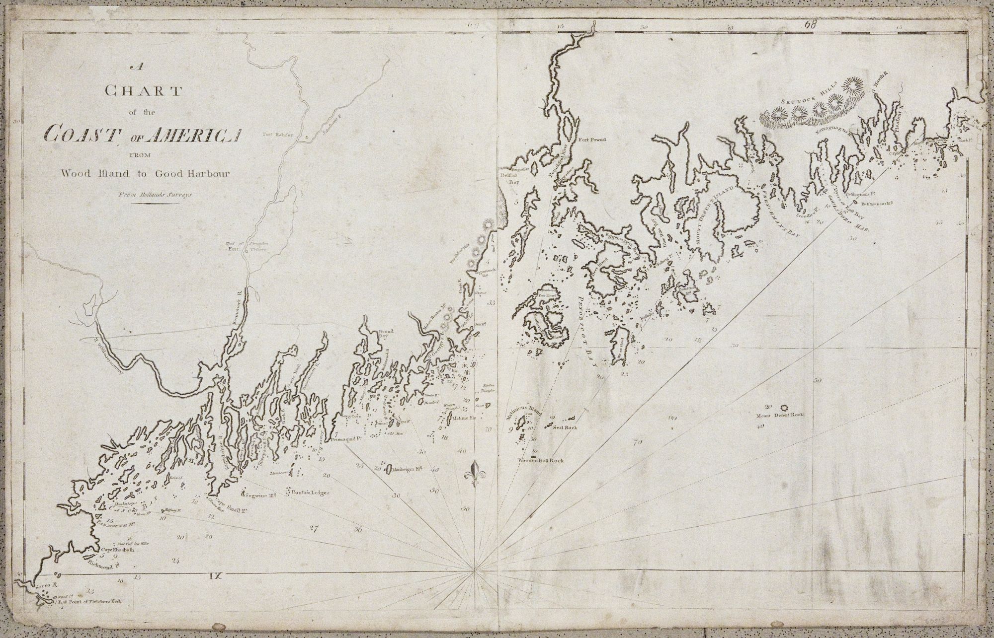
Maine/ Canada. NORMAN, John & William. [Boston, 1801/ 1803] A Chart of the Coast of America from Wood Island to Good Harbour From Hollands Surveys. 20 x 32 inches. Expected soiling & wear, some repairs to outer areas with small areas of restorations, still very good of this kind. The second earliest chart of the Maine coast published in America; the first, by Clark, is all but unobtainable. The Norman was the best available chart of this area in the early years of the United States, and as it was specifically intended for use at sea, it is now of extreme rarity. This especially rare second state of the chart, which added the title lacking from state one, appeared only in the 1803 edition of the American Pilot. The American Revolution brought an end to Britain’s leading role in the mapping of America. The task now fell to the American publishing industry, still in its infancy, but with direct access to new surveys that were documenting the rapid growth of the nation. In particular, there was a need for nautical charts for use by the expanding New England commercial fleets. The first American maritime atlas, Matthew Clark’s A Complete Set of Charts of the Coast of America, was published in Boston in 1790. Two of Clark’s charts were engraved by John Norman, who was inspired to launch his own enterprise. On Jan. 1, 1790, Norman advertised in the Boston Gazette the publication of “A New General Chart of the West Indies,” with a notice stating that he was currently engraving charts of the entire coast of America on a large scale. These were first assembled and published as The American Pilot in 1791. Norman’s Pilot, the second American maritime atlas, indeed the second American atlas of any kind, marked an advance over the earlier work of Matthew Clark. New editions of Norman’s Pilot appeared in 1792 and 1794, and after John Norman’s death, his son, William, brought out editions in 1794, 1798, 1801, and 1803. Despite the seemingly large number of editions, The American Pilot is one of the rarest of all American atlases. Wheat and Brun (pps. 198-199) locate just ten complete copies for the first five editions, and the 1803 edition is equally rare. Wheat & Brun 166.
Price: $12,500.00