click here to zoom
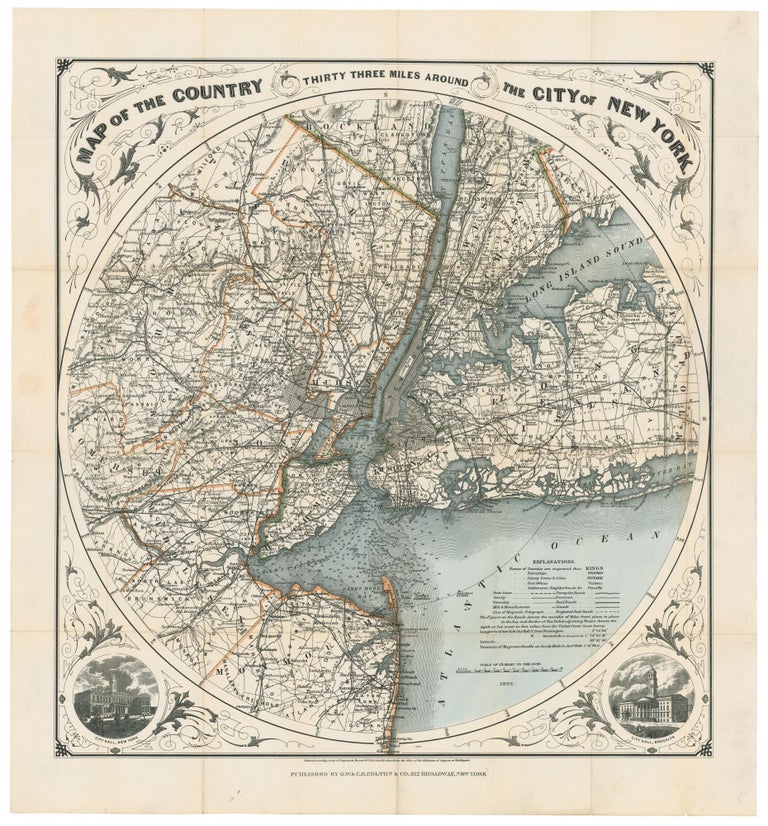
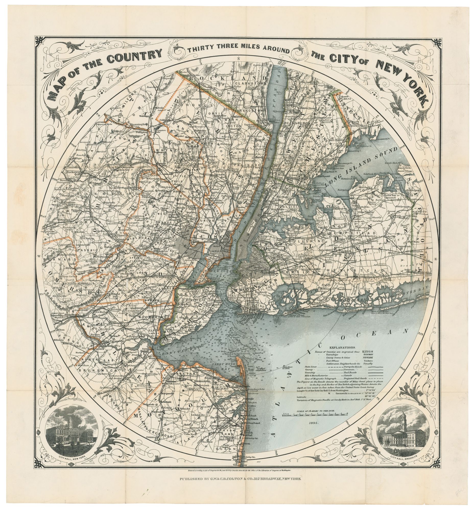
New York City/ New Jersey. G. W & C. B. COLTON & CO. [New York, 1889/ 1895] Map of the Country Thirty Three Miles Around The City of New York. 22 ¼ x 21 inches. Original wash & outline color; ex folding map with original cover, separate, map here flattened & mounted on thin rice paper, a few reinforced fold separations, overall near excellent. Very attractive, circular map of the New York metropolitan area shown just three years prior to the unification of the five boroughs as Greater New York City in 1898. The very scarce final issue of this long and popular series of New York metro maps. It displays in great detail the area’s already highly connected transportation network of road and rail that made it into a metropolis. Unlike earlier maps, topographic features are here all but obscured by the transportation data and various boundary lines. Brooklyn’s status as a still independent city is reflected in the image of its city hall at lower right; New York’s city hall appears at lower left. The map also includes navigational data—depths and shoals—for New York Harbor and some of the area’s other waterways. This map was one of Colton’s most popular folding maps; it tracked the expansion of the metro area over a period of about a half a century. The earliest edition we found appeared in 1846, and this issue of 1895 seems to have been the final one, with numerous iterations in the intervening years. The circular-format of the New York metro area was pioneered by John Eddy in 1812. In addition to roads and rail lines, the later editions of the map such as this one added street grids for Jersey City and Newark. cf Haskell, Manhattan Maps, no. 1425.
Sold