click here to zoom
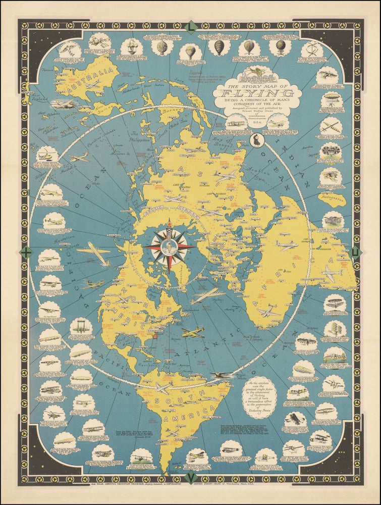
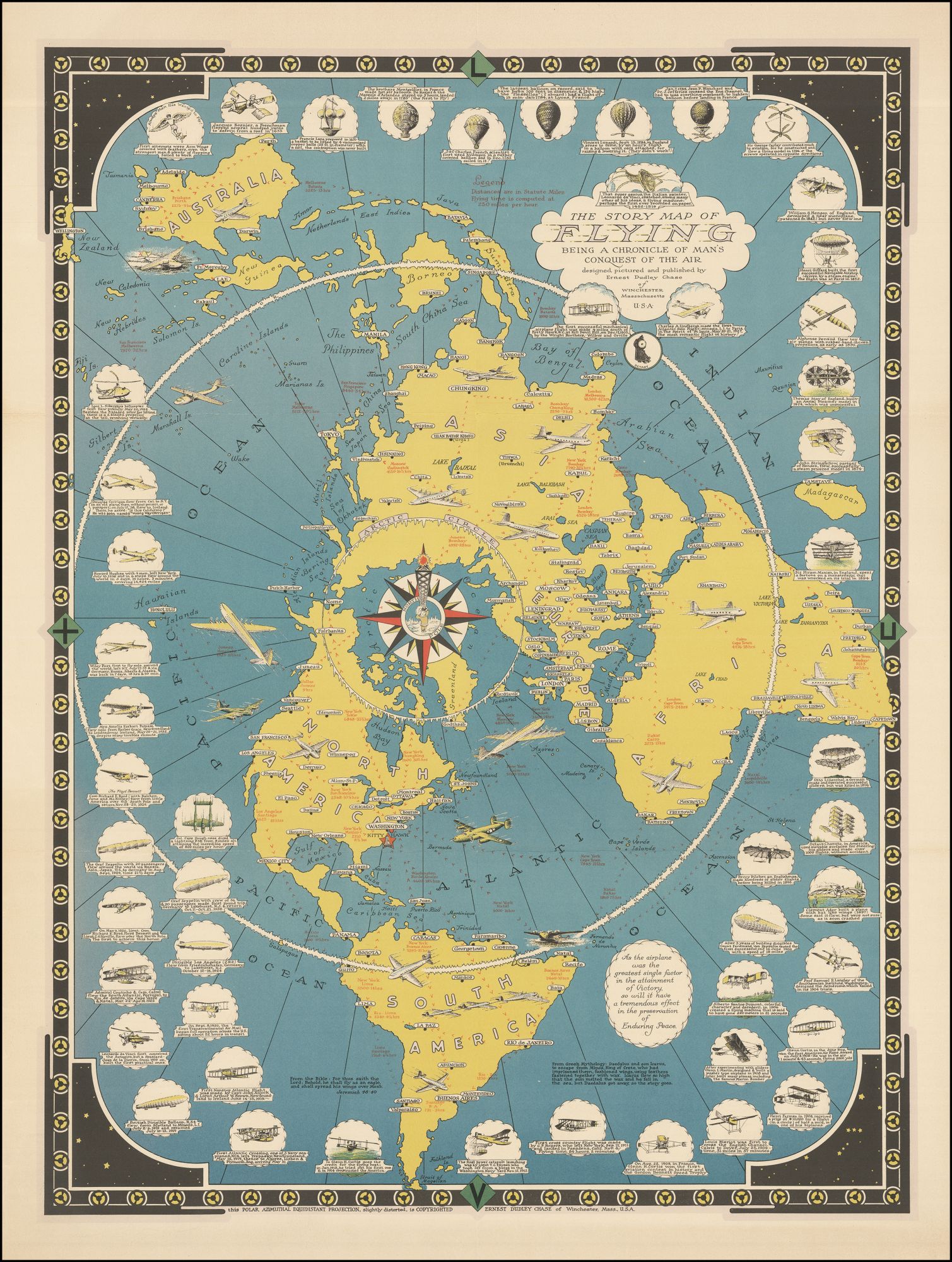
Pictorial Map/ Flight. CHASE, Ernest Dudley [Winchester, Massachusetts: n.d. but 1942] The Story Map of Flying Being a Chronicle of Man's Conquest of the Air . . . 26 x 19 3/8 inches. Original color print. Slight fold wear, lightly age toned, library stamp on verso, else excellent. A striking map, relating the history of flight, with over 50 annotated vignettes illustrating milestones in that history. The vignettes display advances, records, firsts and methodologies, some quite outlandish, in the history of man’s attempt to defeat gravity, dating from Leonardo da Vinci. Chase notes that the map itself is plotted on a “slightly distorted” Polar Azimuthal Equidistant Projection that he copyrighted. This projection was popular on “Air Age” maps, in part because it lent itself, as here, to showing great circle flight routes over the poles. The map notes the flying times and distances between various locales. This map was reprinted in 1944 with a blue border and with the date included. Ernest Dudley Chase (1878-1966) was also one of the most prolific pictorial map artists of the 20th century, producing about 50 maps from the 1930s to the 1960s, covering a wide assortment of places and topics. Born in Lowell, Massachusetts, he began his career as a graphic artist, establishing his own greeting card company, which he sold to Rust Craft Publishers in 1920. He authored The Romance of Greeting Cards, the first complete history of the medium, published in 1926, with a revised edition in 1956. It wasn’t until he was 49 years old did Chase began drawing maps, which he self-published from his home in Winchester, Massachusetts. Chase donated many examples of his maps to the Harvard University Map Collection, Pusey Library, which featured them in the exhibition "The Pictorial Maps of Ernest Dudley Chase" from February to April 2003. According to the curators of the exhibit, Chase "designed pictorial maps ranging in scale from his own hometown to global themes of navigation, exploration, communication, and world peace. He could be alternately whimsical, didactic, and subtly allusive--often on the same map." In 2009, the State Library of Massachusetts presented the exhibition "Ernest Dudley Chase: A Worldview in Maps," showcasing the wide variety of his works. Rumsey 8053; Hornsby, S. J. Picturing America, pp. 36, 243, 248; pl. 146.
Sold