click here to zoom
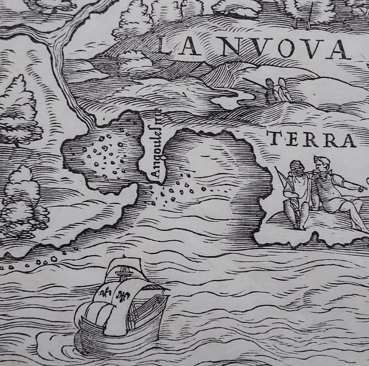
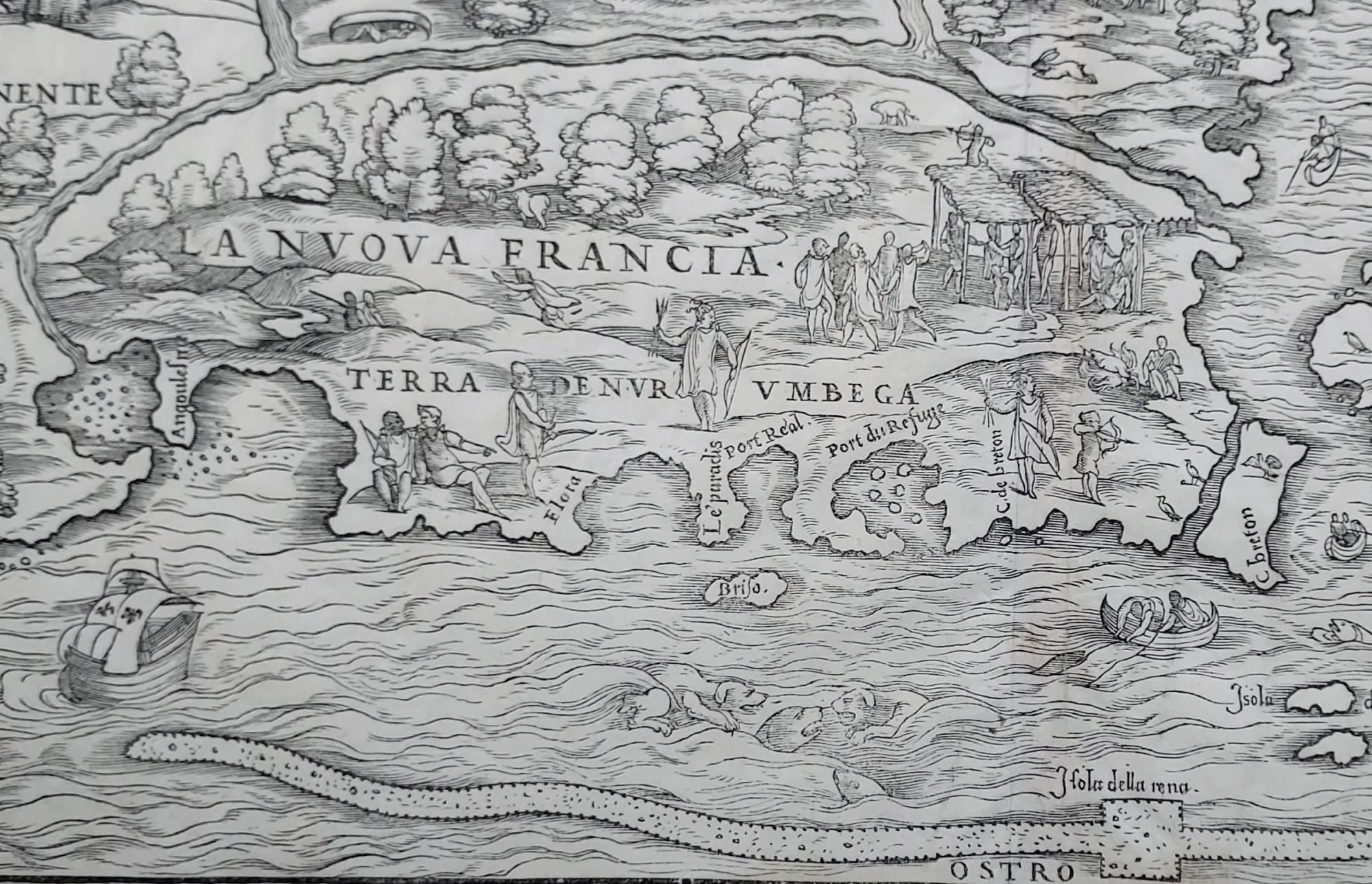
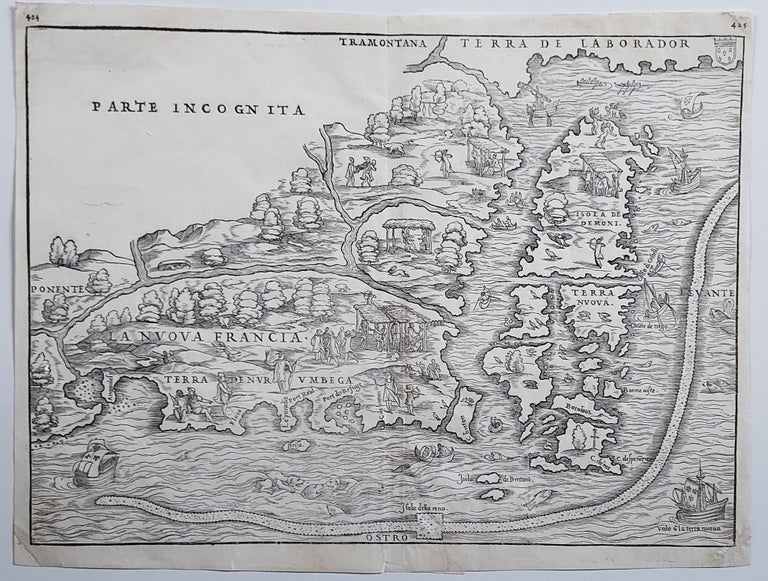
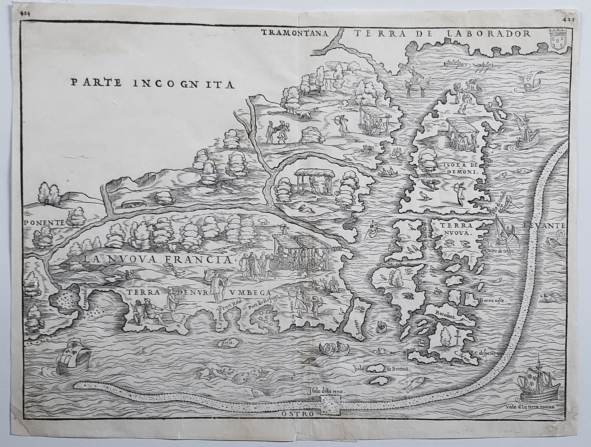
New England/ New York City. RAMUSIO, J. B./ GASTALDI, G. [Venice, 1556] La Nuova Francia. 10 1/2 x 14 1/2 inches. Woodcut map. A few minor marginal repairs, else excellent condition. The map is a lively woodcut filled with charming representations of Indians and their customs as well as of flora and fauna. Most of the illustrations of Indian life on the map are in the area of “Port du Refuge,” Narragansett Bay, where Verrazano and his crew stayed ashore longer than at any other locale on their voyage. This experience was the likely source of this early place name. The long snake-like shape shadowing the coastline is a crude representation of the Grand Banks. Two fishermen in an open boat dragging their net suggest this area’s then abundant fishing. This and other details on the map were drawn from a letter written by Verrazano describing his voyage. Verrazano’s participation in the map is further borne out by the two ships at lower right and left, both having fleurs de lis in their sails; Verrazano sailed in behalf of Charles I of France. The fact that the map was based on a written document would in part account for its sketch-like simplicity. Indicative of the primitive nature of its cartography is that Cape Breton Island is shown as nearly adjacent to Buzzard's Bay on Cape Cod. The rarity of this first issue of the map is due to the fact that woodblocks for the maps in the first edition of Ramusio’s book were destroyed in a fire in 1557, only a year after the book’s first publication. The first edition is readily identified by both its pagination (pp. 424 and 425) and by the shapes of the trees on the woodcut, all of which have a rounded, “puffy” shape rather than being of the weeping variety as on the later states. Osher, Maine 175 (Exhibition Catalogue) #1; Augustyn/Cohen, Manhattan In Maps, pp. 18-19; Burden 25, state 1; Goss, J. North America, Map 8.
The rare first state (of three) of “the first printed map devoted to the New England region” (Osher). The map also contains the most accurate early delineation of the New York Harbor based on the first European sighting of it by Verrazano: “the best surviving early map to register this momentous episode”(Augustyn/Cohen). The harbor’s two large bays separated by the narrows named after Verrazano are clearly delineated on the map, though their orientation tilts incorrectly to the west. Manhattan itself, at least in insular form, is not shown on the map, as Verrazano did not enter either the East or the Hudson rivers in his brief reconnaissance of the harbor.
Sold