click here to zoom
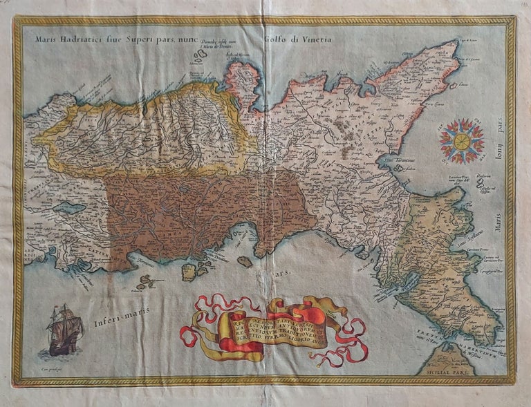
Napoli/ Italy. ORTELIUS, A. [Antwerp, 1579] Regni Neapolitani... 14 ¼ x 19 ¼ inches. Fine original color; oxidized area reinforced, minor loss lower centerfold & some creasing, overall fair condition. An attractive map of approximately the southern third of Italy encompassing the provinces of Apulia, Campania and Calabria and including Naples, Salerno and Pompeii. It was the first map of the Kingdom of Naples to appear in a modern atlas. Ortelius used local authorities for geographical information and was scrupulous about citing them: the map was derived from information provided by the Italian architect and antiquarian Pirro Ligorio. This can be seen in the amount of highly localized information on the map—villages, waterways, topographic features. A beautiful compass rose indicates the northwest orientation of the map. Van der Krogt 7400:31:021/022.
Sold