
click here to zoom
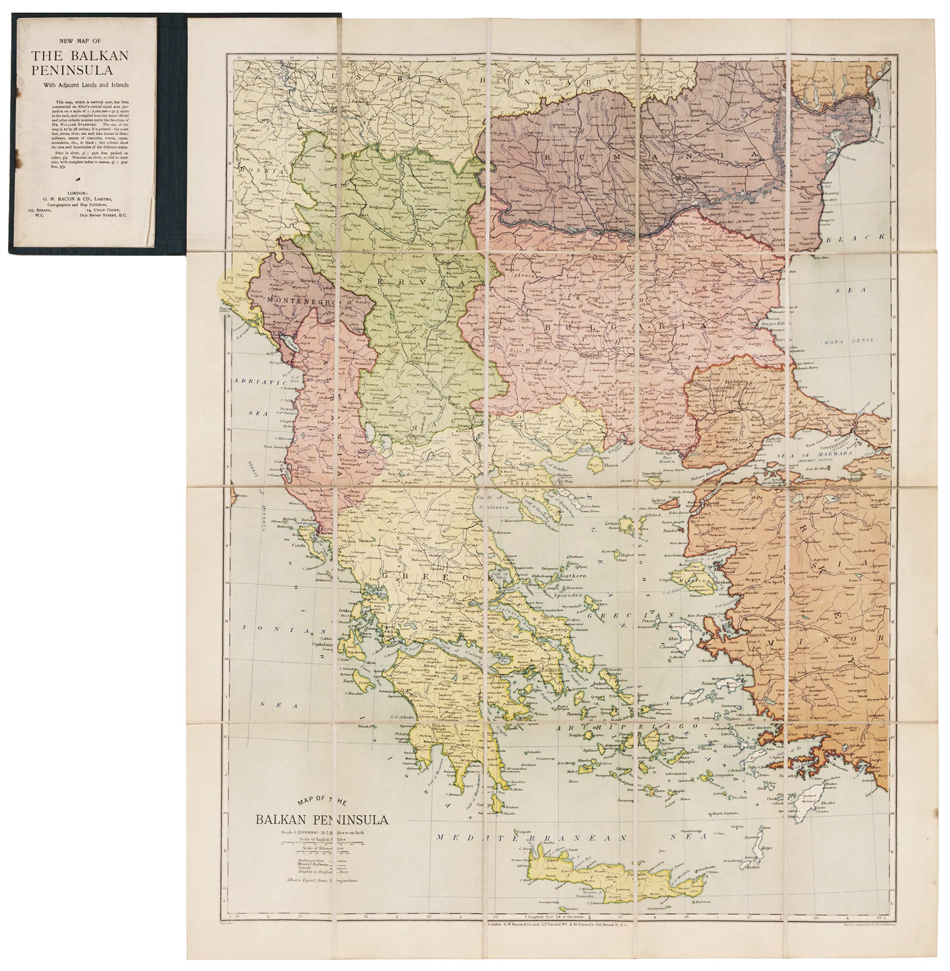
Map Of The Balkan Peninsula….
25 x 19 ½ inches, Folding map, dissected & mounted on linen, appended to original, clothbound covers, advertisement & 20 pp. index of place names keyed to the map, the latter loose; excellent condition. A rare, clearly printed, political map of this volatile region, described as "entirely new" in the advertisement included here. Although the map is not dated, the Royal Geographic Society reported its acquisition of an example in July of 1914 (see below). Since the Archduke Franz Ferdinand was assassinated on June 28, 1914, and World War I officially began July 28, 1914, it is likely the map was published between these dates. It was compiled under the supervision of William Stanford, son of Edward, founder of the great map establishment. William was active from 1904 and died in 1932. Bacon & Co. was a leading English maker and seller of maps from 1862 to 1922. It occupied premises at 127 Strand, the address given in the imprint on this map, from 1870 to 1919. The Geographic Journal, Vol. 44, No. 1 (July, 1914) p. 130.
Price: $450.00