click here to zoom
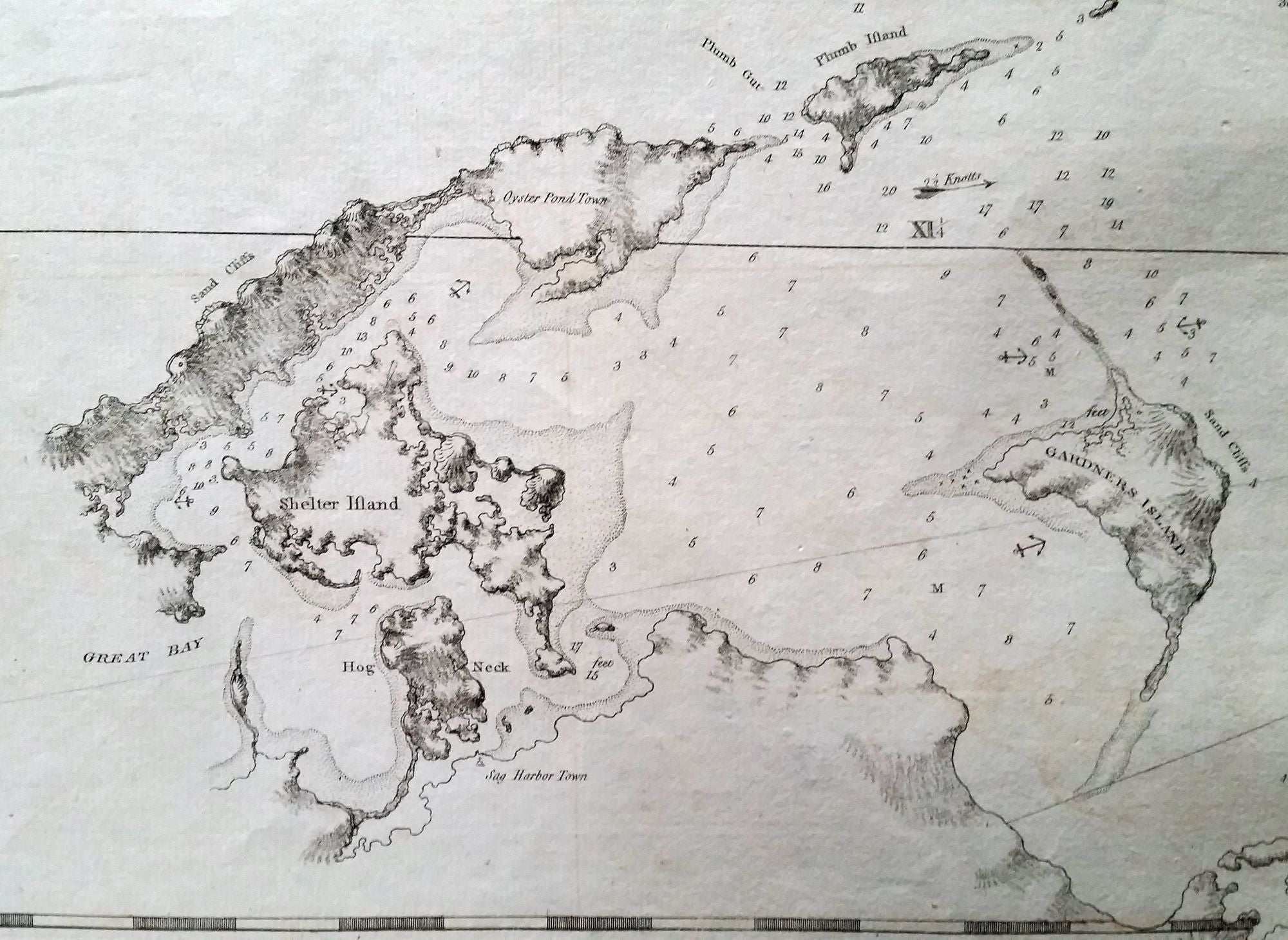
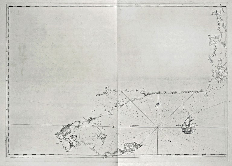
Untitled Nautical Chart of Eastern Long Island, Block Island & Parts of the Connecticut Coast & Narragansett Bay.
Copperplate engraving on two joined sheets, 29 x 41 1/4 inches. Mint condition. A rare and most unusual chart that provided the best mapping of eastern Long Island, including Shelter Island, and Block Island to date. That the chart was only partially finished affords us a rare look at what an 18th-century map in mid process would look like. In relatively complete form on the chart are Block Island, Montauk, Shelter and Gardiner's islands, and some of the coast of Peconic Bay. The rest--the Connecticut and Rhode Island shoreline and Narragansett Bay--are lightly sketched in. The chart's incompleteness was due to the outbreak of the American Revolution. (The chart was first published in 1777.) Major Samuel Holland’s surveying team began the charting of the Northeast in the north and worked south toward the New York area. As noted by Hornsby (see below), by December of 1774, Holland's team had completed their survey as far south as Newport, Rhode Island. "Holland was also planning the next season's surveying, intending to extend the survey from Narragansett Bay to the Hudson River, including Long Island" (Hornsby). Our chart covers the eastern portion of the range described. However, with the bloody confrontation at Lexington and Concord in April 1775, a British surveying team working waters not so far away would not be welcomed by local residents. Given this volatile climate, there was little that Holland could accomplish. Moreover, his superiors feared the loss of Holland's charts and instruments to the rebels, which would have negated years of arduous and expensive labor. Holland turned over his materials for secure transport back to England, although charts of the Boston area were diverted to General Gage in Boston, along with three of Holland's surveyors. Holland himself returned to England in November of 1775, and with this, "the General Survey of the Northern District of North America had come to an end" (Hornsby). Clearly this chart was an effort by Des Barres to provide what navigational data he could muster of a very vital area. Des Barres also produced a chart focusing on western Long Island, Hell Gate, and the East River that is similarly incomplete. Hornsby, S. J. Surveyors of Empire, pp. 83-85.
Sold