click here to zoom
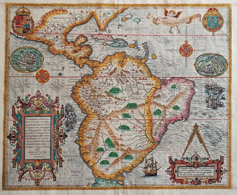
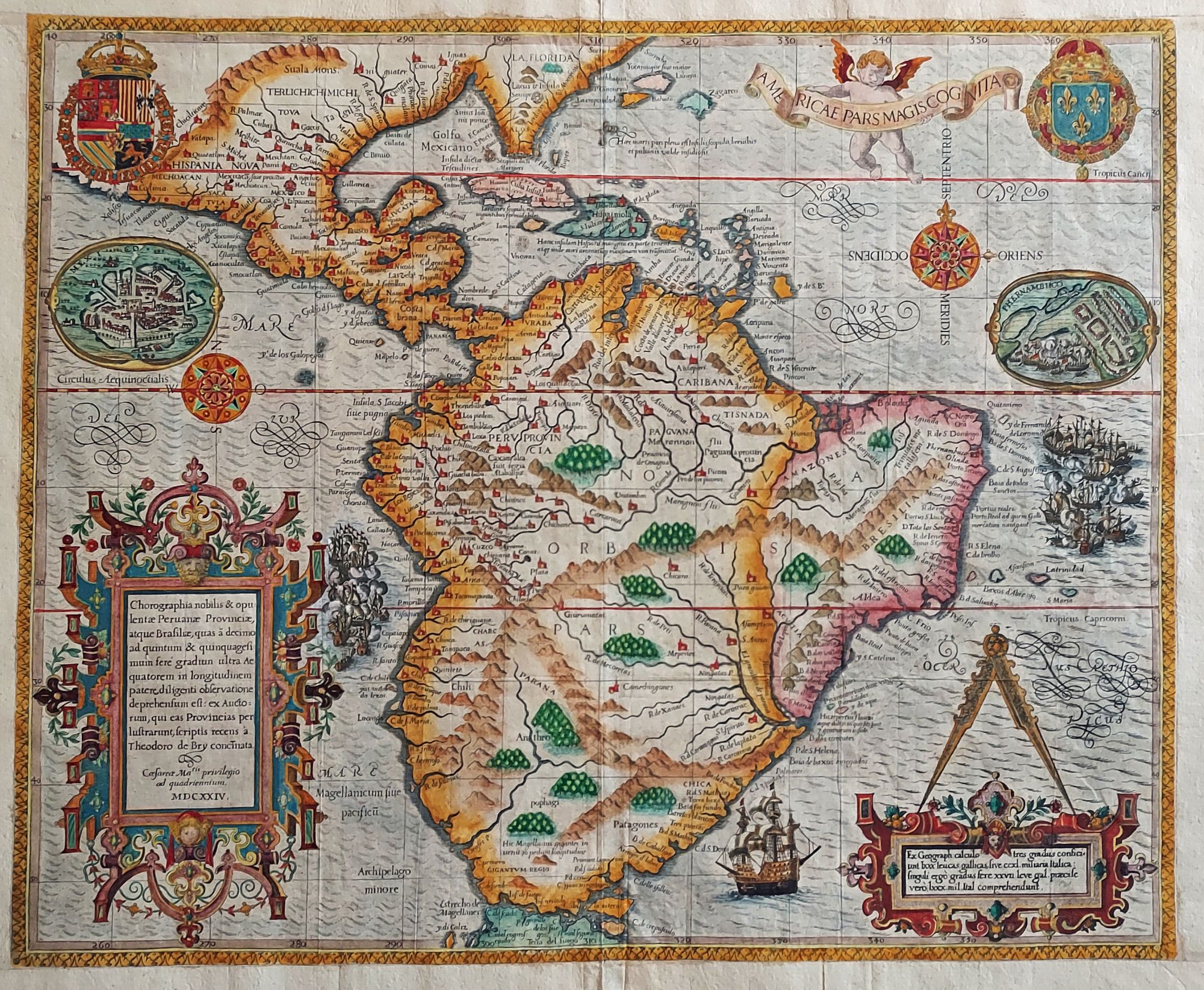
South America/ Brazil/ Caribbean/ Florida. DE BRY, T. [Frankfurt, 1592/ 1624] Americae Pars Magis Cognita. Chorographia nobilis & opulentae Peruanae Provinciae, atque Brasiliae, . . . MDCXXIV. 14 3/8 x 17 1/4 inches. Fine hand color; margins expertly extended with no loss of engraved surface, else excellent condition. The very rare and augmented second state of this masterwork of engraving, reissued to report and celebrate the Dutch victories against the Portuguese in the New World. The map first appeared in Book III of De Bry’s Grands Voyages and depicted the extent of the Spanish Empire in America at its approximate high water mark. In 1624, the map was updated and reprinted for inclusion in the Mercurii Gallobelgici, a publication printed twice a year for sale at the Frankfurt book fair. This work, of a type referred to as a Messerelation, reported political news of the day. Since their contents were soon dated, Messerelationen were seldom preserved, and are now rare. The occasion for the inclusion of this map in a 1625 Messerelation was the 1624 Dutch invasion of Brazil and their May 8th capture of Salvador – Brazil’s Portuguese capital – by Admiral Jacob Willekens. To bring the map up to date with these important events, an anonymous engraver skillfully added an inset view of Pernambuco under naval siege, two great sea battles, and a plan of Mexico City. The explanatory cartouche to the lower right and the fine ship approaching the Straits of Magellan were also re-engraved. Burden 80, State 2.
Sold