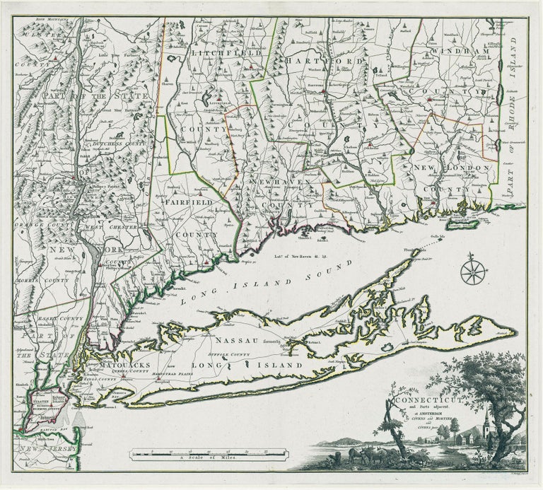
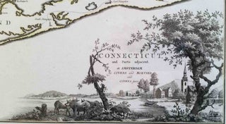
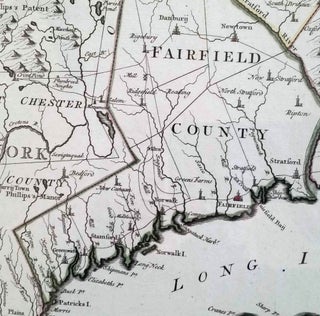
Connecticut. ROMANS, B./ COVENS & MORTIER & COVENS [Amsterdam, 1780] Connecticut and Parts adjacent… 20 ½ x 23 ¼ inches. Copperplate engraving with original outline color; all edges deckled, uncut; mint condition; in a fine archival frame. Very rare; separately published. The earliest acquirable map of Connecticut of folio size or better, and arguably the most beautiful map of the state ever produced. It was the work of an important colonial surveyor and Revolutionary War officer, Bernard Romans. The original edition of the map, published in New Haven in 1777, was known by Thompson to exist in only two examples, though five are now known. (An earlier map of Connecticut by Moses Park published in 1766 and first sold in New London is also known in just a few examples.) The present map, an exact but finer, Dutch re-engraving of the Romans was published a few years later and is also very rare. (The only other acquirable map of Connecticut preceding this one is a very small work by Thomas Kitchen published in the London Magazine in 1758.) Particularly fine is the map’s cartouche that evokes Connecticut’s unique landscape, a combination of bucolic and shoreline beauty with hilly, nearly mountainous topography. It is not known whether a specific town is represented in the view. Beyond the cartouche, the map’s engraving is a model of clarity. Bernard Romans, born in the Netherlands and educated in England, performed important service as a surveyor, first for the Crown following the French and Indian War and then for the American cause during the Revolution. For the British he produced important maps of the Southern District that were the foundation of the mapping of Florida and much of the Southeast for decades. However, his service in the Revolution extended well beyond cartography, as he had a principal role in the capture of Fort Ticonderoga and single-handedly seized Fort George from its two-man garrison. He was also involved in the construction of Fort Constitution opposite West Point and assisted Henry Knox in the transporting of the Ticonderoga cannon to Boston, which resulted in the British evacuation of that city. In 1777, Romans settled in Wethersfield, Connecticut, retiring temporarily from military service after clashing with his superiors. It was during this period that he prepared this and a number of other maps for publication. He was on his way to return to military service in the middle of 1780 when the ship on which he was traveling was captured by the British; he subsequently spent the rest of the war imprisoned on a ship in Montego Bay in Jamaica. It is at once clear that Romans has here produced a very capable map of the state. How he generated such a work is not as clear, but an advertisement for another map offers some insight. He says that information for this other map was “taken from real surveys, performed by the Publisher [Romans] himself, communicated by his friends, or collected from the Secretary’s office in New-York.” How much original surveying is in this map is difficult to determine, but given Romans’ background and experience, there is no doubt that he was fully equipped to evaluate and emend existing surveys and weave them into a coherent whole. Thompson, E. Maps of Connecticut, no. 28, cf. no. 26; Diamant, L. Bernard Romans, pp. 132-38, illus. p. 133; cf. Wheat & Brun nos. 261-63; cf. Graffagnino, J. K. Shaping of Vermont, pp. 55-57.
Price: $42,500.00


