click here to zoom
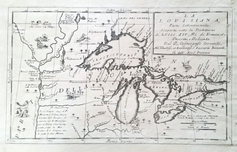
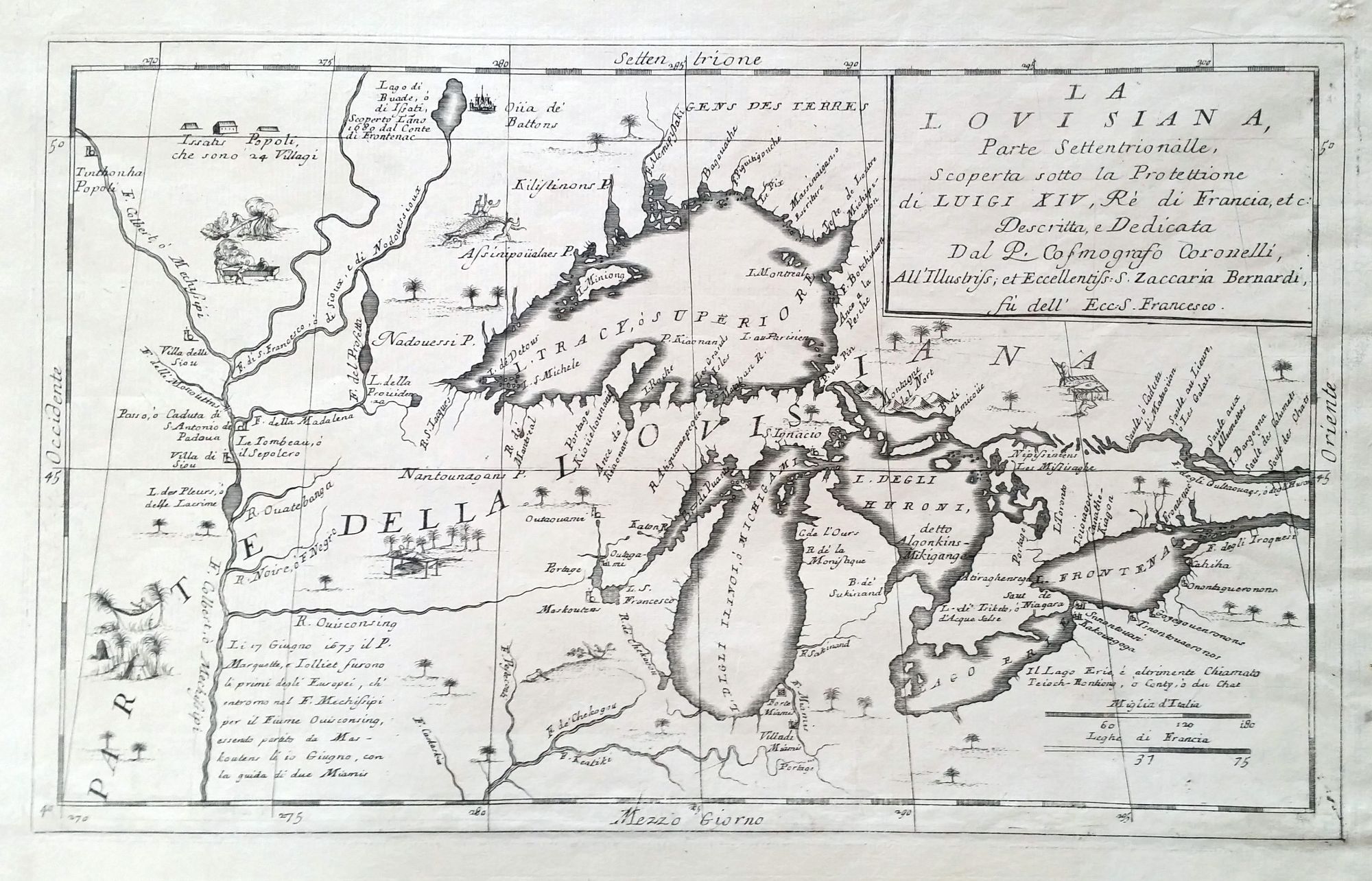
Great Lakes. CORONELLI, V. [Venice, 1695] La Louisiane. 10 ¼ x 16 ¾ inches. Lower margin expertly extended, else excellent condition. One of the first maps to focus on the Great Lakes available to the collector today, it was preceded only by the Coronelli/ Nolin map of 1687. These maps provided “the finest portrayal [of the Great Lakes] since Nicolas Sanson’s ‘Amerique Septentrionale’” (Burden). Coronelli’s primary sources were the manuscripts of Jean Baptiste Louis Franquelin, who was a veritable clearinghouse of all cartographic knowledge generated by French explorers of the Great Lakes, Canada and the upper Mississippi. The efforts of Jolliet, Marquette, Hennepin, and LaSalle and Dablon are all reflected on this map, sometimes explicitly. "Finer maps of the Great Lakes than those by Coronelli were not published again for many years" (Karpinski, p. 55). Karpinski, L. C. Maps of Famous Cartographers; Burden 701.
Sold