click here to zoom
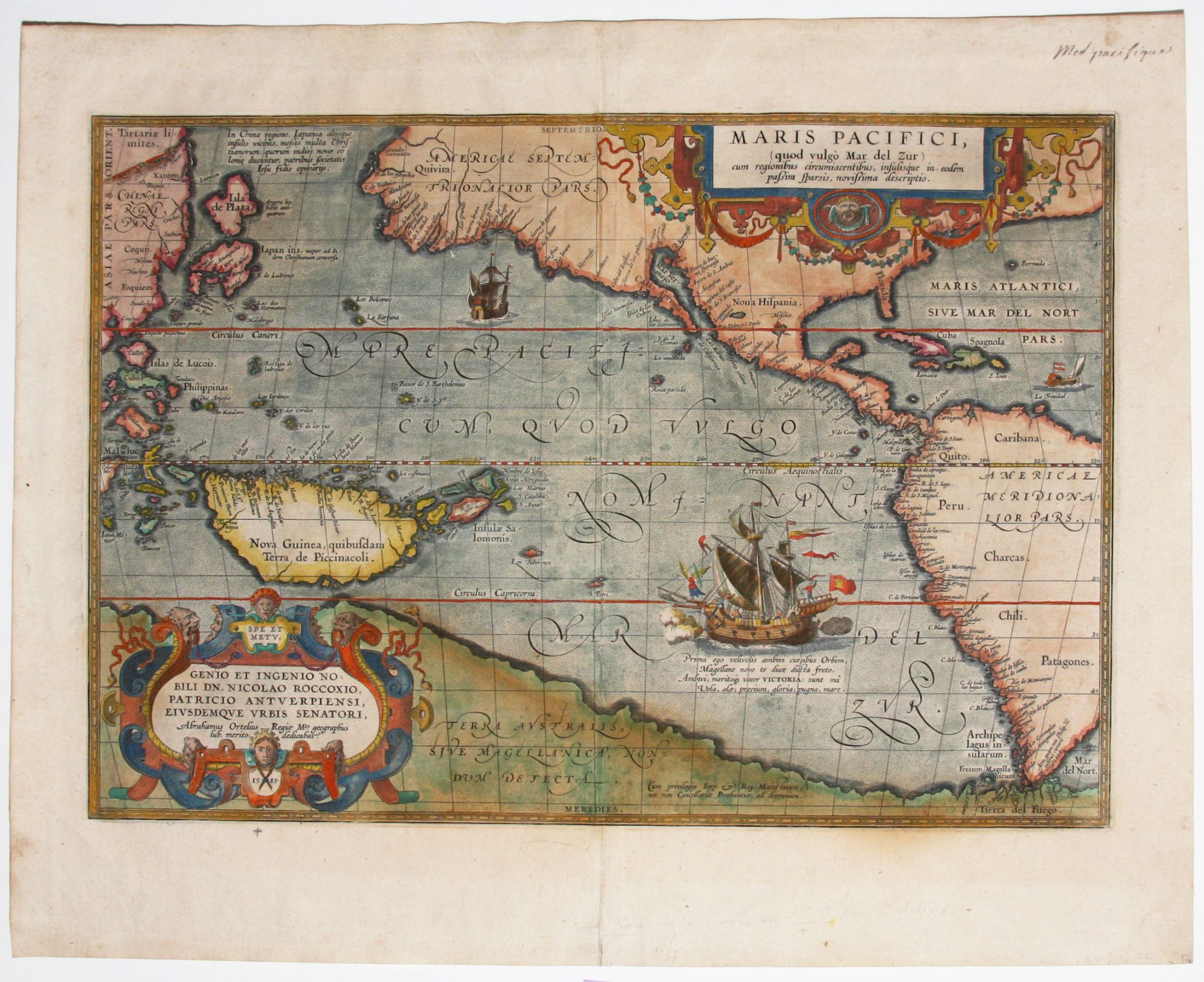
Maris Pacifici, (quod vulgo Mar del Zur) . .
13 5/8 x 19 ¾ inches. Fine hand color; very good condition.
The first separate map of the Pacific in a strong example. “One of the most important maps that appeared in the Ortelius atlases ...” (Burden). With its two splendid cartouches and a well-detailed illustration of Magellan’s flagship, the Victoria, this is also one of the most beautifully engraved of Ortelius’ maps. “Being one of Ortelius’ most desirable maps combined with the fact that it was not issued in the atlas until 1590, it is not as available as the various versions of his map of America” (Burden).
This work provided some of the best mapping of the West Coast of North America before the regressive California-as-an-island myth would bedevil the mapping of this part of the world for nearly 100 years. Moreover, Wagner says that the map’s delineation of this area
* Burden 74; Koeman, I.C. Atlantes Neerlandici, III, p. 62; Wagner, H. Cartography of the Northwest Coast, p. 74, no. 156; van den Broecke 12.
Sold