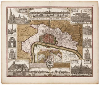
Antwerp/ Financial History. VISSCHER, C.J. /VISSCHER, N. J. [Amsterdam, c. 1630] Marchionatus Sacri Romani Imperii… C.J. Visscher Excudebat. 18 x 21 ¾ inches. Fine original color; bit of edge chipping & toning in margins, else excellent. .....
Antwerp/ Financial History. VISSCHER, C.J. /VISSCHER, N. J. [Amsterdam, c. 1630] Marchionatus Sacri Romani Imperii… C.J. Visscher Excudebat. 18 x 21 ¾ inches. Fine original color; bit of edge chipping & toning in margins, else excellent. .....
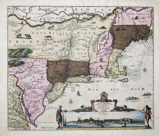
A map that is as historically important as it is attractive: it was the culmination of all the surveys conducted by the Dutch colonists of New Netherlands during their first three decades in America. It is also the first printed map to delineate the shape of Manhattan with relative accuracy;.....
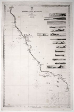
Scarce, finely engraved chart on two sheets of the entire west coast of the United States and including the southern portion of Vancouver Island. Each of the 27 coastal recognitions on the charts is delicately realized. These provided visual reference for the entry to the major bays and ports as.....
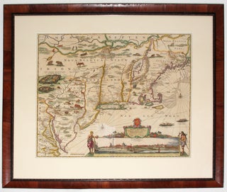
This is the most lavishly decorative of all the early editions of the best 17th century, Dutch map of the Northeast and New York. It added illustrations of animals and other detail not found on previous issues. The map was the culmination of all the surveys of the area conducted.....
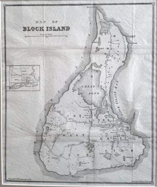
Block Island. THOMPSON, J. C. [Providence, RI: 1882] Map Of Block Island. 13 ¾ x 11 ¾ inches. Framed size: 22 x 19 inches. Lithograph. Very minor fold wear; excellent condition. [With:] Block Island. I. Map and Guide. II. Historic Sketch. Rev. S. T. Livermore [Hartford, CT: 1882] 125 pp.....
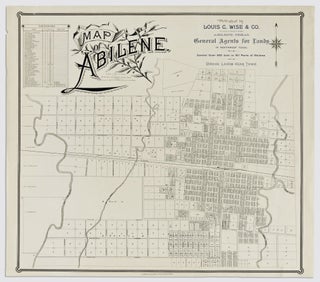
Abilene, Texas. KIRBY, A. H./ THOMAS, J. A./ LOUIS C. WISE & CO. (publisher) [Galveston: c. 1885] Map of Abilene. 22 ¾ x 25 inches. Lithograph. Fine condition. An unusually elegant example of a promotional city plan and possibly the earliest printed.....
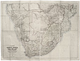
This large, superbly detailed map of South Africa shows the region just prior to the outbreak of the Second Boer War. The Boer territories - Orange Free State and the South African Republic - are both shown in yellow, as distinct from the surrounding red of British lands. The gold.....